TopoQuest Logo
Do you find TopoQuest useful?
Help keep TopoQuest running and adding new maps/features by donating!
Bitcoin:  19c7KJd3qBynnjoSw5npx9KScwjBe4ifkT
Litecoin:  LXs6TkuXGGXo1vDsWCkWVdjQX94eUKd6ui
Home View Maps Find Maps Find Places Resources & Links


Martin, Kentucky Topographic Map

USGS Map Title: Martin, KY
USGS Map MRC: 37082E7
DRG (GeoTIFF) Download: o37082e7.tif


Neighboring USGS Topographic Map Quads:


  Ivyton, KY  
37082F8
 

  Prestonsburg, KY  
37082F7
 

  Lancer, KY  
37082F6
 

  David, KY  
37082E8
 

  Martin, KY  
37082E7
 

  Harold, KY  
37082E6
 

  Handshoe, KY  
37082D8
 

  Wayland, KY  
37082D7
 

  McDowell, KY  
37082D6


Map MRC Location:

N38°
W83°
N38°
W82°
H8 H7 H6 H5 H4 H3 H2 H1
G8 G7 G6 G5 G4 G3 G2 G1
F8 F7 F6 F5 F4 F3 F2 F1
E8 E7 E6 E5 E4 E3 E2 E1
D8 D7 D6 D5 D4 D3 D2 D1
C8 C7 C6 C5 C4 C3 C2 C1
B8 B7 B6 B5 B4 B3 B2 B1
A8 A7 A6 A5 A4 A3 A2 A1
N37°
W83°
N37°
W82°

Martin, KY USGS 1:24K Topographic Map Preview:
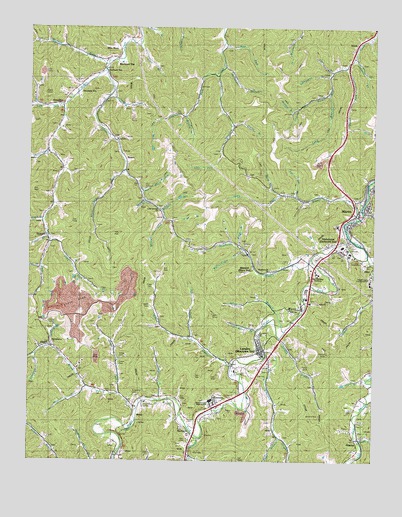
Martin, KY USGS Topographic Map
Click on map above to begin viewing in our Map Viewer.

This topographic map contains these locations and features:
Feature Name Type Latitude Longitude GNIS ID View Map
Akers BranchStreamN37.5237°W82.7524°485802View Map
Allen BranchStreamN37.6218°W82.8354°485846View Map
Allen CemeteryCemeteryN37.5054°W82.8171°485858View Map
Allen CemeteryCemeteryN37.5173°W82.8365°485859View Map
Allen Central High SchoolSchoolN37.5176°W82.8085°510043View Map
AlphorettaPopulated PlaceN37.5632°W82.7643°485898View Map
Alum Lick ForkStreamN37.5837°W82.8404°485911View Map
Alum Lick SchoolSchoolN37.5793°W82.8449°510053View Map
Atkins CemeteryCemeteryN37.5304°W82.8418°486119View Map
Beech BranchStreamN37.6245°W82.8363°486691View Map
Beech BranchStreamN37.5698°W82.8691°486694View Map
Bethel ChurchChurchN37.5276°W82.8015°510041View Map
Big ForkStreamN37.5354°W82.8154°487174View Map
Blue RiverPopulated PlaceN37.6193°W82.8438°507534View Map
Bob Post OfficePost OfficeN37.6024°W82.8635°2097296View Map
Bradley BranchStreamN37.5995°W82.8191°487794View Map
Brush CreekStreamN37.5151°W82.8352°488078View Map
Brush Creek SchoolSchoolN37.5304°W82.8621°488087View Map
Buck BranchStreamN37.5698°W82.7563°488192View Map
Buck Branch School (historical)SchoolN37.5765°W82.7821°510066View Map
Buckeye BranchStreamN37.6143°W82.8477°488251View Map
Buckeye School (historical)SchoolN37.6170°W82.8557°510068View Map
Buckeye StationLocaleN37.6151°W82.8438°488257View Map
Caney CreekStreamN37.6129°W82.8479°488834View Map
Chestnut Lick BranchStreamN37.6059°W82.7671°489455View Map
City of MartinCivilN37.5667°W82.7602°2405031View Map
Coeburn Police DepartmentBuildingN37.5742°W82.7856°2085836View Map
Cold Springs ChurchChurchN37.5726°W82.8263°510040View Map
Cold Springs SchoolSchoolN37.5704°W82.8257°489795View Map
Collins RockPillarN37.5134°W82.7732°489873View Map
Conley ForkStreamN37.6115°W82.8071°489970View Map
Conley SchoolSchoolN37.6115°W82.8093°510079View Map
Conn BranchStreamN37.6123°W82.7654°489973View Map
David Area Volunteer Fire DepartmentBuildingN37.6048°W82.8611°2636396View Map
Derossett BranchStreamN37.6109°W82.7665°490826View Map
Derossett School (historical)SchoolN37.6048°W82.7657°510083View Map
Doc Allen BranchStreamN37.5373°W82.7924°490944View Map
Dock Post OfficePost OfficeN37.6210°W82.8046°2097297View Map
EasternPopulated PlaceN37.5170°W82.8060°491508View Map
Fitzpatrick CemeteryCemeteryN37.5195°W82.8365°492151View Map
Floyd County Vocational SchoolSchoolN37.5604°W82.7513°510044View Map
Frazer CemeteryCemeteryN37.5506°W82.8299°492473View Map
Fredville Post Office (historical)Post OfficeN37.6104°W82.7852°2119576View Map
GoodloePopulated PlaceN37.6037°W82.8627°508111View Map
Goose CreekStreamN37.5068°W82.8129°493011View Map
Gosling BranchStreamN37.5015°W82.8152°493047View Map
Hale ForkStreamN37.5557°W82.8707°493554View Map
Hays BranchStreamN37.5068°W82.7840°493931View Map
Henrys BranchStreamN37.5357°W82.7838°494064View Map
Hicks CemeteryCemeteryN37.5395°W82.8674°494162View Map
Hicks ForkStreamN37.5326°W82.8663°494163View Map
HippoPopulated PlaceN37.5326°W82.8688°508252View Map
HitePopulated PlaceN37.5570°W82.7535°508254View Map
Hollybush BranchStreamN37.6137°W82.8046°494418View Map
Hollybush ForkStreamN37.5473°W82.8727°494424View Map
HunterPopulated PlaceN37.5062°W82.7563°508298View Map
Hunter BranchStreamN37.5763°W82.7601°494778View Map
Hunter BranchStreamN37.5057°W82.7546°494779View Map
Jarrell ForkStreamN37.6134°W82.7602°495174View Map
Joel Crisp BranchStreamN37.5768°W82.7796°495304View Map
Johns BranchStreamN37.5376°W82.7818°495341View Map
Johnson ForkStreamN37.6071°W82.8453°495404View Map
Johnson School (historical)SchoolN37.6037°W82.8438°510115View Map
Keel ForkStreamN37.6209°W82.8052°495587View Map
Lafferty BranchStreamN37.6176°W82.7571°510118View Map
Lafferty SchoolSchoolN37.6132°W82.7615°495906View Map
LangleyPopulated PlaceN37.5318°W82.7907°495981View Map
Left Beaver ChurchChurchN37.5507°W82.7502°496188View Map
Left Fork Beaver CreekStreamN37.5590°W82.7524°496194View Map
Lick ForkStreamN37.6020°W82.8629°496510View Map
Long BranchStreamN37.6059°W82.7671°497038View Map
Long ForkStreamN37.5770°W82.7846°497103View Map
MantonLocaleN37.5562°W82.7938°497502View Map
MartinPopulated PlaceN37.5729°W82.7527°497596View Map
Martin Police DepartmentBuildingN37.5715°W82.7528°2767421View Map
Martin Post OfficePost OfficeN37.5739°W82.7520°2768077View Map
Martin Volunteer Fire DepartmentBuildingN37.5688°W82.7533°2636610View Map
Martin-Allen DivisionCivilN37.5450°W82.7745°1936851View Map
Maytown Census Designated PlaceCensusN37.5327°W82.7992°2629650View Map
Maytown Volunteer Fire DepartmentBuildingN37.5315°W82.7924°2637396View Map
MidasPopulated PlaceN37.5123°W82.8349°508596View Map
Molly Cabin BranchStreamN37.5601°W82.7965°498476View Map
Mountain Christian AcademySchoolN37.5554°W82.7721°510045View Map
Mud Creek Baptist ChurchChurchN37.6159°W82.8443°2095984View Map
Mudlick BranchStreamN37.5212°W82.8535°499055View Map
NorthernPopulated PlaceN37.5079°W82.8154°508723View Map
Notch Block ForkStreamN37.5779°W82.8341°499624View Map
Open ForkStreamN37.5887°W82.8682°499950View Map
Open Fork SchoolSchoolN37.5832°W82.8616°510146View Map
Ousley BranchStreamN37.5968°W82.8018°500044View Map
Patton CemeteryCemeteryN37.5273°W82.7754°500262View Map
Permele StationLocaleN37.6062°W82.8568°500419View Map
Peter BranchStreamN37.5623°W82.7993°500455View Map
Philadelphia ChurchChurchN37.5343°W82.8663°500522View Map
Pitts CemeteryCemeteryN37.5887°W82.8068°500787View Map
Pitts ForkStreamN37.5626°W82.8674°500788View Map
Pitts ForkStreamN37.5882°W82.8052°500789View Map
Pitts Fork School (historical)SchoolN37.5632°W82.8671°510158View Map
Pitts SchoolSchoolN37.5873°W82.8046°500790View Map
Prater BranchStreamN37.5643°W82.8679°501272View Map
Prater CemeteryCemeteryN37.5281°W82.8415°501274View Map
Prater ForkStreamN37.5193°W82.8413°501278View Map
Prater Fork SchoolSchoolN37.5220°W82.8416°501280View Map
PyramidPopulated PlaceN37.5648°W82.8688°508886View Map
Ratliff CemeteryCemeteryN37.5448°W82.8304°501585View Map
Reffett BranchStreamN37.5543°W82.8574°501711View Map
Right Fork Beaver CreekStreamN37.5590°W82.7524°501863View Map
RisnerPopulated PlaceN37.5868°W82.8402°508942View Map
Risner DivisionCivilN37.6005°W82.8210°1937221View Map
Saint Joseph Martin HospitalHospitalN37.5789°W82.7503°2660323View Map
Samson StationLocaleN37.6118°W82.8468°502886View Map
Shepherd BranchStreamN37.5304°W82.8718°503343View Map
SloanPopulated PlaceN37.6198°W82.7577°509080View Map
Spring BranchStreamN37.5748°W82.8327°504108View Map
Stephens BranchStreamN37.5584°W82.7727°504331View Map
Stephens Branch ChurchChurchN37.5548°W82.7871°510042View Map
Stephens Branch SchoolSchoolN37.5543°W82.7921°504334View Map
Turkey CreekStreamN37.5315°W82.7893°505598View Map
Turner BranchStreamN37.5176°W82.8271°505648View Map
Turner CemeteryCemeteryN37.5187°W82.8257°505657View Map
WarcoPopulated PlaceN37.5443°W82.7757°506212View Map
Wilson CreekStreamN37.5270°W82.8010°506897View Map
Wilson ForkStreamN37.5704°W82.8263°506908View Map
Wolfpen BranchStreamN37.5723°W82.8271°507046View Map
Wolfpen BranchStreamN37.6007°W82.7802°507047View Map

Note: Coordinates in the location and feature list above are referenced to NAD83 datum.


Copyright (C) 2008-2024 Ryan Niemi / Sunset Dynamics ... All Rights Reserved