TopoQuest Logo
Do you find TopoQuest useful?
Help keep TopoQuest running and adding new maps/features by donating!
Bitcoin:  19c7KJd3qBynnjoSw5npx9KScwjBe4ifkT
Litecoin:  LXs6TkuXGGXo1vDsWCkWVdjQX94eUKd6ui
Home View Maps Find Maps Find Places Resources & Links


Wayland, Kentucky Topographic Map

USGS Map Title: Wayland, KY
USGS Map MRC: 37082D7
DRG (GeoTIFF) Download: o37082d7.tif


Neighboring USGS Topographic Map Quads:


  David, KY  
37082E8
 

  Martin, KY  
37082E7
 

  Harold, KY  
37082E6
 

  Handshoe, KY  
37082D8
 

  Wayland, KY  
37082D7
 

  McDowell, KY  
37082D6
 

  Hindman, KY  
37082C8
 

  Kite, KY  
37082C7
 

  Wheelwright, KY  
37082C6


Map MRC Location:

N38°
W83°
N38°
W82°
H8 H7 H6 H5 H4 H3 H2 H1
G8 G7 G6 G5 G4 G3 G2 G1
F8 F7 F6 F5 F4 F3 F2 F1
E8 E7 E6 E5 E4 E3 E2 E1
D8 D7 D6 D5 D4 D3 D2 D1
C8 C7 C6 C5 C4 C3 C2 C1
B8 B7 B6 B5 B4 B3 B2 B1
A8 A7 A6 A5 A4 A3 A2 A1
N37°
W83°
N37°
W82°

Wayland, KY USGS 1:24K Topographic Map Preview:
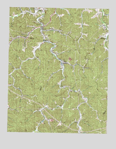
Wayland, KY USGS Topographic Map
Click on map above to begin viewing in our Map Viewer.

This topographic map contains these locations and features:
Feature Name Type Latitude Longitude GNIS ID View Map
Bear BranchStreamN37.4223°W82.8691°486522View Map
Beaver Creek Volunteer Fire Department / Knott County Emergency Rescue SquadBuildingN37.4062°W82.7822°2637323View Map
BettyPopulated PlaceN37.4509°W82.8393°507502View Map
Betty Post Office (historical)Post OfficeN37.4503°W82.8396°2337573View Map
Big BranchStreamN37.4009°W82.8068°487104View Map
Big Springs BranchStreamN37.4390°W82.8599°487272View Map
Bolin BranchStreamN37.4784°W82.8402°509875View Map
BoscoPopulated PlaceN37.4987°W82.8410°487709View Map
Bosco SchoolSchoolN37.4990°W82.8410°509755View Map
Bradley BranchStreamN37.4207°W82.8077°487793View Map
Bradley CemeteryCemeteryN37.4215°W82.8074°487798View Map
Caney ForkStreamN37.4173°W82.7968°488862View Map
Caney Fork Old Regular Baptist ChurchChurchN37.4093°W82.8018°488868View Map
Chafins CemeteryCemeteryN37.4706°W82.8635°489306View Map
City of WaylandCivilN37.4510°W82.7994°2405695View Map
Collins CemeteryCemeteryN37.4243°W82.8104°489863View Map
Conley CemeteryCemeteryN37.4493°W82.8502°489961View Map
Coolwater BranchStreamN37.4907°W82.8713°490029View Map
Dark Hollow School (historical)SchoolN37.3812°W82.7852°509769View Map
DemaPopulated PlaceN37.4204°W82.8052°507842View Map
Drift Freewill Baptist ChurchChurchN37.4826°W82.7571°509563View Map
Dry ForkStreamN37.4376°W82.8666°491192View Map
Esteps BranchStreamN37.4812°W82.8332°491816View Map
EstillPopulated PlaceN37.4570°W82.8188°491820View Map
Four Mile SchoolSchoolN37.4326°W82.8721°492377View Map
Fourmile BranchStreamN37.4320°W82.8713°492384View Map
GarrettPopulated PlaceN37.4798°W82.8316°492717View Map
Garrett Volunteer Fire DepartmentBuildingN37.4777°W82.8228°2636766View Map
General Allen BranchStreamN37.4954°W82.8488°492765View Map
Gibson CemeteryCemeteryN37.3970°W82.8338°492807View Map
Gibson CreekStreamN37.3965°W82.8318°492809View Map
GloPopulated PlaceN37.4479°W82.8093°492920View Map
Golden Years Rest HomeHospitalN37.4637°W82.8324°509859View Map
Green BranchStreamN37.4012°W82.8118°493256View Map
Hampton BranchStreamN37.4843°W82.7552°493651View Map
Howard BranchStreamN37.4723°W82.8499°494650View Map
Hueysville (historical)Populated PlaceN37.4951°W82.8436°2097294View Map
Hueysville Post OfficePost OfficeN37.4987°W82.8410°1721336View Map
Hueysville Post Office (historical)Post OfficeN37.4941°W82.8420°2097295View Map
Huff BranchStreamN37.3882°W82.8282°494732View Map
Hunter BranchStreamN37.4693°W82.8535°494777View Map
Jones ForkStreamN37.4668°W82.8304°495499View Map
Jump StationLocaleN37.4929°W82.7563°495550View Map
LackeyPopulated PlaceN37.4684°W82.8288°495888View Map
Lackey Post Office (historical)Post OfficeN37.4628°W82.8350°2337611View Map
Lackey Railroad Station (historical)LocaleN37.4637°W82.8347°2337612View Map
Left Beaver Volunteer Fire Department and Rescue Squad Station 3BuildingN37.4661°W82.7682°2637387View Map
Lickskillet BranchStreamN37.4173°W82.7946°496530View Map
Little Doty BranchStreamN37.4154°W82.7829°496706View Map
Little Union ChurchChurchN37.4784°W82.8190°496886View Map
Lower Caney School (historical)SchoolN37.4043°W82.8038°509812View Map
Lower Rock Fork SchoolSchoolN37.4673°W82.8693°509819View Map
Martin BranchStreamN37.4004°W82.8743°497597View Map
Martin BranchStreamN37.4512°W82.8135°497598View Map
Martin BranchStreamN37.4968°W82.7571°497599View Map
Martin CemeteryCemeteryN37.3887°W82.7813°497607View Map
Mill BranchStreamN37.4090°W82.7743°498203View Map
Mill CreekStreamN37.4384°W82.8049°498244View Map
MinniePopulated PlaceN37.4723°W82.7540°498414View Map
Motts BranchStreamN37.4457°W82.8563°498685View Map
Muddy BranchStreamN37.4232°W82.8079°499024View Map
Old Beaver Church of Regular BaptistChurchN37.4754°W82.7518°509562View Map
Oldhouse BranchStreamN37.3751°W82.7845°499912View Map
Patten BranchStreamN37.3848°W82.7857°500248View Map
Pentecostal Church of ChristChurchN37.4818°W82.7504°509561View Map
Plum BranchStreamN37.4695°W82.8629°500961View Map
Porter (historical)Populated PlaceN37.4461°W82.8569°2337653View Map
Porter JunctionPopulated PlaceN37.4720°W82.8293°501149View Map
Porter School (historical)SchoolN37.4501°W82.8418°509837View Map
RavenPopulated PlaceN37.4029°W82.8063°508904View Map
Raven Post Office (historical)Post OfficeN37.4089°W82.8026°2337624View Map
Right Fork Steele CreekStreamN37.4404°W82.7796°501930View Map
Rock ForkStreamN37.4793°W82.8341°502115View Map
Rock Fork Old Regular Baptist ChurchChurchN37.4707°W82.8621°509560View Map
Salisbury BranchStreamN37.4065°W82.7763°502805View Map
Salisbury School (historical)SchoolN37.4045°W82.7743°509850View Map
Saltlick CreekStreamN37.4945°W82.8413°502845View Map
Salyers BranchStreamN37.4948°W82.8579°502864View Map
Salyers Branch SchoolSchoolN37.4979°W82.8607°509852View Map
School Number Six (historical)SchoolN37.3942°W82.7830°2337634View Map
Shop BranchStreamN37.4426°W82.7929°503415View Map
Sizemore BranchStreamN37.4701°W82.7540°503590View Map
Sizemore SchoolSchoolN37.4662°W82.7657°509855View Map
Slone BranchStreamN37.3779°W82.8388°503704View Map
Slone School (historical)SchoolN37.3915°W82.8302°509856View Map
Sly BranchStreamN37.3884°W82.7832°503718View Map
Stamper BranchStreamN37.4443°W82.7885°504242View Map
Steel Creek Regular Baptist ChurchChurchN37.4382°W82.7796°509559View Map
Steele CreekStreamN37.4434°W82.8063°504308View Map
Stonecoal BranchStreamN37.4754°W82.8332°504464View Map
Stonecoal BranchStreamN37.4932°W82.7574°504469View Map
Stonecoal ChurchChurchN37.4743°W82.8324°504471View Map
Stonecoal School (historical)SchoolN37.4762°W82.8104°509858View Map
Sugarcamp BranchStreamN37.4115°W82.8566°504686View Map
Terry BranchStreamN37.4005°W82.8245°505090View Map
Thornsbury BranchStreamN37.3957°W82.8407°505222View Map
Topmost Baptist ChurchChurchN37.3859°W82.7860°509558View Map
Triplett BranchStreamN37.4501°W82.8413°505510View Map
Turkey Creek School (historical)SchoolN37.4759°W82.7832°509865View Map
Turner CemeteryCemeteryN37.4090°W82.7771°505654View Map
WaylandPopulated PlaceN37.4451°W82.8052°506308View Map
Wayland DivisionCivilN37.4778°W82.8377°1937309View Map
Wayland United Methodist ChurchChurchN37.4479°W82.8068°509557View Map
Wayland Volunteer Fire DepartmentBuildingN37.4451°W82.8001°2636540View Map
Welco StationPopulated PlaceN37.4868°W82.8360°506364View Map
Wells Coal Mine (historical)MineN37.4569°W82.8414°2337642View Map
West GarrettPopulated PlaceN37.4845°W82.8349°506454View Map
Zion Deliverance ChurchChurchN37.4445°W82.8046°509556View Map

Note: Coordinates in the location and feature list above are referenced to NAD83 datum.


Copyright (C) 2008-2024 Ryan Niemi / Sunset Dynamics ... All Rights Reserved