TopoQuest Logo
Do you find TopoQuest useful?
Help keep TopoQuest running and adding new maps/features by donating!
Bitcoin:  19c7KJd3qBynnjoSw5npx9KScwjBe4ifkT
Litecoin:  LXs6TkuXGGXo1vDsWCkWVdjQX94eUKd6ui
Home View Maps Find Maps Find Places Resources & Links


Martin Canyon, Nevada Topographic Map

USGS Map Title: Martin Canyon, NV
USGS Map MRC: 39119D4
DRG (GeoTIFF) Download: o39119d4.tif


Neighboring USGS Topographic Map Quads:


  Patrick, NV  
39119E5
 

  Derby Dam, NV  
39119E4
 

  Fernley West, NV  
39119E3
 

  Chalk Hills, NV  
39119D5
 

  Martin Canyon, NV  
39119D4
 

  Stockton Flat Well, NV  
39119D3
 

  Flowery Peak, NV  
39119C5
 

  Misfits Flat, NV  
39119C4
 

  Churchill Butte, NV  
39119C3


Map MRC Location:

N40°
W120°
N40°
W119°
H8 H7 H6 H5 H4 H3 H2 H1
G8 G7 G6 G5 G4 G3 G2 G1
F8 F7 F6 F5 F4 F3 F2 F1
E8 E7 E6 E5 E4 E3 E2 E1
D8 D7 D6 D5 D4 D3 D2 D1
C8 C7 C6 C5 C4 C3 C2 C1
B8 B7 B6 B5 B4 B3 B2 B1
A8 A7 A6 A5 A4 A3 A2 A1
N39°
W120°
N39°
W119°

Martin Canyon, NV USGS 1:24K Topographic Map Preview:
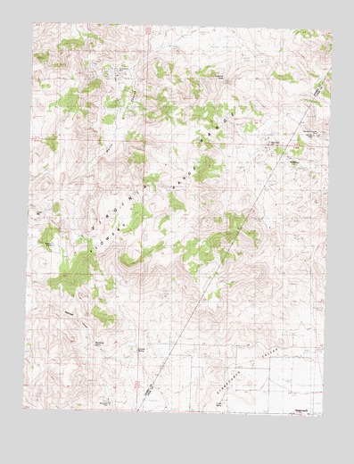
Martin Canyon, NV USGS Topographic Map
Click on map above to begin viewing in our Map Viewer.

This topographic map contains these locations and features:
Feature Name Type Latitude Longitude GNIS ID View Map
Biddleman SpringSpringN39.4830°W119.4207°854880View Map
Blackhawk CanyonValleyN39.3913°W119.4605°850753View Map
Blackhawk MineMineN39.3774°W119.4646°838894View Map
Blackhawk SpringSpringN39.3965°W119.4718°850752View Map
Cinder MountainSummitN39.4380°W119.4985°839536View Map
Cinder Mountain MineMineN39.4369°W119.4963°848309View Map
Cooney ReservoirReservoirN39.4007°W119.4752°848020View Map
Cooney SpringSpringN39.3951°W119.4540°839667View Map
Corral SpringSpringN39.3781°W119.4178°839708View Map
Goose Valley MineMineN39.4705°W119.4655°855733View Map
Gooseberry MillLocaleN39.4844°W119.4666°848308View Map
Gooseberry MineMineN39.4844°W119.4666°840726View Map
Gooseberry Mine Tailings DamDamN39.4816°W119.4627°863511View Map
Gooseberry Tailings ReservoirReservoirN39.4827°W119.4625°863512View Map
Iron Mountain Mining DistrictCivilN39.3771°W119.4538°848371View Map
Lizard MineMineN39.3796°W119.4643°848310View Map
Martin CanyonValleyN39.4988°W119.4443°850750View Map
Meeker PondLakeN39.4282°W119.4903°850751View Map
Ramsey (historical)Populated PlaceN39.4563°W119.3910°848216View Map
Ramsey MineMineN39.4655°W119.3849°843073View Map
Ramsey Mining DistrictCivilN39.4563°W119.3910°855049View Map
Ramsey Post Office (historical)Post OfficeN39.4563°W119.3910°864574View Map
Ramsey-Comstock MineMineN39.4666°W119.3843°843075View Map
San Juan HillSummitN39.4621°W119.4027°845649View Map
San Juan MineMineN39.4594°W119.3996°848311View Map
Windy Day MineMineN39.4596°W119.4063°848322View Map

Note: Coordinates in the location and feature list above are referenced to NAD83 datum.


Copyright (C) 2008-2024 Ryan Niemi / Sunset Dynamics ... All Rights Reserved