TopoQuest Logo
Do you find TopoQuest useful?
Help keep TopoQuest running and adding new maps/features by donating!
Bitcoin:  19c7KJd3qBynnjoSw5npx9KScwjBe4ifkT
Litecoin:  LXs6TkuXGGXo1vDsWCkWVdjQX94eUKd6ui
Home View Maps Find Maps Find Places Resources & Links


Fernley West, Nevada Topographic Map

USGS Map Title: Fernley West, NV
USGS Map MRC: 39119E3
DRG (GeoTIFF) Download: o39119e3.tif


Neighboring USGS Topographic Map Quads:


  Olinghouse, NV  
39119F4
 

  Wadsworth, NV  
39119F3
 

  Two Tips, NV  
39119F2
 

  Derby Dam, NV  
39119E4
 

  Fernley West, NV  
39119E3
 

  Fernley East, NV  
39119E2
 

  Martin Canyon, NV  
39119D4
 

  Stockton Flat Well, NV  
39119D3
 

  Silver Springs North, NV  
39119D2


Map MRC Location:

N40°
W120°
N40°
W119°
H8 H7 H6 H5 H4 H3 H2 H1
G8 G7 G6 G5 G4 G3 G2 G1
F8 F7 F6 F5 F4 F3 F2 F1
E8 E7 E6 E5 E4 E3 E2 E1
D8 D7 D6 D5 D4 D3 D2 D1
C8 C7 C6 C5 C4 C3 C2 C1
B8 B7 B6 B5 B4 B3 B2 B1
A8 A7 A6 A5 A4 A3 A2 A1
N39°
W120°
N39°
W119°

Fernley West, NV USGS 1:24K Topographic Map Preview:
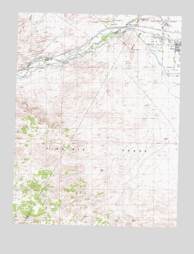
Fernley West, NV USGS Topographic Map
Click on map above to begin viewing in our Map Viewer.

This topographic map contains these locations and features:
Feature Name Type Latitude Longitude GNIS ID View Map
Airway Beacon 212LocaleN39.5974°W119.3696°838394View Map
Airway Beacon 216LocaleN39.6080°W119.2902°838395View Map
Alexander MineMineN39.6135°W119.3618°847633View Map
Canal TownshipCivilN39.5257°W119.2718°857630View Map
Derby Tungsten MineMineN39.6027°W119.3574°855060View Map
FernleyPopulated PlaceN39.6080°W119.2518°840446View Map
Fernley ValleyBasinN39.6063°W119.2602°856830View Map
Freeman SpringSpringN39.5516°W119.2621°850586View Map
GilpinPopulated PlaceN39.5980°W119.3357°856032View Map
Gilpin (historical)LocaleN39.6016°W119.3346°847628View Map
Gilpin Rest StopLocaleN39.6032°W119.3366°850585View Map
Horse SpringSpringN39.5327°W119.3085°841106View Map
Nevada Highway Patrol Northern Command West FernleyBuildingN39.6086°W119.2643°2740080View Map
Olinghouse Junction (historical)LocaleN39.6174°W119.3088°856829View Map
Painted Rock InterchangeCrossingN39.5916°W119.3693°847626View Map
Roderick (historical)Populated PlaceN39.5888°W119.3732°857554View Map
Roderick Post Office (historical)Post OfficeN39.5888°W119.3732°864484View Map
Smith RanchLocaleN39.5957°W119.3541°847591View Map
Wadsworth Volunteer Fire DepartmentBuildingN39.6176°W119.3112°2581229View Map
Wadsworth-Pyramid Lake InterchangeCrossingN39.6166°W119.3099°847654View Map
West-Main Street InterchangeCrossingN39.6166°W119.2652°863190View Map

Note: Coordinates in the location and feature list above are referenced to NAD83 datum.


Copyright (C) 2008-2025 Ryan Niemi / Sunset Dynamics ... All Rights Reserved