TopoQuest Logo
Do you find TopoQuest useful?
Help keep TopoQuest running and adding new maps/features by donating!
Bitcoin:  19c7KJd3qBynnjoSw5npx9KScwjBe4ifkT
Litecoin:  LXs6TkuXGGXo1vDsWCkWVdjQX94eUKd6ui
Home View Maps Find Maps Find Places Resources & Links


Matlock, Washington Topographic Map

USGS Map Title: Matlock, WA
USGS Map MRC: 47123B4
DRG (GeoTIFF) Download: o47123b4.tif


Neighboring USGS Topographic Map Quads:


  Grisdale, WA  
47123C5
 

  Dry Bed Lakes, WA  
47123C4
 

  Vance Creek, WA  
47123C3
 

  Wynoochee Valley NE, WA  
47123B5
 

  Matlock, WA  
47123B4
 

  Nahwatzel Lake, WA  
47123B3
 

  Prices Peak, WA  
47123A5
 

  Elma, WA  
47123A4
 

  McCleary, WA  
47123A3


Map MRC Location:

N48°
W124°
N48°
W123°
H8 H7 H6 H5 H4 H3 H2 H1
G8 G7 G6 G5 G4 G3 G2 G1
F8 F7 F6 F5 F4 F3 F2 F1
E8 E7 E6 E5 E4 E3 E2 E1
D8 D7 D6 D5 D4 D3 D2 D1
C8 C7 C6 C5 C4 C3 C2 C1
B8 B7 B6 B5 B4 B3 B2 B1
A8 A7 A6 A5 A4 A3 A2 A1
N47°
W124°
N47°
W123°

Matlock, WA USGS 1:24K Topographic Map Preview:
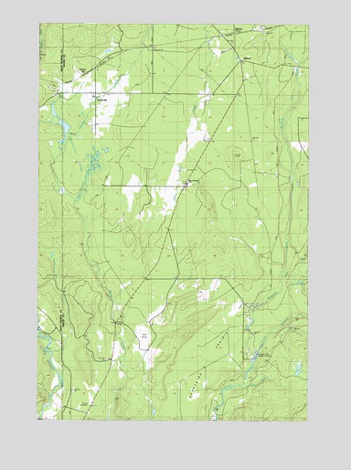
Matlock, WA USGS Topographic Map
Click on map above to begin viewing in our Map Viewer.

This topographic map contains these locations and features:
Feature Name Type Latitude Longitude GNIS ID View Map
Bingham CreekStreamN47.1437°W123.4029°1516566View Map
Bingham Creek TrailTrailN47.2093°W123.3785°1516568View Map
Carstairs PrairieFlatN47.1456°W123.4282°1517428View Map
DeckervillePopulated PlaceN47.2273°W123.4749°1518574View Map
Deckerville SwampSwampN47.2028°W123.4773°1528642View Map
Dry Bed CreekStreamN47.1629°W123.4668°1518933View Map
Frisken WyePopulated PlaceN47.2343°W123.4827°1519818View Map
Helene CreekStreamN47.1359°W123.4071°1528641View Map
Martins BridgeBridgeN47.1551°W123.4654°1522776View Map
Mary M Knight Elementary SchoolSchoolN47.1994°W123.4325°1531006View Map
Mason County Fire District 12BuildingN47.2001°W123.4329°2643464View Map
MatlockLocaleN47.2470°W123.4102°1528643View Map
MatlockPopulated PlaceN47.2379°W123.4079°1522803View Map
Matlock Post OfficePost OfficeN47.2386°W123.4076°2769245View Map
Outlet CreekStreamN47.1684°W123.3874°1524104View Map
Scott PrairieAreaN47.1531°W123.4515°1528914View Map
Simpson State Salmon HatcheryLocaleN47.1445°W123.4013°1533226View Map
Turnow CemeteryCemeteryN47.1300°W123.4755°1527481View Map

Note: Coordinates in the location and feature list above are referenced to NAD83 datum.


Copyright (C) 2008-2025 Ryan Niemi / Sunset Dynamics ... All Rights Reserved