TopoQuest Logo
Do you find TopoQuest useful?
Help keep TopoQuest running and adding new maps/features by donating!
Bitcoin:  19c7KJd3qBynnjoSw5npx9KScwjBe4ifkT
Litecoin:  LXs6TkuXGGXo1vDsWCkWVdjQX94eUKd6ui
Home View Maps Find Maps Find Places Resources & Links


McCleary, Washington Topographic Map

USGS Map Title: McCleary, WA
USGS Map MRC: 47123A3
DRG (GeoTIFF) Download: o47123a3.tif


Neighboring USGS Topographic Map Quads:


  Matlock, WA  
47123B4
 

  Nahwatzel Lake, WA  
47123B3
 

  Shelton Valley, WA  
47123B2
 

  Elma, WA  
47123A4
 

  McCleary, WA  
47123A3
 

  Kamilche Valley, WA  
47123A2
 

  South Elma, WA  
46123H4
 

  Malone, WA  
46123H3
 

  Capitol Peak, WA  
46123H2


Map MRC Location:

N48°
W124°
N48°
W123°
H8 H7 H6 H5 H4 H3 H2 H1
G8 G7 G6 G5 G4 G3 G2 G1
F8 F7 F6 F5 F4 F3 F2 F1
E8 E7 E6 E5 E4 E3 E2 E1
D8 D7 D6 D5 D4 D3 D2 D1
C8 C7 C6 C5 C4 C3 C2 C1
B8 B7 B6 B5 B4 B3 B2 B1
A8 A7 A6 A5 A4 A3 A2 A1
N47°
W124°
N47°
W123°

McCleary, WA USGS 1:24K Topographic Map Preview:
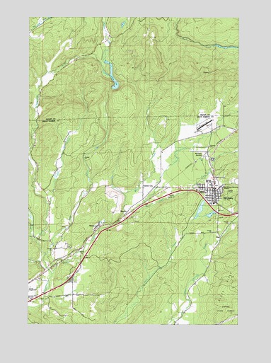
McCleary, WA USGS Topographic Map
Click on map above to begin viewing in our Map Viewer.

This topographic map contains these locations and features:
Feature Name Type Latitude Longitude GNIS ID View Map
Bear Valley Skyranch AirportAirportN47.0816°W123.2706°1533828View Map
Beehive Retirement CommunityBuildingN47.0540°W123.2703°2607737View Map
Bush CreekStreamN47.0282°W123.3665°1503674View Map
City of McClearyCivilN47.0586°W123.2727°2411061View Map
Cloquallum Truck TrailTrailN47.1134°W123.2715°1517871View Map
East Fork Wildcat CreekStreamN47.0412°W123.3221°1504642View Map
Falls CreekStreamN47.0329°W123.3718°1504825View Map
Forest View Senior 55 Plus Community Mobile Home ParkPopulated PlaceN47.0512°W123.3009°2607372View Map
Garden CityPopulated PlaceN47.0543°W123.3032°1512233View Map
Garden City PitMineN47.0466°W123.3182°2605692View Map
Grays Harbor Fire District 5 Station 51 Bush CreekBuildingN47.0335°W123.3667°2619783View Map
HillgrovePopulated PlaceN47.0665°W123.2679°1505524View Map
Mark Reed Hospital HeliportAirportN47.0562°W123.2604°1533827View Map
McClearyPopulated PlaceN47.0532°W123.2654°1506537View Map
McCleary Assembly of God ChurchChurchN47.0528°W123.2671°2608519View Map
McCleary City HallBuildingN47.0553°W123.2649°2610604View Map
McCleary Community CenterBuildingN47.0558°W123.2752°2608289View Map
McCleary Community ChurchChurchN47.0532°W123.2652°2609658View Map
McCleary DivisionCivilN47.0420°W123.2748°1939552View Map
McCleary Elementary SchoolSchoolN47.0492°W123.2657°1515114View Map
McCleary Fire Department Grays Harbor Fire District 12BuildingN47.0553°W123.2643°2643280View Map
McCleary JunctionPopulated PlaceN47.0682°W123.2724°1511135View Map
McCleary Police DepartmentBuildingN47.0553°W123.2649°2722066View Map
McCleary Post OfficePost OfficeN47.0550°W123.2668°2606979View Map
McCleary Pythian CemeteryCemeteryN47.0560°W123.2763°2605478View Map
McCleary School District 065 OfficeSchoolN47.0496°W123.2659°2518508View Map
McCleary Sewage Treatment PlantLocaleN47.0544°W123.2742°2610695View Map
McCleary Timberland LibraryBuildingN47.0549°W123.2668°2610208View Map
McCleary Transit StationLocaleN47.0553°W123.2649°2605465View Map
McCleary United Methodist ChurchChurchN47.0523°W123.2643°2609659View Map
Mohneys PrairieFlatN47.0804°W123.2718°1511605View Map
Olympic Christian CenterChurchN47.0550°W123.2729°2609660View Map
Powers CreekStreamN47.0487°W123.3640°1507612View Map
Raccoon RunStreamN47.0215°W123.2708°2085408View Map
RayvillePopulated PlaceN47.0443°W123.3174°1511249View Map
SinePopulated PlaceN47.0315°W123.2646°1511317View Map
Stump LakeLakeN47.0986°W123.3251°1508788View Map
Viking West Mobile Home ParkPopulated PlaceN47.0177°W123.3698°2607373View Map
West Fork Wildcat CreekStreamN47.0407°W123.3229°1509408View Map
WhitesLocaleN47.0393°W123.3368°1513240View Map
Wildcat CreekStreamN47.0201°W123.3621°1509513View Map
Wildcat PondLakeN47.0481°W123.2731°2778668View Map

Note: Coordinates in the location and feature list above are referenced to NAD83 datum.


Copyright (C) 2008-2025 Ryan Niemi / Sunset Dynamics ... All Rights Reserved