TopoQuest Logo
Do you find TopoQuest useful?
Help keep TopoQuest running and adding new maps/features by donating!
Bitcoin:  19c7KJd3qBynnjoSw5npx9KScwjBe4ifkT
Litecoin:  LXs6TkuXGGXo1vDsWCkWVdjQX94eUKd6ui
Home View Maps Find Maps Find Places Resources & Links


Maukey Gulch, Montana Topographic Map

USGS Map Title: Maukey Gulch, MT
USGS Map MRC: 46113B5
DRG (GeoTIFF) Download: o46113b5.tif


Neighboring USGS Topographic Map Quads:


  Stony Creek, MT  
46113C6
 

  Cornish Gulch, MT  
46113C5
 

  Antelope Creek, MT  
46113C4
 

  Mount Emerine, MT  
46113B6
 

  Maukey Gulch, MT  
46113B5
 

  Potato Lakes, MT  
46113B4
 

  Whetstone Ridge, MT  
46113A6
 

  Moose Lake, MT  
46113A5
 

  Carpp Ridge, MT  
46113A4


Map MRC Location:

N47°
W114°
N47°
W113°
H8 H7 H6 H5 H4 H3 H2 H1
G8 G7 G6 G5 G4 G3 G2 G1
F8 F7 F6 F5 F4 F3 F2 F1
E8 E7 E6 E5 E4 E3 E2 E1
D8 D7 D6 D5 D4 D3 D2 D1
C8 C7 C6 C5 C4 C3 C2 C1
B8 B7 B6 B5 B4 B3 B2 B1
A8 A7 A6 A5 A4 A3 A2 A1
N46°
W114°
N46°
W113°

Maukey Gulch, MT USGS 1:24K Topographic Map Preview:
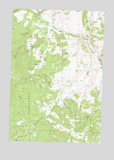
Maukey Gulch, MT USGS Topographic Map
Click on map above to begin viewing in our Map Viewer.

This topographic map contains these locations and features:
Feature Name Type Latitude Longitude GNIS ID View Map
Angelico CreekStreamN46.1591°W113.5656°779047View Map
Beaver CreekStreamN46.2341°W113.5717°779605View Map
Bentz MineMineN46.1252°W113.6165°779712View Map
Big Moffat GulchValleyN46.2480°W113.5909°779842View Map
Eagle CanyonValleyN46.2080°W113.5065°782747View Map
East Fork Rock CreekStreamN46.2002°W113.5001°782900View Map
Elk CreekStreamN46.1366°W113.5954°783071View Map
Emerine GulchValleyN46.2346°W113.5754°783178View Map
Emerine GulchValleyN46.2402°W113.5729°783179View Map
Helm CreekStreamN46.1769°W113.5523°768021View Map
Mallard CreekStreamN46.2427°W113.5123°786798View Map
Mariposa Post Office (historical)Post OfficeN46.2130°W113.5504°1781807View Map
Maukey GulchValleyN46.2249°W113.5329°786931View Map
McDonald MineMineN46.2096°W113.5537°803204View Map
McDonald MineMineN46.2094°W113.5542°787034View Map
Milo LakeLakeN46.1674°W113.5466°787445View Map
Moose Meadow CreekStreamN46.1391°W113.5917°787657View Map
Moose MeadowsLakeN46.1308°W113.5992°787659View Map
NE NE Section 6 MineMineN46.2224°W113.5167°803198View Map
Poison CreekStreamN46.1910°W113.5203°789030View Map
Ross ForkStreamN46.2246°W113.5256°789787View Map
Sapphire GulchValleyN46.2458°W113.5923°790017View Map
SE NE Section 6 MineMineN46.2194°W113.5156°803199View Map
Showers CreekStreamN46.1969°W113.5892°790464View Map
Stephens ReservoirReservoirN46.1976°W113.5880°791492View Map
Swamp CreekStreamN46.1777°W113.5520°791759View Map
West Fork Beaver CreekStreamN46.2180°W113.5854°792977View Map
West Fork Rock CreekStreamN46.2238°W113.5223°793072View Map
West Fork Work CenterLocaleN46.2288°W113.5584°793102View Map

Note: Coordinates in the location and feature list above are referenced to NAD83 datum.


Copyright (C) 2008-2025 Ryan Niemi / Sunset Dynamics ... All Rights Reserved