TopoQuest Logo
Do you find TopoQuest useful?
Help keep TopoQuest running and adding new maps/features by donating!
Bitcoin:  19c7KJd3qBynnjoSw5npx9KScwjBe4ifkT
Litecoin:  LXs6TkuXGGXo1vDsWCkWVdjQX94eUKd6ui
Home View Maps Find Maps Find Places Resources & Links


Maynard, Minnesota Topographic Map

USGS Map Title: Maynard, MN
USGS Map MRC: 44095H4
DRG (GeoTIFF) Download: o44095h4.tif


Neighboring USGS Topographic Map Quads:


  Gracelock, MN  
45095A5
 

  Kerkhoven SW, MN  
45095A4
 

  Kerkhoven SE, MN  
45095A3
 

  Asbury, MN  
44095H5
 

  Maynard, MN  
44095H4
 

  Clara City, MN  
44095H3
 

  Granite Falls, MN  
44095G5
 

  Minnesota Falls, MN  
44095G4
 

  Sacred Heart, MN  
44095G3


Map MRC Location:

N45°
W96°
N45°
W95°
H8 H7 H6 H5 H4 H3 H2 H1
G8 G7 G6 G5 G4 G3 G2 G1
F8 F7 F6 F5 F4 F3 F2 F1
E8 E7 E6 E5 E4 E3 E2 E1
D8 D7 D6 D5 D4 D3 D2 D1
C8 C7 C6 C5 C4 C3 C2 C1
B8 B7 B6 B5 B4 B3 B2 B1
A8 A7 A6 A5 A4 A3 A2 A1
N44°
W96°
N44°
W95°

Maynard, MN USGS 1:24K Topographic Map Preview:
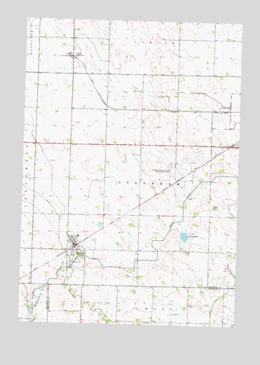
Maynard, MN USGS Topographic Map
Click on map above to begin viewing in our Map Viewer.

This topographic map contains these locations and features:
Feature Name Type Latitude Longitude GNIS ID View Map
Baptist ChurchChurchN44.9100°W95.4706°2066157View Map
Chetomba CreekStreamN44.8980°W95.4711°641150View Map
City of MaynardCivilN44.9052°W95.4679°2395052View Map
County Ditch Number FifteenCanalN44.9705°W95.4061°641696View Map
Franko State Wildlife Management AreaParkN44.9375°W95.4117°643895View Map
GluekPopulated PlaceN44.9852°W95.4734°644191View Map
Gluek Post Office (historical)Post OfficeN44.9853°W95.4731°2066767View Map
Gluek Post Office (historical)Post OfficeN44.9853°W95.4731°2066130View Map
Howard's AirportAirportN44.9768°W95.4082°2676828View Map
Judicial Ditch Number OneCanalN44.8872°W95.3831°645771View Map
MacCray West Elementary SchoolSchoolN44.9111°W95.4667°2066790View Map
MacCray West Elementary SchoolSchoolN44.9111°W95.4667°2066153View Map
MaynardPopulated PlaceN44.9069°W95.4689°647635View Map
MaynardLocaleN44.9069°W95.4681°2066789View Map
MaynardLocaleN44.9069°W95.4681°2066152View Map
Maynard City HallBuildingN44.9078°W95.4692°2066788View Map
Maynard City HallBuildingN44.9078°W95.4692°2066151View Map
Maynard Fire DepartmentBuildingN44.9072°W95.4705°2666431View Map
Maynard Lutheran ChurchChurchN44.9056°W95.4667°2066793View Map
Maynard Lutheran ChurchChurchN44.9056°W95.4667°2066156View Map
Maynard Post OfficePost OfficeN44.9072°W95.4694°2066786View Map
Maynard Post OfficePost OfficeN44.9072°W95.4694°2066149View Map
Norborg LakeLakeN44.9122°W95.4058°648579View Map
Pioneer Land LibraryBuildingN44.9075°W95.4694°2066787View Map
Pioneer Land LibraryBuildingN44.9075°W95.4694°2066150View Map
Presbyterian ChurchChurchN44.9103°W95.4717°2066792View Map
Presbyterian ChurchChurchN44.9103°W95.4717°2066155View Map
Township of StonehamCivilN44.9344°W95.4324°665717View Map
Wang ChurchChurchN44.8761°W95.4275°653763View Map
Wang Lutheran Church CemeteryCemeteryN44.8758°W95.4275°2065396View Map
Wesota Station (historical)LocaleN44.9847°W95.4722°2066766View Map
Wesota Station (historical)LocaleN44.9847°W95.4722°2066129View Map

Note: Coordinates in the location and feature list above are referenced to NAD83 datum.


Copyright (C) 2008-2025 Ryan Niemi / Sunset Dynamics ... All Rights Reserved