TopoQuest Logo
Do you find TopoQuest useful?
Help keep TopoQuest running and adding new maps/features by donating!
Bitcoin:  19c7KJd3qBynnjoSw5npx9KScwjBe4ifkT
Litecoin:  LXs6TkuXGGXo1vDsWCkWVdjQX94eUKd6ui
Home View Maps Find Maps Find Places Resources & Links


Clara City, Minnesota Topographic Map

USGS Map Title: Clara City, MN
USGS Map MRC: 44095H3
DRG (GeoTIFF) Download: o44095h3.tif


Neighboring USGS Topographic Map Quads:


  Kerkhoven SW, MN  
45095A4
 

  Kerkhoven SE, MN  
45095A3
 

  Raymond, MN  
45095A2
 

  Maynard, MN  
44095H4
 

  Clara City, MN  
44095H3
 

  Prinsburg, MN  
44095H2
 

  Minnesota Falls, MN  
44095G4
 

  Sacred Heart, MN  
44095G3
 

  Renville, MN  
44095G2


Map MRC Location:

N45°
W96°
N45°
W95°
H8 H7 H6 H5 H4 H3 H2 H1
G8 G7 G6 G5 G4 G3 G2 G1
F8 F7 F6 F5 F4 F3 F2 F1
E8 E7 E6 E5 E4 E3 E2 E1
D8 D7 D6 D5 D4 D3 D2 D1
C8 C7 C6 C5 C4 C3 C2 C1
B8 B7 B6 B5 B4 B3 B2 B1
A8 A7 A6 A5 A4 A3 A2 A1
N44°
W96°
N44°
W95°

Clara City, MN USGS 1:24K Topographic Map Preview:
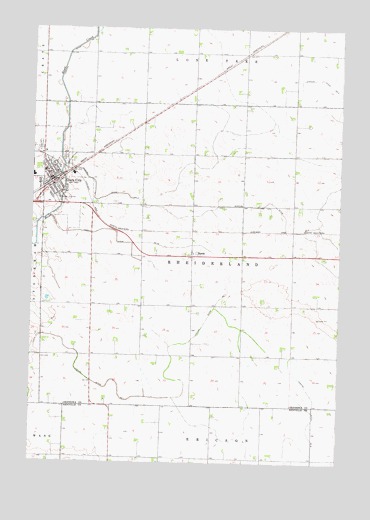
Clara City, MN USGS Topographic Map
Click on map above to begin viewing in our Map Viewer.

This topographic map contains these locations and features:
Feature Name Type Latitude Longitude GNIS ID View Map
Bethany CemeteryCemeteryN44.9625°W95.3620°639992View Map
Bethany Reformed ChurchChurchN44.9581°W95.3681°2066778View Map
Bethany Reformed ChurchChurchN44.9581°W95.3681°2066141View Map
BundePopulated PlaceN44.9347°W95.3103°640642View Map
Bunde Christian Reformed ChurchChurchN44.9350°W95.3092°2066785View Map
Bunde Christian Reformed ChurchChurchN44.9350°W95.3092°2066148View Map
Christian Reform Church CemeteryCemeteryN44.9355°W95.3080°2066180View Map
City of Clara CityCivilN44.9584°W95.3672°663803View Map
Clara CityPopulated PlaceN44.9550°W95.3664°641238View Map
Clara CityLocaleN44.9547°W95.3681°2066776View Map
Clara CityLocaleN44.9547°W95.3681°2066139View Map
Clara City ClinicHospitalN44.9542°W95.3708°2066781View Map
Clara City ClinicHospitalN44.9542°W95.3708°2066144View Map
Clara City Fire DepartmentBuildingN44.9578°W95.3694°2066773View Map
Clara City Fire DepartmentBuildingN44.9563°W95.3696°2066136View Map
Clara City HallBuildingN44.9578°W95.3694°2066771View Map
Clara City HallBuildingN44.9578°W95.3694°2066134View Map
Clara City Nursing HomeHospitalN44.9614°W95.3697°2066782View Map
Clara City Nursing HomeHospitalN44.9614°W95.3697°2066145View Map
Clara City Police DepartmentBuildingN44.9578°W95.3694°2066772View Map
Clara City Police DepartmentBuildingN44.9563°W95.3696°2066135View Map
Clara City Post OfficePost OfficeN44.9550°W95.3681°2066774View Map
Clara City Post OfficePost OfficeN44.9550°W95.3681°2066137View Map
Clara City Public LibraryBuildingN44.9553°W95.3681°2066775View Map
Clara City Public LibraryBuildingN44.9553°W95.3681°2066138View Map
County Ditch Number FiftytwoCanalN44.9394°W95.3408°642177View Map
Faith Lutheran ChurchChurchN44.9550°W95.3661°2066777View Map
Faith Lutheran ChurchChurchN44.9550°W95.3661°2066140View Map
Immanuel Lutheran ChurchChurchN44.9583°W95.3650°2066779View Map
Immanuel Lutheran ChurchChurchN44.9583°W95.3650°2066142View Map
Judicial Ditch Number TwoCanalN44.9419°W95.2658°645842View Map
MacCray High SchoolSchoolN44.9575°W95.3744°2066784View Map
MacCray High SchoolSchoolN44.9575°W95.3744°2066147View Map
MacCray Junior High SchoolSchoolN44.9586°W95.3697°2066783View Map
MacCray Junior High SchoolSchoolN44.9586°W95.3697°2066146View Map
Saint Clara Catholic ChurchChurchN44.9586°W95.3689°2066780View Map
Saint Clara Catholic ChurchChurchN44.9586°W95.3689°2066143View Map
Township of RheiderlandCivilN44.9341°W95.3080°665403View Map

Note: Coordinates in the location and feature list above are referenced to NAD83 datum.


Copyright (C) 2008-2024 Ryan Niemi / Sunset Dynamics ... All Rights Reserved