TopoQuest Logo
Do you find TopoQuest useful?
Help keep TopoQuest running and adding new maps/features by donating!
Bitcoin:  19c7KJd3qBynnjoSw5npx9KScwjBe4ifkT
Litecoin:  LXs6TkuXGGXo1vDsWCkWVdjQX94eUKd6ui
Home View Maps Find Maps Find Places Resources & Links


Maynard, Iowa Topographic Map

USGS Map Title: Maynard, IA
USGS Map MRC: 42091G8
DRG (GeoTIFF) Download: o42091g8.tif


Neighboring USGS Topographic Map Quads:


  Alpha, IA  
42092H1
 

  Hawkeye, IA  
42091H8
 

  West Union, IA  
42091H7
 

  Sumner, IA  
42092G1
 

  Maynard, IA  
42091G8
 

  Fayette, IA  
42091G7
 

  Fairbank, IA  
42092F1
 

  Oelwein, IA  
42091F8
 

  Stanley, IA  
42091F7


Map MRC Location:

N43°
W92°
N43°
W91°
H8 H7 H6 H5 H4 H3 H2 H1
G8 G7 G6 G5 G4 G3 G2 G1
F8 F7 F6 F5 F4 F3 F2 F1
E8 E7 E6 E5 E4 E3 E2 E1
D8 D7 D6 D5 D4 D3 D2 D1
C8 C7 C6 C5 C4 C3 C2 C1
B8 B7 B6 B5 B4 B3 B2 B1
A8 A7 A6 A5 A4 A3 A2 A1
N42°
W92°
N42°
W91°

Maynard, IA USGS 1:24K Topographic Map Preview:
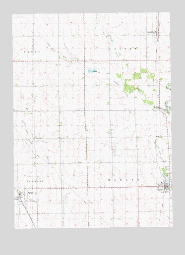
Maynard, IA USGS Topographic Map
Click on map above to begin viewing in our Map Viewer.

This topographic map contains these locations and features:
Feature Name Type Latitude Longitude GNIS ID View Map
Calvary CemeteryCemeteryN42.7664°W91.9858°455078View Map
Center Grove CemeteryCemeteryN42.8186°W91.8757°455286View Map
City of MaynardCivilN42.7739°W91.8775°2395053View Map
City of RandaliaCivilN42.8636°W91.8864°2396312View Map
City of WestgateCivilN42.7682°W91.9956°2397280View Map
Emmanuel United Methodist ChurchChurchN42.7750°W91.8807°1945099View Map
Harlan Township Fire DepartmentBuildingN42.7741°W91.8792°1945096View Map
Hope CemeteryCemeteryN42.8028°W91.9612°457642View Map
Hope ChurchChurchN42.8028°W91.9629°457647View Map
Little Volga RiverStreamN42.8178°W91.8796°458521View Map
Long Grove CemeteryCemeteryN42.7708°W91.8765°1945193View Map
MaynardPopulated PlaceN42.7739°W91.8824°458870View Map
Maynard (historical)LocaleN42.7739°W91.8824°1945094View Map
Maynard Community HallBuildingN42.7730°W91.8807°1945098View Map
Maynard Cooperative Company ElevatorLocaleN42.7736°W91.8821°1945097View Map
Maynard Cooperative Company ElevatorLocaleN42.8622°W91.8849°1945170View Map
Maynard Elementary SchoolSchoolN42.7704°W91.8805°462834View Map
Maynard ParkParkN42.7800°W91.8799°458871View Map
Maynard Post OfficePost OfficeN42.7739°W91.8824°1945095View Map
North Branch Volga RiverStreamN42.8314°W91.9129°459564View Map
Northeast Iowa High School CharterSchoolN42.7704°W91.8802°2719813View Map
RandaliaPopulated PlaceN42.8630°W91.8857°460519View Map
Randalia (historical)LocaleN42.8622°W91.8849°1945173View Map
Randalia Post OfficePost OfficeN42.8622°W91.8849°1945171View Map
Saint Paul Lutheran ChurchChurchN42.7747°W91.8838°1945100View Map
Saint Peters Lutheran ChurchChurchN42.7700°W91.9963°1945166View Map
Stoe Creek BridgeBridgeN42.8022°W91.9877°1945204View Map
Township of CenterCivilN42.8623°W91.9044°467576View Map
Township of HarlanCivilN42.7743°W91.9033°468005View Map
Twin BridgeBridgeN42.8180°W91.8793°1945199View Map
Twin Bridges County ParkParkN42.8183°W91.8799°462398View Map
Union ChurchChurchN42.8186°W91.9991°462450View Map
Union Evangelical CemeteryCemeteryN42.8187°W91.9997°1945194View Map
United Methodist ChurchChurchN42.8622°W91.8849°1945172View Map
West Central Junior - Senior High SchoolSchoolN42.7704°W91.8807°2719901View Map
WestgatePopulated PlaceN42.7700°W91.9963°462940View Map
Westgate (historical)LocaleN42.7666°W91.9946°1945167View Map
Westgate Elevator Company ElevatorLocaleN42.7700°W91.9963°1945164View Map
Westgate Fire DepartmentBuildingN42.7698°W91.9954°2577336View Map
Westgate First RespondersBuildingN42.7698°W91.9954°2599849View Map
Westgate Post OfficePost OfficeN42.7700°W91.9963°1945165View Map
Westgate Public LibraryBuildingN42.7700°W91.9963°1945163View Map

Note: Coordinates in the location and feature list above are referenced to NAD83 datum.


Copyright (C) 2008-2024 Ryan Niemi / Sunset Dynamics ... All Rights Reserved