TopoQuest Logo
Do you find TopoQuest useful?
Help keep TopoQuest running and adding new maps/features by donating!
Bitcoin:  19c7KJd3qBynnjoSw5npx9KScwjBe4ifkT
Litecoin:  LXs6TkuXGGXo1vDsWCkWVdjQX94eUKd6ui
Home View Maps Find Maps Find Places Resources & Links


Mazama, Washington Topographic Map

USGS Map Title: Mazama, WA
USGS Map MRC: 48120E4
DRG (GeoTIFF) Download: o48120e4.tif


Neighboring USGS Topographic Map Quads:


  Robinson Mountain, WA  
48120F5
 

  McLeod Mountain, WA  
48120F4
 

  Sweetgrass Butte, WA  
48120F3
 

  Silver Star Mountain, WA  
48120E5
 

  Mazama, WA  
48120E4
 

  Rendevous Mountain, WA  
48120E3
 

  Gilbert, WA  
48120D5
 

  Midnight Mountain, WA  
48120D4
 

  Thompson Ridge, WA  
48120D3


Map MRC Location:

N49°
W121°
N49°
W120°
H8 H7 H6 H5 H4 H3 H2 H1
G8 G7 G6 G5 G4 G3 G2 G1
F8 F7 F6 F5 F4 F3 F2 F1
E8 E7 E6 E5 E4 E3 E2 E1
D8 D7 D6 D5 D4 D3 D2 D1
C8 C7 C6 C5 C4 C3 C2 C1
B8 B7 B6 B5 B4 B3 B2 B1
A8 A7 A6 A5 A4 A3 A2 A1
N48°
W121°
N48°
W120°

Mazama, WA USGS 1:24K Topographic Map Preview:
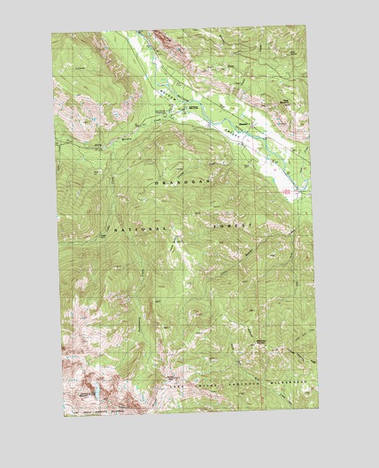
Mazama, WA USGS Topographic Map
Click on map above to begin viewing in our Map Viewer.

This topographic map contains these locations and features:
Feature Name Type Latitude Longitude GNIS ID View Map
Aero Methow Rescue ServiceBuildingN48.5862°W120.4101°2643544View Map
Caloway CreekStreamN48.6165°W120.4662°1517232View Map
Cedar CreekStreamN48.5888°W120.4715°1517542View Map
Cedar Creek TrailTrailN48.5896°W120.4632°1529940View Map
Cedar FallsFallsN48.5585°W120.4804°1517560View Map
Cedar FallsLocaleN48.5576°W120.4795°1529726View Map
Early Winters CampgroundLocaleN48.5979°W120.4429°1529941View Map
Early Winters CampgroundLocaleN48.5971°W120.4459°1529728View Map
Early Winters CreekStreamN48.6010°W120.4382°1519066View Map
Early Winters Visitor CenterLocaleN48.5999°W120.4387°1529729View Map
Early Winters Visitors StationLocaleN48.5996°W120.4368°1519067View Map
Flagg MountainSummitN48.5988°W120.3862°1519630View Map
Gardner MountainSummitN48.5071°W120.4882°1519897View Map
Goat CreekStreamN48.5743°W120.3801°1520027View Map
Goat Peak TrailTrailN48.6201°W120.3968°1529943View Map
Goat SpringSpringN48.6158°W120.3842°1520061View Map
Goat WallCliffN48.6201°W120.4473°1520063View Map
Goat Wall CreekStreamN48.6238°W120.4587°1520064View Map
Huckleberry CreekStreamN48.5693°W120.4732°1521023View Map
Left Fork Little Boulder CreekStreamN48.5565°W120.3865°1521996View Map
Little Boulder CreekStreamN48.5713°W120.3812°1522169View Map
Looney CreekStreamN48.5860°W120.4148°1522448View Map
MazamaPopulated PlaceN48.5921°W120.4040°1522828View Map
McKinney MountainSummitN48.5215°W120.4062°1522918View Map
North Cascades Scenic HighwayAreaN48.5832°W120.4998°1529939View Map
Okanogan Fire District 6 Mazama Fire DepartmentBuildingN48.5864°W120.4100°2643861View Map
Pekin CreekStreamN48.5904°W120.4982°1524306View Map
Sandy ButteSummitN48.5554°W120.4437°1525428View Map
Spokane GulchValleyN48.6032°W120.4159°1526385View Map
Storey PeakSummitN48.5115°W120.4468°1526594View Map
Thiese CreekStreamN48.6026°W120.4129°1527084View Map

Note: Coordinates in the location and feature list above are referenced to NAD83 datum.


Copyright (C) 2008-2024 Ryan Niemi / Sunset Dynamics ... All Rights Reserved