TopoQuest Logo
Do you find TopoQuest useful?
Help keep TopoQuest running and adding new maps/features by donating!
Bitcoin:  19c7KJd3qBynnjoSw5npx9KScwjBe4ifkT
Litecoin:  LXs6TkuXGGXo1vDsWCkWVdjQX94eUKd6ui
Home View Maps Find Maps Find Places Resources & Links


Silver Star Mountain, Washington Topographic Map

USGS Map Title: Silver Star Mountain, WA
USGS Map MRC: 48120E5
DRG (GeoTIFF) Download: o48120e5.tif


Neighboring USGS Topographic Map Quads:


  Slate Peak, WA  
48120F6
 

  Robinson Mountain, WA  
48120F5
 

  McLeod Mountain, WA  
48120F4
 

  Washington Pass, WA  
48120E6
 

  Silver Star Mountain, WA  
48120E5
 

  Mazama, WA  
48120E4
 

  McAlester Mountain, WA  
48120D6
 

  Gilbert, WA  
48120D5
 

  Midnight Mountain, WA  
48120D4


Map MRC Location:

N49°
W121°
N49°
W120°
H8 H7 H6 H5 H4 H3 H2 H1
G8 G7 G6 G5 G4 G3 G2 G1
F8 F7 F6 F5 F4 F3 F2 F1
E8 E7 E6 E5 E4 E3 E2 E1
D8 D7 D6 D5 D4 D3 D2 D1
C8 C7 C6 C5 C4 C3 C2 C1
B8 B7 B6 B5 B4 B3 B2 B1
A8 A7 A6 A5 A4 A3 A2 A1
N48°
W121°
N48°
W120°

Silver Star Mountain, WA USGS 1:24K Topographic Map Preview:
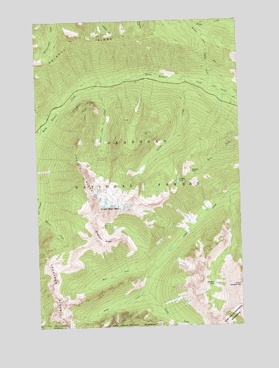
Silver Star Mountain, WA USGS Topographic Map
Click on map above to begin viewing in our Map Viewer.

This topographic map contains these locations and features:
Feature Name Type Latitude Longitude GNIS ID View Map
Delancy RidgeRidgeN48.6171°W120.6037°1518664View Map
Dolly LakeLakeN48.5643°W120.5612°1529959View Map
Driveway Butte TrailTrailN48.6190°W120.5240°1518923View Map
Kangaroo RidgeRidgeN48.5110°W120.6145°1521564View Map
Klipchuck CampgroundLocaleN48.5968°W120.5134°1529731View Map
Mudhole LakeLakeN48.5624°W120.5305°1523499View Map
North Gardner MountainSummitN48.5154°W120.5018°1523885View Map
Pine CreekStreamN48.5790°W120.6232°1524442View Map
Shelokum LakeLakeN48.5167°W120.5186°1525663View Map
Silver Star CreekStreamN48.5996°W120.5843°1525794View Map
Silver Star MountainSummitN48.5479°W120.5845°1525796View Map
Snagtooth RidgeRidgeN48.5346°W120.5890°1526001View Map
South Fork Cedar CreekStreamN48.5151°W120.5595°1526174View Map
Varden CreekStreamN48.6007°W120.5318°1527688View Map
Varden LakeLakeN48.5592°W120.5394°1527689View Map
Vasiliki RidgeRidgeN48.5610°W120.5951°1527690View Map
West Fork Cedar CreekStreamN48.5246°W120.5537°1527935View Map

Note: Coordinates in the location and feature list above are referenced to NAD83 datum.


Copyright (C) 2008-2025 Ryan Niemi / Sunset Dynamics ... All Rights Reserved