TopoQuest Logo
Do you find TopoQuest useful?
Help keep TopoQuest running and adding new maps/features by donating!
Bitcoin:  19c7KJd3qBynnjoSw5npx9KScwjBe4ifkT
Litecoin:  LXs6TkuXGGXo1vDsWCkWVdjQX94eUKd6ui
Home View Maps Find Maps Find Places Resources & Links


McCaslin Mountain, Wisconsin Topographic Map

USGS Map Title: McCaslin Mountain, WI
USGS Map MRC: 45088D4
DRG (GeoTIFF) Download: o45088d4.tif


Neighboring USGS Topographic Map Quads:


  Blackwell, WI  
45088E5
 

  Goodman SW, WI  
45088E4
 

  Coleman Lake, WI  
45088E3
 

  Otter Lake, WI  
45088D5
 

  McCaslin Mountain, WI  
45088D4
 

  Roaring Rapids, WI  
45088D3
 

  Townsend, WI  
45088C5
 

  Wheeler Lake, WI  
45088C4
 

  Thunder Mountain, WI  
45088C3


Map MRC Location:

N46°
W89°
N46°
W88°
H8 H7 H6 H5 H4 H3 H2 H1
G8 G7 G6 G5 G4 G3 G2 G1
F8 F7 F6 F5 F4 F3 F2 F1
E8 E7 E6 E5 E4 E3 E2 E1
D8 D7 D6 D5 D4 D3 D2 D1
C8 C7 C6 C5 C4 C3 C2 C1
B8 B7 B6 B5 B4 B3 B2 B1
A8 A7 A6 A5 A4 A3 A2 A1
N45°
W89°
N45°
W88°

McCaslin Mountain, WI USGS 1:24K Topographic Map Preview:
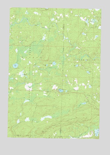
McCaslin Mountain, WI USGS Topographic Map
Click on map above to begin viewing in our Map Viewer.

This topographic map contains these locations and features:
Feature Name Type Latitude Longitude GNIS ID View Map
Berry LakeLakeN45.4389°W88.3916°1578759View Map
Cloud LakeLakeN45.4469°W88.4383°1579019View Map
Crane LakeLakeN45.4451°W88.4071°1579058View Map
Deer LakeLakeN45.4440°W88.4911°1579102View Map
Deer Lake D12.198 DamDamN45.4316°W88.4784°1792735View Map
Deer Lake FlowageLakeN45.4342°W88.4767°1579107View Map
Deer Lake Outlet FlowageReservoirN45.4316°W88.4784°1792736View Map
Evergreen LakeLakeN45.4450°W88.4481°1579224View Map
Harper LakeLakeN45.4880°W88.3943°1579394View Map
King LakeLakeN45.4209°W88.4284°1579591View Map
Knowles Creek ImpoundmentReservoirN45.4073°W88.4804°2783909View Map
Lake IrwinLakeN45.4252°W88.3887°1584514View Map
McCaslin LakeLakeN45.3815°W88.3781°1579837View Map
McCaslin Lookout TowerTowerN45.3808°W88.4529°1581273View Map
McCaslin MountainSummitN45.3952°W88.3934°1579838View Map
McCaslin Mountain State Natural AreaParkN45.3811°W88.4493°2060883View Map
Newman CreekStreamN45.4516°W88.4240°1580003View Map
Pemma CreekStreamN45.4272°W88.4862°1580106View Map
Perch LakeLakeN45.4880°W88.3860°1580110View Map
Smith CreekStreamN45.3861°W88.3896°1580433View Map
Spring CreekStreamN45.4139°W88.3868°1580486View Map
Spruce LakeLakeN45.4205°W88.4209°1580509View Map

Note: Coordinates in the location and feature list above are referenced to NAD83 datum.


Copyright (C) 2008-2025 Ryan Niemi / Sunset Dynamics ... All Rights Reserved