TopoQuest Logo
Do you find TopoQuest useful?
Help keep TopoQuest running and adding new maps/features by donating!
Bitcoin:  19c7KJd3qBynnjoSw5npx9KScwjBe4ifkT
Litecoin:  LXs6TkuXGGXo1vDsWCkWVdjQX94eUKd6ui
Home View Maps Find Maps Find Places Resources & Links


Wheeler Lake, Wisconsin Topographic Map

USGS Map Title: Wheeler Lake, WI
USGS Map MRC: 45088C4
DRG (GeoTIFF) Download: o45088c4.tif


Neighboring USGS Topographic Map Quads:


  Otter Lake, WI  
45088D5
 

  McCaslin Mountain, WI  
45088D4
 

  Roaring Rapids, WI  
45088D3
 

  Townsend, WI  
45088C5
 

  Wheeler Lake, WI  
45088C4
 

  Thunder Mountain, WI  
45088C3
 

  Shadow Lake, WI  
45088B5
 

  Mountain, WI  
45088B4
 

  Shay Lake, WI  
45088B3


Map MRC Location:

N46°
W89°
N46°
W88°
H8 H7 H6 H5 H4 H3 H2 H1
G8 G7 G6 G5 G4 G3 G2 G1
F8 F7 F6 F5 F4 F3 F2 F1
E8 E7 E6 E5 E4 E3 E2 E1
D8 D7 D6 D5 D4 D3 D2 D1
C8 C7 C6 C5 C4 C3 C2 C1
B8 B7 B6 B5 B4 B3 B2 B1
A8 A7 A6 A5 A4 A3 A2 A1
N45°
W89°
N45°
W88°

Wheeler Lake, WI USGS 1:24K Topographic Map Preview:
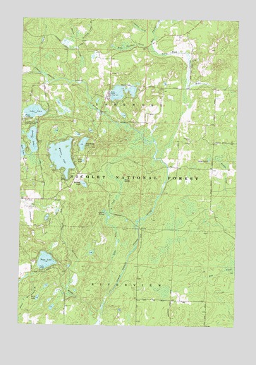
Wheeler Lake, WI USGS Topographic Map
Click on map above to begin viewing in our Map Viewer.

This topographic map contains these locations and features:
Feature Name Type Latitude Longitude GNIS ID View Map
Battle CreekStreamN45.3494°W88.4676°1578711View Map
Birch LakeLakeN45.3170°W88.4638°1578791View Map
Buck LakeLakeN45.2610°W88.4892°1578872View Map
Bullfrog LakeLakeN45.3075°W88.4633°1578884View Map
Deer IslandIslandN45.3214°W88.4796°1580994View Map
East Thunder CreekStreamN45.3619°W88.4232°1579184View Map
Forbes SpringSpringN45.3177°W88.3912°1579269View Map
Hickey SpringsSpringN45.3097°W88.4396°1579439View Map
John LakeLakeN45.3369°W88.4925°1579538View Map
Knowles CreekStreamN45.3633°W88.4909°1579600View Map
Lakewood Country Club Airport (historical)AirportN45.2944°W88.4946°1582049View Map
Lakewood Volunteer Fire DepartmentBuildingN45.3443°W88.4947°2696972View Map
Mary ParkParkN45.3441°W88.4476°1579824View Map
McCaslin BrookStreamN45.2550°W88.4523°1579836View Map
Miriam LakeLakeN45.3294°W88.4599°1580846View Map
Munger LakeLakeN45.3255°W88.4932°1579971View Map
Paya LakeLakeN45.2760°W88.4848°1580100View Map
Pine Ridge LakeLakeN45.3241°W88.4641°1580163View Map
Snow Falls CreekStreamN45.2619°W88.4498°1580444View Map
Snow Falls Creek State Natural AreaParkN45.2700°W88.4458°2081915View Map
Spring CreekStreamN45.3700°W88.4268°1580490View Map
Sullivan SpringsSpringN45.2964°W88.4507°1580552View Map
Town of LakewoodCivilN45.3331°W88.4311°1583520View Map
Virgin IslandIslandN45.3225°W88.4734°1580995View Map
Waubee LakeLakeN45.3453°W88.4422°1580730View Map
West Thunder CreekStreamN45.3619°W88.4232°1580760View Map
Wheeler LakeLakeN45.3188°W88.4761°1580765View Map
Wheeler Lake Swimming BeachBeachN45.3094°W88.4734°1580993View Map

Note: Coordinates in the location and feature list above are referenced to NAD83 datum.


Copyright (C) 2008-2024 Ryan Niemi / Sunset Dynamics ... All Rights Reserved