TopoQuest Logo
Do you find TopoQuest useful?
Help keep TopoQuest running and adding new maps/features by donating!
Bitcoin:  19c7KJd3qBynnjoSw5npx9KScwjBe4ifkT
Litecoin:  LXs6TkuXGGXo1vDsWCkWVdjQX94eUKd6ui
Home View Maps Find Maps Find Places Resources & Links


McDonalds Mill, Virginia Topographic Map

USGS Map Title: McDonalds Mill, VA
USGS Map MRC: 37080C3
DRG (GeoTIFF) Download: o37080c3.tif


Neighboring USGS Topographic Map Quads:


  Waiteville, WV  
37080D4
 

  Craig Springs, VA  
37080D3
 

  Looney, VA  
37080D2
 

  Newport, VA  
37080C4
 

  McDonalds Mill, VA  
37080C3
 

  Glenvar, VA  
37080C2
 

  Blacksburg, VA  
37080B4
 

  Ironto, VA  
37080B3
 

  Elliston, VA  
37080B2


Map MRC Location:

N38°
W81°
N38°
W80°
H8 H7 H6 H5 H4 H3 H2 H1
G8 G7 G6 G5 G4 G3 G2 G1
F8 F7 F6 F5 F4 F3 F2 F1
E8 E7 E6 E5 E4 E3 E2 E1
D8 D7 D6 D5 D4 D3 D2 D1
C8 C7 C6 C5 C4 C3 C2 C1
B8 B7 B6 B5 B4 B3 B2 B1
A8 A7 A6 A5 A4 A3 A2 A1
N37°
W81°
N37°
W80°

McDonalds Mill, VA USGS 1:24K Topographic Map Preview:
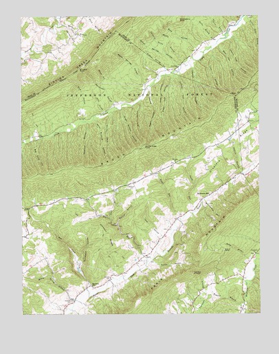
McDonalds Mill, VA USGS Topographic Map
Click on map above to begin viewing in our Map Viewer.

This topographic map contains these locations and features:
Feature Name Type Latitude Longitude GNIS ID View Map
Acre of RocksSummitN37.2768°W80.2687°1495182View Map
Adaline BranchStreamN37.3668°W80.2667°1481259View Map
Aiken Dam HollowValleyN37.3498°W80.2941°1481269View Map
Allen HollowValleyN37.3338°W80.3279°1481287View Map
Alls CemeteryCemeteryN37.3323°W80.2553°1481293View Map
Anderson CemeteryCemeteryN37.2554°W80.3492°1481314View Map
Austin HollowValleyN37.2720°W80.3072°1481363View Map
Bear Pen HollowValleyN37.3628°W80.2710°1481523View Map
Bennett CemeteryCemeteryN37.2654°W80.3287°1481629View Map
Bennetts MillPopulated PlaceN37.2618°W80.3389°1495259View Map
Betsy Boating HollowValleyN37.3317°W80.3361°1481678View Map
Big Ford HollowValleyN37.3236°W80.3656°1481726View Map
Blankenship HollowValleyN37.2972°W80.2785°1481843View Map
Bone HollowValleyN37.3610°W80.2828°1481926View Map
Bruisers KnobSummitN37.3532°W80.3437°1482049View Map
Brush Mountain WildernessReserveN37.3252°W80.3287°2767363View Map
Cabin BranchStreamN37.3737°W80.2584°1482206View Map
Caldwell Fields Recreation SiteLocaleN37.3371°W80.3256°1488692View Map
California HollowValleyN37.3588°W80.2985°1482223View Map
Canterbury ChurchChurchN37.3537°W80.2909°1482311View Map
Catawba Valley AirportAirportN37.2836°W80.3015°2675578View Map
Cherry Tree HollowValleyN37.3654°W80.2648°1482464View Map
Crawford RidgeRidgeN37.3274°W80.2550°1482823View Map
District A-01CivilN37.2929°W80.3516°1986190View Map
Double Ridge KnobSummitN37.3201°W80.3098°1495476View Map
Dry RunStreamN37.2721°W80.3084°1483139View Map
Gallion BranchStreamN37.3090°W80.2578°1483580View Map
Grave CemeteryCemeteryN37.3746°W80.2531°1483761View Map
Gravel Hill BranchStreamN37.3743°W80.3556°1483762View Map
Half Acre of RocksSummitN37.2674°W80.2848°1495638View Map
Harles BranchStreamN37.3715°W80.3528°1483940View Map
Harles HillSummitN37.3679°W80.3501°1495654View Map
Hazelnut HollowValleyN37.3302°W80.3414°1467881View Map
Huckleberry KnobSummitN37.3735°W80.2909°1495726View Map
Jack HollowValleyN37.2820°W80.3006°1484378View Map
Johnson RidgeRidgeN37.2826°W80.3300°1484484View Map
Jones HollowValleyN37.3502°W80.2988°1484502View Map
Leyman HollowValleyN37.3537°W80.2849°1484789View Map
Locust Lick HollowValleyN37.3498°W80.2929°1485020View Map
Lynn HollowValleyN37.3609°W80.2743°1485140View Map
Maple Springs HollowValleyN37.3462°W80.3096°1485178View Map
McDonalds MillPopulated PlaceN37.3001°W80.2756°1495916View Map
Mill CreekStreamN37.2604°W80.3406°1485433View Map
Mill HollowValleyN37.3391°W80.3127°1485444View Map
Mossy Spring BranchStreamN37.2551°W80.3470°1485567View Map
Mount Union ChurchChurchN37.3135°W80.2934°1485646View Map
Muddy BranchStreamN37.3557°W80.2884°1485737View Map
Mullins BranchStreamN37.2874°W80.3242°1485753View Map
North Fork Valley Rural Historic DistrictParkN37.2751°W80.3084°1674657View Map
Pepper RunStreamN37.2899°W80.2925°1486140View Map
Piney Grove ChurchChurchN37.2754°W80.2520°1486248View Map
Rock HollowValleyN37.3319°W80.3419°1486700View Map
Rocky BranchStreamN37.2724°W80.2523°1486728View Map
Ruben Springs HollowValleyN37.3539°W80.2922°1486803View Map
Rush HollowValleyN37.3353°W80.3307°1486823View Map
Sandy BranchStreamN37.3643°W80.2712°1486933View Map
Sarver HollowValleyN37.3455°W80.3316°1486947View Map
Sarver Tract Recreation SiteLocaleN37.3593°W80.3326°1488693View Map
Sites BranchStreamN37.2904°W80.3278°1487267View Map
Smith RunStreamN37.2929°W80.2834°1487348View Map
Sugar Bottom HollowValleyN37.3362°W80.3222°1487685View Map
Sugar House HollowValleyN37.3446°W80.3073°1487694View Map
Sulphur Springs HollowValleyN37.3527°W80.2985°1487723View Map
Turkeypen HollowValleyN37.2714°W80.3451°1488035View Map
White ChurchChurchN37.2560°W80.3473°1488284View Map
Whitelock CemeteryCemeteryN37.3040°W80.3170°1488324View Map
Whitewash HollowValleyN37.3382°W80.3260°1488345View Map
Womack BranchStreamN37.2535°W80.2598°1488468View Map

Note: Coordinates in the location and feature list above are referenced to NAD83 datum.


Copyright (C) 2008-2024 Ryan Niemi / Sunset Dynamics ... All Rights Reserved