TopoQuest Logo
Do you find TopoQuest useful?
Help keep TopoQuest running and adding new maps/features by donating!
Bitcoin:  19c7KJd3qBynnjoSw5npx9KScwjBe4ifkT
Litecoin:  LXs6TkuXGGXo1vDsWCkWVdjQX94eUKd6ui
Home View Maps Find Maps Find Places Resources & Links


Waiteville, West Virginia Topographic Map

USGS Map Title: Waiteville, WV
USGS Map MRC: 37080D4
DRG (GeoTIFF) Download: o37080d4.tif


Neighboring USGS Topographic Map Quads:


  Union, WV  
37080E5
 

  Gap Mills, WV  
37080E4
 

  Paint Bank, VA  
37080E3
 

  Interior, VA  
37080D5
 

  Waiteville, WV  
37080D4
 

  Craig Springs, VA  
37080D3
 

  Eggleston, VA  
37080C5
 

  Newport, VA  
37080C4
 

  McDonalds Mill, VA  
37080C3


Map MRC Location:

N38°
W81°
N38°
W80°
H8 H7 H6 H5 H4 H3 H2 H1
G8 G7 G6 G5 G4 G3 G2 G1
F8 F7 F6 F5 F4 F3 F2 F1
E8 E7 E6 E5 E4 E3 E2 E1
D8 D7 D6 D5 D4 D3 D2 D1
C8 C7 C6 C5 C4 C3 C2 C1
B8 B7 B6 B5 B4 B3 B2 B1
A8 A7 A6 A5 A4 A3 A2 A1
N37°
W81°
N37°
W80°

Waiteville, WV USGS 1:24K Topographic Map Preview:
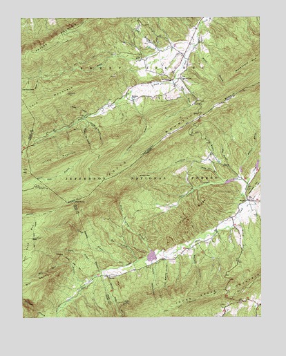
Waiteville, WV USGS Topographic Map
Click on map above to begin viewing in our Map Viewer.

This topographic map contains these locations and features:
Feature Name Type Latitude Longitude GNIS ID View Map
Bee BranchStreamN37.3985°W80.4395°1481585View Map
Big Laurel BranchStreamN37.4165°W80.3867°1481744View Map
Bob BranchStreamN37.4871°W80.4278°1550409View Map
Brushy MountainSummitN37.4337°W80.4387°1482068View Map
CaptainPopulated PlaceN37.3923°W80.4548°1482318View Map
Connallys LakeReservoirN37.4385°W80.3766°1489513View Map
Corner BranchStreamN37.3965°W80.4462°1482715View Map
Crosier BranchStreamN37.4696°W80.4423°1550844View Map
Dicks CreekStreamN37.4237°W80.3820°1483008View Map
Eliber Springs BranchStreamN37.4010°W80.4301°1483260View Map
Fork MountainSummitN37.4632°W80.4934°1500066View Map
Georges Cut HollowValleyN37.4560°W80.4653°1551221View Map
Harvey HollowValleyN37.4579°W80.4667°1551385View Map
Hickory FlatGapN37.4682°W80.4778°1551421View Map
Jefferson National ForestForestN37.4979°W80.3956°2043585View Map
Jimmy Horry SpringSpringN37.4829°W80.4109°1557691View Map
Johns Creek Mountain TrailTrailN37.3785°W80.4212°1484471View Map
Johns Creek Number Four DamDamN37.4371°W80.3771°1489512View Map
Johns Creek Number One DamDamN37.4018°W80.4281°1489509View Map
Johns Creek Number Three DamDamN37.4355°W80.3853°1489511View Map
Johns Creek Number Two DamDamN37.4318°W80.3881°1489508View Map
Johns Creek Volunteer Fire DepartmentBuildingN37.4254°W80.3823°2086308View Map
Johnson FlatsFlatN37.4710°W80.4962°1551598View Map
Johnson HollowValleyN37.4754°W80.4906°1540984View Map
Kire MountainSummitN37.4362°W80.4978°1499633View Map
Line Branch HollowValleyN37.3992°W80.4246°1484853View Map
Little MountainSummitN37.4401°W80.4848°1551878View Map
Little Oregon CreekStreamN37.4304°W80.3817°1484947View Map
Lone Pine PeakSummitN37.4082°W80.4945°1485038View Map
MaggiePopulated PlaceN37.4235°W80.3820°1485155View Map
McDaniels LakeReservoirN37.4018°W80.4281°1489510View Map
Middle CreekStreamN37.4326°W80.3864°1485364View Map
Mountain Lake WildernessReserveN37.4079°W80.4709°2035215View Map
Muddy Fork BranchStreamN37.4343°W80.3970°1485740View Map
Mudlick BranchStreamN37.4323°W80.3848°1485747View Map
Negro BranchStreamN37.3948°W80.4584°1485817View Map
New Zion CemeteryCemeteryN37.4751°W80.4159°1558745View Map
New Zion Union ChurchChurchN37.4746°W80.4162°1552304View Map
North Fork Potts CreekStreamN37.4882°W80.4109°1552338View Map
Piney RidgeRidgeN37.4168°W80.4081°1486262View Map
Porterfield BranchStreamN37.4312°W80.3934°1486369View Map
Potts Creek Baptist ChurchChurchN37.4746°W80.4178°1558751View Map
Potts Creek Wildlife Management AreaParkN37.4968°W80.3978°2043546View Map
Potts MountainRangeN37.4485°W80.4270°1486391View Map
Rainbow PondLakeN37.4663°W80.4418°1552578View Map
Ray ForkStreamN37.4732°W80.4201°1552593View Map
Ray SidingLocaleN37.4637°W80.4101°1552594View Map
Salt Pond MountainSummitN37.4085°W80.4945°1500016View Map
Saltpeter BranchStreamN37.3757°W80.4820°1486909View Map
Schoolhouse HollowValleyN37.3965°W80.4301°1486963View Map
Shingle HollowValleyN37.4037°W80.4098°1487200View Map
South Fork Potts CreekStreamN37.4882°W80.4109°1552978View Map
Taylor CemeteryCemeteryN37.4173°W80.3762°1487793View Map
Virginias Walk TrailTrailN37.4326°W80.4884°1553680View Map
Virginias Walk TrailTrailN37.4326°W80.4884°1488779View Map
WaitevillePopulated PlaceN37.4737°W80.4220°1555904View Map
Waiteville Post OfficePost OfficeN37.4737°W80.4214°1559411View Map
War SpurRidgeN37.3901°W80.4923°1488186View Map
War Spur BranchStreamN37.3912°W80.4631°1488187View Map
War Spur ConnectorTrailN37.3968°W80.4973°1488680View Map
War Spur ShelterLocaleN37.3968°W80.4709°1488780View Map
War Spur TrailTrailN37.3896°W80.4964°1488679View Map
Whiskey HollowValleyN37.4596°W80.4651°1553417View Map
White BranchStreamN37.4376°W80.3914°1488280View Map
White Rock Recreation AreaParkN37.4296°W80.4914°1488318View Map
White RocksPillarN37.4235°W80.4726°1487092View Map
Wilson BranchStreamN37.4882°W80.4098°1553474View Map

Note: Coordinates in the location and feature list above are referenced to NAD83 datum.


Copyright (C) 2008-2025 Ryan Niemi / Sunset Dynamics ... All Rights Reserved