TopoQuest Logo
Do you find TopoQuest useful?
Help keep TopoQuest running and adding new maps/features by donating!
Bitcoin:  19c7KJd3qBynnjoSw5npx9KScwjBe4ifkT
Litecoin:  LXs6TkuXGGXo1vDsWCkWVdjQX94eUKd6ui
Home View Maps Find Maps Find Places Resources & Links


McFarland, Kansas Topographic Map

USGS Map Title: McFarland, KS
USGS Map MRC: 39096A2
DRG (GeoTIFF) Download: o39096a2.tif


Neighboring USGS Topographic Map Quads:


  Wamego, KS  
39096B3
 

  Belvue, KS  
39096B2
 

  Saint Marys, KS  
39096B1
 

  Alma, KS  
39096A3
 

  McFarland, KS  
39096A2
 

  Maple Hill, KS  
39096A1
 

  Allendorph, KS  
38096H3
 

  Hessdale, KS  
38096H2
 

  Keene, KS  
38096H1


Map MRC Location:

N40°
W97°
N40°
W96°
H8 H7 H6 H5 H4 H3 H2 H1
G8 G7 G6 G5 G4 G3 G2 G1
F8 F7 F6 F5 F4 F3 F2 F1
E8 E7 E6 E5 E4 E3 E2 E1
D8 D7 D6 D5 D4 D3 D2 D1
C8 C7 C6 C5 C4 C3 C2 C1
B8 B7 B6 B5 B4 B3 B2 B1
A8 A7 A6 A5 A4 A3 A2 A1
N39°
W97°
N39°
W96°

McFarland, KS USGS 1:24K Topographic Map Preview:
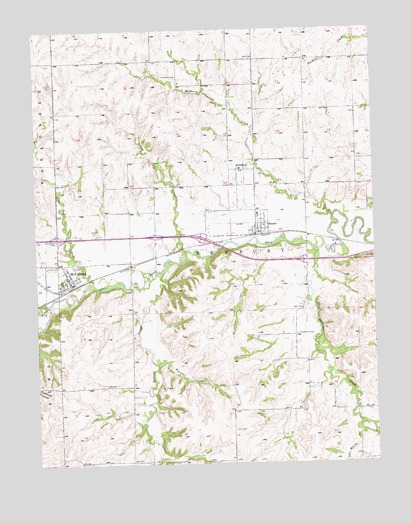
McFarland, KS USGS Topographic Map
Click on map above to begin viewing in our Map Viewer.

This topographic map contains these locations and features:
Feature Name Type Latitude Longitude GNIS ID View Map
Bethlehem CemeteryCemeteryN39.0372°W96.1543°476607View Map
City of McFarlandCivilN39.0544°W96.2380°2395066View Map
City of PaxicoCivilN39.0688°W96.1671°2396166View Map
Joe Woody BranchStreamN39.0108°W96.1300°476759View Map
Kuenzli CreekStreamN39.0550°W96.2033°476758View Map
McFarlandPopulated PlaceN39.0528°W96.2378°476608View Map
McFarland CemeteryCemeteryN39.0643°W96.2430°476609View Map
McFarland City HallBuildingN39.0551°W96.2405°2693185View Map
McFarland Detention DamDamN39.0600°W96.2469°479975View Map
McFarland Post OfficePost OfficeN39.0524°W96.2379°2692469View Map
McFarland Sewer Treatment PlantLocaleN39.0569°W96.2360°2692058View Map
Mill Creek Baptist ChurchChurchN39.0524°W96.2372°2692823View Map
Mill Creek Campground and Recreational Vehicle ParkLocaleN39.0639°W96.1754°2694450View Map
Mill Creek Valley Junior High SchoolSchoolN39.0721°W96.1682°2506542View Map
Mill Creek Valley Middle SchoolSchoolN39.0683°W96.1660°2506469View Map
Mulberry CreekStreamN39.0711°W96.1408°476613View Map
NewburyPopulated PlaceN39.0847°W96.1753°476612View Map
Paw Paw CreekStreamN39.0525°W96.2297°476605View Map
PaxicoPopulated PlaceN39.0694°W96.1664°476610View Map
Paxico Post OfficePost OfficeN39.0671°W96.1690°2693914View Map
Paxico Sewer Treatment PlantLocaleN39.0700°W96.1602°2691929View Map
Paxico United Methodist ChurchChurchN39.0683°W96.1691°2689518View Map
Pierce CreekStreamN39.0289°W96.2064°476606View Map
Pretty CreekStreamN39.0453°W96.2461°476603View Map
Sacred Heart Catholic ChurchChurchN39.0850°W96.1744°2690193View Map
Snokomo CreekStreamN39.0611°W96.1455°476772View Map
Spring CreekStreamN39.0611°W96.1950°476611View Map
Township of NewburyCivilN39.0581°W96.1686°476771View Map
Trinity Lutheran ChurchChurchN39.0537°W96.2388°2692824View Map
Wabaunsee County Fire District 7BuildingN39.0573°W96.2389°2111953View Map
Wabaunsee County Fire District 7BuildingN39.0668°W96.1684°2111954View Map
Wabaunsee County Sewer District Number 1 Wastewater Treatment PlantLocaleN39.0553°W96.1696°2693580View Map

Note: Coordinates in the location and feature list above are referenced to NAD83 datum.


Copyright (C) 2008-2024 Ryan Niemi / Sunset Dynamics ... All Rights Reserved