TopoQuest Logo
Do you find TopoQuest useful?
Help keep TopoQuest running and adding new maps/features by donating!
Bitcoin:  19c7KJd3qBynnjoSw5npx9KScwjBe4ifkT
Litecoin:  LXs6TkuXGGXo1vDsWCkWVdjQX94eUKd6ui
Home View Maps Find Maps Find Places Resources & Links


McFarland, California Topographic Map

USGS Map Title: McFarland, CA
USGS Map MRC: 35119F2
DRG (GeoTIFF) Download: o35119f2.tif


Neighboring USGS Topographic Map Quads:


  Delano West, CA  
35119G3
 

  Delano East, CA  
35119G2
 

  Richgrove, CA  
35119G1
 

  Pond, CA  
35119F3
 

  McFarland, CA  
35119F2
 

  Deepwell Ranch, CA  
35119F1
 

  Wasco, CA  
35119E3
 

  Famoso, CA  
35119E2
 

  North of Oildale, CA  
35119E1


Map MRC Location:

N36°
W120°
N36°
W119°
H8 H7 H6 H5 H4 H3 H2 H1
G8 G7 G6 G5 G4 G3 G2 G1
F8 F7 F6 F5 F4 F3 F2 F1
E8 E7 E6 E5 E4 E3 E2 E1
D8 D7 D6 D5 D4 D3 D2 D1
C8 C7 C6 C5 C4 C3 C2 C1
B8 B7 B6 B5 B4 B3 B2 B1
A8 A7 A6 A5 A4 A3 A2 A1
N35°
W120°
N35°
W119°

McFarland, CA USGS 1:24K Topographic Map Preview:
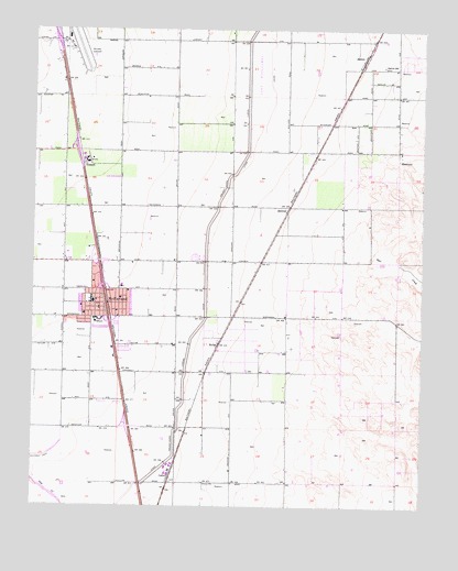
McFarland, CA USGS Topographic Map
Click on map above to begin viewing in our Map Viewer.

This topographic map contains these locations and features:
Feature Name Type Latitude Longitude GNIS ID View Map
Browning Road Elementary SchoolSchoolN35.6827°W119.2223°1835937View Map
Browning Road ParkParkN35.6875°W119.2221°1835936View Map
CalicoPopulated PlaceN35.6327°W119.2065°1660413View Map
Central Valley Modified Community Correctional FacilityBuildingN35.6682°W119.2290°2739965View Map
City of McFarlandCivilN35.6779°W119.2327°2411062View Map
Delano Army Air Field (historical)MilitaryN35.7458°W119.2361°1987609View Map
Delano Municipal AirportAirportN35.7452°W119.2383°1653389View Map
Delano-McFarland DivisionCivilN35.6834°W119.1970°1935186View Map
Dyer CreekStreamN35.6947°W119.1537°241695View Map
First Missionary Baptist ChurchChurchN35.6836°W119.2315°1835939View Map
Golden State Modified Community Correctional FacilityBuildingN35.6699°W119.2277°2739964View Map
HollisPopulated PlaceN35.6675°W119.1912°252905View Map
Jackson Branch Kern County LibraryBuildingN35.6772°W119.2296°1835943View Map
JasminPopulated PlaceN35.7427°W119.1448°1660808View Map
Jasmin SchoolSchoolN35.7402°W119.1387°244006View Map
Kern Avenue Elementary SchoolSchoolN35.6788°W119.2316°1835944View Map
Kern County Fire Department Station 33 McFarlandBuildingN35.6819°W119.2344°2665354View Map
Lake WoollomesReservoirN35.7388°W119.1791°251805View Map
Mc Farland Post OfficePost OfficeN35.6809°W119.2296°1835950View Map
McFarlandPopulated PlaceN35.6780°W119.2293°1652750View Map
McFarland City HallBuildingN35.6777°W119.2326°1835976View Map
McFarland High SchoolSchoolN35.6736°W119.2309°1835977View Map
McFarland Middle SchoolSchoolN35.6794°W119.2321°1835949View Map
McFarland ParkParkN35.6727°W119.2290°1835978View Map
McFarland Police DepartmentBuildingN35.6778°W119.2326°2756220View Map
Raymond-Souche RanchLocaleN35.6527°W119.1320°1653188View Map
San Joaquin High SchoolSchoolN35.6711°W119.2329°1835981View Map
V B Ranch DairyLocaleN35.6639°W119.2311°2704085View Map
VinlandPopulated PlaceN35.7150°W119.2348°1661643View Map
ZentnerPopulated PlaceN35.7030°W119.1693°253009View Map

Note: Coordinates in the location and feature list above are referenced to NAD83 datum.


Copyright (C) 2008-2024 Ryan Niemi / Sunset Dynamics ... All Rights Reserved