TopoQuest Logo
Do you find TopoQuest useful?
Help keep TopoQuest running and adding new maps/features by donating!
Bitcoin:  19c7KJd3qBynnjoSw5npx9KScwjBe4ifkT
Litecoin:  LXs6TkuXGGXo1vDsWCkWVdjQX94eUKd6ui
Home View Maps Find Maps Find Places Resources & Links


Delano West, California Topographic Map

USGS Map Title: Delano West, CA
USGS Map MRC: 35119G3
DRG (GeoTIFF) Download: o35119g3.tif


Neighboring USGS Topographic Map Quads:


  Alpaugh, CA  
35119H4
 

  Pixley, CA  
35119H3
 

  Sausalito School, CA  
35119H2
 

  Allensworth, CA  
35119G4
 

  Delano West, CA  
35119G3
 

  Delano East, CA  
35119G2
 

  Wasco NW, CA  
35119F4
 

  Pond, CA  
35119F3
 

  McFarland, CA  
35119F2


Map MRC Location:

N36°
W120°
N36°
W119°
H8 H7 H6 H5 H4 H3 H2 H1
G8 G7 G6 G5 G4 G3 G2 G1
F8 F7 F6 F5 F4 F3 F2 F1
E8 E7 E6 E5 E4 E3 E2 E1
D8 D7 D6 D5 D4 D3 D2 D1
C8 C7 C6 C5 C4 C3 C2 C1
B8 B7 B6 B5 B4 B3 B2 B1
A8 A7 A6 A5 A4 A3 A2 A1
N35°
W120°
N35°
W119°

Delano West, CA USGS 1:24K Topographic Map Preview:
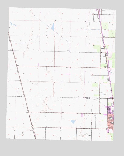
Delano West, CA USGS Topographic Map
Click on map above to begin viewing in our Map Viewer.

This topographic map contains these locations and features:
Feature Name Type Latitude Longitude GNIS ID View Map
Albany ParkParkN35.7847°W119.2607°1835985View Map
Albany Park SchoolSchoolN35.7841°W119.2626°1835986View Map
American Gun Club (historical)LocaleN35.8563°W119.3632°1661884View Map
Apostolic ChurchChurchN35.7686°W119.2573°1835987View Map
Apostolic ChurchChurchN35.7830°W119.2504°1835988View Map
Bethel Chapel Filipino Assembly of God ChurchChurchN35.7730°W119.2576°1835989View Map
ButeraLocaleN35.8091°W119.2573°239902View Map
CaratanLocaleN35.8202°W119.2601°240227View Map
CaricLocaleN35.8319°W119.2621°240241View Map
Cesar Chavez ParkParkN35.7672°W119.2529°1835992View Map
Christian Alliance ChurchChurchN35.7641°W119.2537°1835993View Map
City of DelanoCivilN35.7670°W119.2637°2410317View Map
College RanchLocaleN35.8155°W119.3315°1702056View Map
Delano Community CenterBuildingN35.7677°W119.2518°1836000View Map
Delano Community Correctional FacilityBuildingN35.7655°W119.3043°2739986View Map
Delano McFarland District CemeteryCemeteryN35.7630°W119.2579°241405View Map
Delano Police DepartmentBuildingN35.7886°W119.2514°2770070View Map
Earlimart DivisionCivilN35.8560°W119.3160°1935080View Map
Ellington SchoolSchoolN35.7677°W119.2515°241972View Map
Filipino Assembly of God ChurchChurchN35.7702°W119.2579°1836006View Map
Filipino Community Council Recreation CenterParkN35.7750°W119.2504°1836007View Map
Fremont Elementary SchoolSchoolN35.7722°W119.2548°242492View Map
Guadalupe Catholic ChurchChurchN35.7680°W119.2551°1836013View Map
KCHJ-AM (Delano)TowerN35.8111°W119.3226°1664864View Map
Kern County Fire Department Station 37 Delano WestBuildingN35.7683°W119.2600°1836008View Map
Kern Valley State PrisonBuildingN35.7660°W119.3209°2739954View Map
KernellPopulated PlaceN35.7569°W119.3440°1656555View Map
North Kern State PrisonBuildingN35.7811°W119.3077°2739984View Map
North Kern State Prison Fire DepartmentBuildingN35.7812°W119.3061°2665133View Map
PagliaruloLocaleN35.8388°W119.2643°247105View Map
Primera Iglesia BautistaChurchN35.7755°W119.2579°1836022View Map
RadnorPopulated PlaceN35.8302°W119.2618°1656601View Map
Saint Paul Baptist ChurchChurchN35.7683°W119.2534°1836025View Map
Spanish Assembly of God ChurchChurchN35.7730°W119.2576°1836027View Map
Sun Valley DairyLocaleN35.7964°W119.2892°2702313View Map
Temple Bautista BelenChurchN35.7600°W119.2501°1836028View Map
Valle Vista ParkParkN35.7583°W119.2551°1836029View Map
Valle Vista SchoolSchoolN35.7608°W119.2548°1836030View Map
White RiverStreamN35.8516°W119.2879°274479View Map

Note: Coordinates in the location and feature list above are referenced to NAD83 datum.


Copyright (C) 2008-2025 Ryan Niemi / Sunset Dynamics ... All Rights Reserved