TopoQuest Logo
Do you find TopoQuest useful?
Help keep TopoQuest running and adding new maps/features by donating!
Bitcoin:  19c7KJd3qBynnjoSw5npx9KScwjBe4ifkT
Litecoin:  LXs6TkuXGGXo1vDsWCkWVdjQX94eUKd6ui
Home View Maps Find Maps Find Places Resources & Links


McKinley, Michigan Topographic Map

USGS Map Title: McKinley, MI
USGS Map MRC: 44083F8
DRG (GeoTIFF) Download: o44083f8.tif


Neighboring USGS Topographic Map Quads:


  Comins, MI  
44084G1
 

  McCollum Lake, MI  
44083G8
 

  McGinn Creek, MI  
44083G7
 

  Fairview, MI  
44084F1
 

  McKinley, MI  
44083F8
 

  Curran, MI  
44083F7
 

  Mack Lake, MI  
44084E1
 

  Goodar, MI  
44083E8
 

  Alcona Dam Pond, MI  
44083E7


Map MRC Location:

N45°
W84°
N45°
W83°
H8 H7 H6 H5 H4 H3 H2 H1
G8 G7 G6 G5 G4 G3 G2 G1
F8 F7 F6 F5 F4 F3 F2 F1
E8 E7 E6 E5 E4 E3 E2 E1
D8 D7 D6 D5 D4 D3 D2 D1
C8 C7 C6 C5 C4 C3 C2 C1
B8 B7 B6 B5 B4 B3 B2 B1
A8 A7 A6 A5 A4 A3 A2 A1
N44°
W84°
N44°
W83°

McKinley, MI USGS 1:24K Topographic Map Preview:
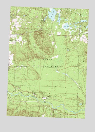
McKinley, MI USGS Topographic Map
Click on map above to begin viewing in our Map Viewer.

This topographic map contains these locations and features:
Feature Name Type Latitude Longitude GNIS ID View Map
Au Sable National Scenic RiverParkN44.6467°W83.9689°1622900View Map
Camp BarakelLocaleN44.7347°W83.9486°1619397View Map
Dollar LakeLakeN44.7379°W83.9989°1619733View Map
Dutch LakeLakeN44.7399°W83.9777°1619787View Map
Hardy Post Office (historical)Post OfficeN44.7236°W83.8825°2498695View Map
Island LakeLakeN44.7296°W83.9099°1620335View Map
Lake DavidLakeN44.7374°W83.9219°1619667View Map
McKinleyPopulated PlaceN44.6470°W83.9372°1620772View Map
McKinley CemeteryCemeteryN44.6528°W83.9392°2500045View Map
McKinley Post Office (historical)Post OfficeN44.6469°W83.9372°2500028View Map
McKinley Station (historical)LocaleN44.6472°W83.9358°2500022View Map
McKinley Trail CampLocaleN44.6386°W83.9761°1622898View Map
Mentor Township - McKinley Fire DepartmentBuildingN44.6474°W83.9395°2626912View Map
Meyer LakeLakeN44.7302°W83.8762°1620802View Map
Ninemile CreekStreamN44.6358°W83.9272°1621011View Map
O'Brien LakeLakeN44.6413°W83.8826°1621077View Map
Penoger LakeLakeN44.7023°W83.9061°1621200View Map
Sand LakeLakeN44.7363°W83.8825°1621505View Map
Shamrock LakeLakeN44.7423°W83.9329°1621573View Map
Shear LakeLakeN44.7372°W83.9439°1621578View Map

Note: Coordinates in the location and feature list above are referenced to NAD83 datum.


Copyright (C) 2008-2025 Ryan Niemi / Sunset Dynamics ... All Rights Reserved