TopoQuest Logo
Do you find TopoQuest useful?
Help keep TopoQuest running and adding new maps/features by donating!
Bitcoin:  19c7KJd3qBynnjoSw5npx9KScwjBe4ifkT
Litecoin:  LXs6TkuXGGXo1vDsWCkWVdjQX94eUKd6ui
Home View Maps Find Maps Find Places Resources & Links


Alcona Dam Pond, Michigan Topographic Map

USGS Map Title: Alcona Dam Pond, MI
USGS Map MRC: 44083E7
DRG (GeoTIFF) Download: o44083e7.tif


Neighboring USGS Topographic Map Quads:


  McKinley, MI  
44083F8
 

  Curran, MI  
44083F7
 

  Bucks Pond, MI  
44083F6
 

  Goodar, MI  
44083E8
 

  Alcona Dam Pond, MI  
44083E7
 

  Glennie, MI  
44083E6
 

  South Branch, MI  
44083D8
 

  Hale, MI  
44083D7
 

  Loud Dam, MI  
44083D6


Map MRC Location:

N45°
W84°
N45°
W83°
H8 H7 H6 H5 H4 H3 H2 H1
G8 G7 G6 G5 G4 G3 G2 G1
F8 F7 F6 F5 F4 F3 F2 F1
E8 E7 E6 E5 E4 E3 E2 E1
D8 D7 D6 D5 D4 D3 D2 D1
C8 C7 C6 C5 C4 C3 C2 C1
B8 B7 B6 B5 B4 B3 B2 B1
A8 A7 A6 A5 A4 A3 A2 A1
N44°
W84°
N44°
W83°

Alcona Dam Pond, MI USGS 1:24K Topographic Map Preview:
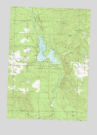
Alcona Dam Pond, MI USGS Topographic Map
Click on map above to begin viewing in our Map Viewer.

This topographic map contains these locations and features:
Feature Name Type Latitude Longitude GNIS ID View Map
Alcona Canoe Rental and CampgroundLocaleN44.5633°W83.7917°2498751View Map
Alcona County ParkParkN44.5833°W83.8150°2498750View Map
Alcona Dam PondReservoirN44.5697°W83.8164°1619004View Map
Bamfield CreekStreamN44.5697°W83.7972°1619081View Map
Bamfield Post Office (historical)Post OfficeN44.5750°W83.7986°2498698View Map
Bamfield Station (historical)LocaleN44.5750°W83.7986°2498682View Map
CurtisvillePopulated PlaceN44.5597°W83.8672°624242View Map
Curtisville CemeteryCemeteryN44.5528°W83.8428°1619645View Map
Curtisville Civic CenterLocaleN44.5525°W83.8669°1619646View Map
Curtisville Post Office (historical)Post OfficeN44.5597°W83.8672°2498697View Map
Grassy LakeLakeN44.5057°W83.7723°627228View Map
Honawan LakeLakeN44.5948°W83.7830°1620235View Map
Hoppy CreekStreamN44.5033°W83.8119°628584View Map
Hoppy LakeLakeN44.5023°W83.8276°1620242View Map
Horseshoe LakeLakeN44.5995°W83.7679°628618View Map
Horseshoe Lake CampgroundLocaleN44.6006°W83.7655°1622899View Map
Penoyer CreekStreamN44.6195°W83.8403°634602View Map
Smith CreekStreamN44.5375°W83.7994°1621652View Map
Stewart CreekStreamN44.5067°W83.8014°1621774View Map
Sunny LakeLakeN44.6084°W83.7946°639084View Map
Township of CurtisCivilN44.5529°W83.7664°1626150View Map
Wilbur CreekStreamN44.5653°W83.8311°1622157View Map

Note: Coordinates in the location and feature list above are referenced to NAD83 datum.


Copyright (C) 2008-2025 Ryan Niemi / Sunset Dynamics ... All Rights Reserved