TopoQuest Logo
Do you find TopoQuest useful?
Help keep TopoQuest running and adding new maps/features by donating!
Bitcoin:  19c7KJd3qBynnjoSw5npx9KScwjBe4ifkT
Litecoin:  LXs6TkuXGGXo1vDsWCkWVdjQX94eUKd6ui
Home View Maps Find Maps Find Places Resources & Links


McNaughton, Wisconsin Topographic Map

USGS Map Title: McNaughton, WI
USGS Map MRC: 45089F5
DRG (GeoTIFF) Download: o45089f5.tif


Neighboring USGS Topographic Map Quads:


  Hazelhurst, WI  
45089G6
 

  Lake Tomahawk, WI  
45089G5
 

  Dam Lake, WI  
45089G4
 

  Harshaw, WI  
45089F6
 

  McNaughton, WI  
45089F5
 

  Rhinelander, WI  
45089F4
 

  Heafford Junction, WI  
45089E6
 

  Woodboro, WI  
45089E5
 

  Lake Julia, WI  
45089E4


Map MRC Location:

N46°
W90°
N46°
W89°
H8 H7 H6 H5 H4 H3 H2 H1
G8 G7 G6 G5 G4 G3 G2 G1
F8 F7 F6 F5 F4 F3 F2 F1
E8 E7 E6 E5 E4 E3 E2 E1
D8 D7 D6 D5 D4 D3 D2 D1
C8 C7 C6 C5 C4 C3 C2 C1
B8 B7 B6 B5 B4 B3 B2 B1
A8 A7 A6 A5 A4 A3 A2 A1
N45°
W90°
N45°
W89°

McNaughton, WI USGS 1:24K Topographic Map Preview:
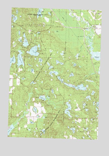
McNaughton, WI USGS Topographic Map
Click on map above to begin viewing in our Map Viewer.

This topographic map contains these locations and features:
Feature Name Type Latitude Longitude GNIS ID View Map
Alva LakeLakeN45.7082°W89.5928°1560810View Map
Beaver LakeLakeN45.7265°W89.5869°1561471View Map
Beaver Lake School (historical)SchoolN45.7275°W89.5849°1964301View Map
Bobs LakeLakeN45.6965°W89.5351°1561993View Map
Cassian-Woodboro County Recreation AreaParkN45.6416°W89.5612°1843831View Map
Cedar SpringSpringN45.7272°W89.5643°1562867View Map
Cedar Spring CreekStreamN45.7180°W89.5140°1843832View Map
Cherry LakeLakeN45.6701°W89.5085°1562989View Map
Clear LakeLakeN45.6821°W89.5544°1563155View Map
Coon LakeLakeN45.6868°W89.5390°1563371View Map
Corner LakeLakeN45.7185°W89.6120°1563409View Map
East Horsehead LakeLakeN45.7002°W89.6111°1564337View Map
Elna LakeLakeN45.6932°W89.5685°1564591View Map
Flag LakeLakeN45.6281°W89.5120°1565049View Map
Garland LakeLakeN45.6448°W89.5758°1565420View Map
Germain Hemlocks State Natural AreaParkN45.7233°W89.6089°2095664View Map
Goodyear CreekStreamN45.6677°W89.5935°1843853View Map
Goodyear LakeLakeN45.6638°W89.5785°1565641View Map
Goodyear SpringsSpringN45.6641°W89.5707°1565642View Map
Hodag LakeLakeN45.6704°W89.5648°1566501View Map
Hook LakeLakeN45.6579°W89.5204°1566666View Map
Island LakeLakeN45.7460°W89.6177°1567013View Map
John LakeLakeN45.6267°W89.5197°1567197View Map
Josie LakeLakeN45.6519°W89.5883°1567295View Map
Lake SamwayLakeN45.6338°W89.5346°1573647View Map
Liege LakeLakeN45.6999°W89.5828°1568025View Map
Long LakeLakeN45.7175°W89.6047°1568562View Map
Lorraine LakeLakeN45.6964°W89.5715°1577423View Map
Lumen LakeLakeN45.7390°W89.6201°1568803View Map
Lyle LakeLakeN45.6575°W89.6145°1577233View Map
Maud LakeLakeN45.6892°W89.5640°1569132View Map
McNaughtonPopulated PlaceN45.7325°W89.5443°1577718View Map
McNaughton LakeLakeN45.7470°W89.5857°1569270View Map
Mildred LakeLakeN45.6755°W89.5340°1569444View Map
NewboldPopulated PlaceN45.6980°W89.5101°1577748View Map
Newbold LakeLakeN45.7064°W89.5534°1843882View Map
Newbold Spring CreekStreamN45.7177°W89.5137°1570247View Map
Newbold SpringsSpringN45.7050°W89.5354°1570248View Map
Ole LakeLakeN45.6983°W89.5571°1570793View Map
Oneida CountyCivilN45.7056°W89.5218°1581103View Map
Perch LakeLakeN45.6316°W89.5757°1571210View Map
Perch LakeLakeN45.6349°W89.5160°1571211View Map
Pine Grove AirportAirportN45.6539°W89.5268°1582177View Map
Pritch LakeLakeN45.6325°W89.5952°1571945View Map
Roby LakeLakeN45.6456°W89.5844°1572416View Map
Rudy LakeLakeN45.6395°W89.5921°1572715View Map
Shadow LakeLakeN45.6445°W89.5094°1573944View Map
Soo LakeLakeN45.6535°W89.5423°1574377View Map
Spruce LakeReservoirN45.6800°W89.5935°1793458View Map
Spruce LakeLakeN45.6817°W89.6060°1574736View Map
Spruce Lake E1176.2 DamDamN45.6800°W89.5935°1793457View Map
Swamp LakeLakeN45.6950°W89.5979°1575151View Map
Thoreau LakeLakeN45.7415°W89.6127°2728551View Map
Timber LakeLakeN45.6897°W89.5938°1575462View Map
Tyler LakeLakeN45.7256°W89.6134°1575838View Map
West Horsehead LakeLakeN45.6975°W89.6233°1576517View Map
Whitey LakeLakeN45.7316°W89.6235°1576693View Map

Note: Coordinates in the location and feature list above are referenced to NAD83 datum.


Copyright (C) 2008-2024 Ryan Niemi / Sunset Dynamics ... All Rights Reserved