TopoQuest Logo
Do you find TopoQuest useful?
Help keep TopoQuest running and adding new maps/features by donating!
Bitcoin:  19c7KJd3qBynnjoSw5npx9KScwjBe4ifkT
Litecoin:  LXs6TkuXGGXo1vDsWCkWVdjQX94eUKd6ui
Home View Maps Find Maps Find Places Resources & Links


Hazelhurst, Wisconsin Topographic Map

USGS Map Title: Hazelhurst, WI
USGS Map MRC: 45089G6
DRG (GeoTIFF) Download: o45089g6.tif


Neighboring USGS Topographic Map Quads:


  Fence Lake, WI  
45089H7
 

  Woodruff, WI  
45089H6
 

  Sayner, WI  
45089H5
 

  Mercer Lake, WI  
45089G7
 

  Hazelhurst, WI  
45089G6
 

  Lake Tomahawk, WI  
45089G5
 

  Burrows Lake, WI  
45089F7
 

  Harshaw, WI  
45089F6
 

  McNaughton, WI  
45089F5


Map MRC Location:

N46°
W90°
N46°
W89°
H8 H7 H6 H5 H4 H3 H2 H1
G8 G7 G6 G5 G4 G3 G2 G1
F8 F7 F6 F5 F4 F3 F2 F1
E8 E7 E6 E5 E4 E3 E2 E1
D8 D7 D6 D5 D4 D3 D2 D1
C8 C7 C6 C5 C4 C3 C2 C1
B8 B7 B6 B5 B4 B3 B2 B1
A8 A7 A6 A5 A4 A3 A2 A1
N45°
W90°
N45°
W89°

Hazelhurst, WI USGS 1:24K Topographic Map Preview:
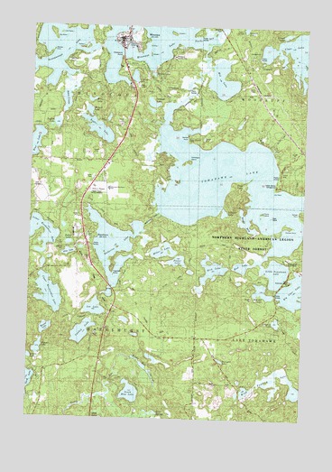
Hazelhurst, WI USGS Topographic Map
Click on map above to begin viewing in our Map Viewer.

This topographic map contains these locations and features:
Feature Name Type Latitude Longitude GNIS ID View Map
Alice LakeLakeN45.8027°W89.7323°1560762View Map
Baker LakeLakeN45.8514°W89.7343°1561108View Map
Berry LakeLakeN45.8513°W89.7230°1561606View Map
Big Carr LakeLakeN45.7909°W89.6295°1561693View Map
Big Ripley IslandIslandN45.8722°W89.7407°1561757View Map
Bird LakeLakeN45.7977°W89.6665°1561821View Map
Bolger LakeLakeN45.8418°W89.7194°1562008View Map
Camp American LegionLocaleN45.7938°W89.6321°1843829View Map
Camp KawagaLocaleN45.8591°W89.7371°1873779View Map
Camp StrongheartLocaleN45.8391°W89.6451°1873780View Map
Camp Twenty-one LakeLakeN45.7810°W89.6368°1562573View Map
Circle A Ranch AirportAirportN45.7938°W89.7301°1582009View Map
Clawson LakeLakeN45.8589°W89.7036°1843835View Map
Clawsons PointCapeN45.8647°W89.7096°1843836View Map
Daniels PointCapeN45.8161°W89.6285°1563700View Map
Dead IslandIslandN45.8144°W89.6410°1563771View Map
Dollar LakeLakeN45.8057°W89.7322°1843840View Map
Doolittle PointCapeN45.8638°W89.7335°1843841View Map
Dry PointCapeN45.8247°W89.6371°1564126View Map
Dugout LakeLakeN45.7721°W89.7453°1564167View Map
Fiefield IslandIslandN45.8680°W89.7271°1843844View Map
Fishers IslandIslandN45.8725°W89.6876°1565025View Map
Foster LakeLakeN45.8002°W89.6823°1565166View Map
HazelhurstPopulated PlaceN45.8077°W89.7251°1566237View Map
Hazelhurst CanalCanalN45.8138°W89.6935°1843855View Map
Hazelhurst Volunteer Fire DepartmentBuildingN45.8073°W89.7242°2696958View Map
Hickson School (historical)SchoolN45.8325°W89.7265°1873782View Map
Indian Mound CampgroundLocaleN45.8241°W89.6399°1566924View Map
Inkpot LakeLakeN45.8726°W89.6343°1566938View Map
Inkwell LakeLakeN45.8157°W89.6616°1566940View Map
Jerome LakeLakeN45.8596°W89.6950°1843861View Map
Jossart IslandIslandN45.8658°W89.6979°1567296View Map
Jyme LakeLakeN45.8392°W89.6714°1843862View Map
Katherine LakeLakeN45.8047°W89.7119°1567360View Map
Kawaguesaga LakeLakeN45.8675°W89.7383°1567367View Map
Kemps Biological CenterLocaleN45.8394°W89.6782°1843864View Map
Kemps PointCapeN45.8388°W89.6763°1567400View Map
Kline IslandIslandN45.8686°W89.6979°1567549View Map
Lakeside CemeteryCemeteryN45.8041°W89.7321°1843868View Map
Lee LakeLakeN45.7849°W89.7197°1567924View Map
Little Ripley IslandIslandN45.8725°W89.7376°1843871View Map
Little Tomahawk LakeLakeN45.7969°W89.6375°1568446View Map
Lower Kaubashine LakeLakeN45.8028°W89.7467°1568737View Map
Madden PointCapeN45.8669°W89.7413°1843873View Map
McGrath LakeLakeN45.7908°W89.6433°1569227View Map
McNaughton State CampLocaleN45.8008°W89.6321°1843875View Map
McNutt LakeLakeN45.8479°W89.7239°1843876View Map
Mid LakeLakeN45.8579°W89.6637°1569408View Map
Miller LakeLakeN45.8033°W89.6890°1569518View Map
MinocquaPopulated PlaceN45.8713°W89.7110°1569580View Map
Minocqua Community BuildingBuildingN45.8702°W89.7068°1843877View Map
Minocqua Country ClubLocaleN45.8655°W89.6857°1843878View Map
Minocqua Elementary SchoolSchoolN45.8233°W89.7144°1566238View Map
Minocqua Fire Department Station 1BuildingN45.8707°W89.7068°2696866View Map
Minocqua LakeLakeN45.8719°W89.6973°1569581View Map
Minocqua MuseumBuildingN45.8702°W89.7071°1843879View Map
Minocqua Police DepartmentBuildingN45.8702°W89.7075°2759907View Map
Minocqua Post OfficePost OfficeN45.8711°W89.7115°1843880View Map
Minocqua Public LibraryBuildingN45.8702°W89.7068°1843881View Map
Minocqua-Hazelhurst SchoolSchoolN45.8230°W89.7143°1873783View Map
Mud LakeLakeN45.7987°W89.6529°1569969View Map
Northwoods Unitarian-Universalist FellowshipChurchN45.8702°W89.7068°1843885View Map
Olmstead IslandIslandN45.8319°W89.6796°1570804View Map
Papkee LakeLakeN45.8437°W89.7385°1571013View Map
Picnic IslandIslandN45.8158°W89.6451°1571338View Map
Porcupine LakeLakeN45.7687°W89.6619°1571787View Map
RantzPopulated PlaceN45.8316°W89.7296°1572080View Map
Rockpile PondLakeN45.7577°W89.6543°1577213View Map
Rocky Run SpringsSpringN45.7658°W89.6957°1572522View Map
Romans PointCapeN45.8116°W89.6346°1572556View Map
Round LakeLakeN45.7785°W89.7420°1572665View Map
Saint Andrews Orthodox MissionChurchN45.8697°W89.7079°1843897View Map
Saint Matthias Episcopal ChurchChurchN45.8697°W89.7079°1843904View Map
Schlecht LakeLakeN45.8505°W89.6949°1843905View Map
Scott SpringsSpringN45.7513°W89.6926°1573848View Map
South Blue LakeLakeN45.7582°W89.7027°1574393View Map
SunflowerPopulated PlaceN45.8033°W89.6424°1873784View Map
Swartz LakeLakeN45.7693°W89.7495°1575168View Map
Tigertail PointCapeN45.7963°W89.7121°1843916View Map
Tomahawk LakeLakeN45.8252°W89.6710°1575499View Map
Tomahawk ThoroughfareChannelN45.8583°W89.6763°1843917View Map
Torpy ParkParkN45.8730°W89.7082°1843918View Map
Town of HazelhurstCivilN45.7751°W89.7348°1583374View Map
Upper Kaubashine LakeLakeN45.7894°W89.7406°1575971View Map
Wind Pudding LakeLakeN45.7607°W89.6350°1576850View Map
Wind Pudding LakeLakeN45.7628°W89.6381°2095672View Map
Wind Pudding Lake State Natural AreaParkN45.7653°W89.6358°2095673View Map
Windy PointCapeN45.8233°W89.6568°1576861View Map
WMYM-AM (Minocqua)TowerN45.8202°W89.7243°1582329View Map
Wolosz PondLakeN45.7620°W89.6533°1577211View Map
WWMH-FM (Minocqua)TowerN45.8202°W89.7243°1582429View Map
Yawkey LakeLakeN45.7774°W89.7252°1577080View Map

Note: Coordinates in the location and feature list above are referenced to NAD83 datum.


Copyright (C) 2008-2024 Ryan Niemi / Sunset Dynamics ... All Rights Reserved