TopoQuest Logo
Do you find TopoQuest useful?
Help keep TopoQuest running and adding new maps/features by donating!
Bitcoin:  19c7KJd3qBynnjoSw5npx9KScwjBe4ifkT
Litecoin:  LXs6TkuXGGXo1vDsWCkWVdjQX94eUKd6ui
Home View Maps Find Maps Find Places Resources & Links


Meath Spring, Arizona Topographic Map

USGS Map Title: Meath Spring, AZ
USGS Map MRC: 35112A4
DRG (GeoTIFF) Download: o35112a4.tif


Neighboring USGS Topographic Map Quads:


  Cathedral Caves, AZ  
35112B5
 

  Ash Fork, AZ  
35112B4
 

  McLellan Reservoir, AZ  
35112B3
 

  Picacho Butte SE, AZ  
35112A5
 

  Meath Spring, AZ  
35112A4
 

  Matterhorn, AZ  
35112A3
 

  Wineglass Ranch, AZ  
34112H5
 

  Paulden, AZ  
34112H4
 

  Hell Point, AZ  
34112H3


Map MRC Location:

N36°
W113°
N36°
W112°
H8 H7 H6 H5 H4 H3 H2 H1
G8 G7 G6 G5 G4 G3 G2 G1
F8 F7 F6 F5 F4 F3 F2 F1
E8 E7 E6 E5 E4 E3 E2 E1
D8 D7 D6 D5 D4 D3 D2 D1
C8 C7 C6 C5 C4 C3 C2 C1
B8 B7 B6 B5 B4 B3 B2 B1
A8 A7 A6 A5 A4 A3 A2 A1
N35°
W113°
N35°
W112°

Meath Spring, AZ USGS 1:24K Topographic Map Preview:
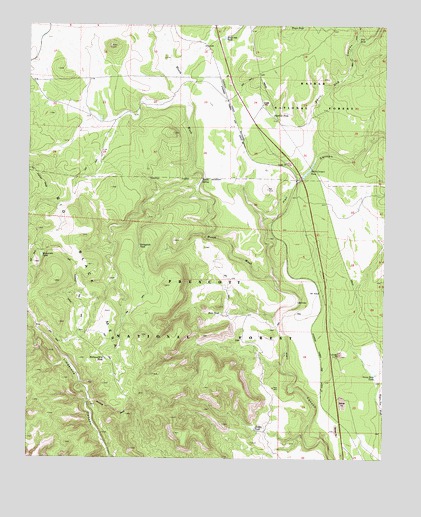
Meath Spring, AZ USGS Topographic Map
Click on map above to begin viewing in our Map Viewer.

This topographic map contains these locations and features:
Feature Name Type Latitude Longitude GNIS ID View Map
AGF Trick TankReservoirN35.0422°W112.4760°42054View Map
AGF Trick TankReservoirN35.0172°W112.4671°42055View Map
BarrataReservoirN35.0453°W112.4057°26005View Map
Bullock TankReservoirN35.0011°W112.4696°38293View Map
Cordes TankReservoirN35.0088°W112.4207°27943View Map
Devil Dog CanyonValleyN35.0872°W112.4005°28432View Map
Floe TankReservoirN35.1212°W112.3853°29066View Map
Hells Canyon TankReservoirN35.0832°W112.4027°29863View Map
Little Water TankReservoirN35.0470°W112.4877°38582View Map
Manzanita TankReservoirN35.0585°W112.4961°31495View Map
Mayes TankReservoirN35.1246°W112.4048°31606View Map
Meath (historical)Populated PlaceN35.1233°W112.4474°42813View Map
Meath Railroad StationBuildingN35.1222°W112.4493°38616View Map
Meath SidingLocaleN35.1189°W112.4385°45024View Map
Meath SpringSpringN35.0807°W112.4399°31701View Map
Meath WashStreamN35.0497°W112.4132°31703View Map
Pipeline TankReservoirN35.0993°W112.4153°33029View Map
Prairie SidingLocaleN35.1031°W112.4305°45023View Map
Railroad Fill TankReservoirN35.0285°W112.4736°33327View Map
Rok SidingLocaleN35.0472°W112.3991°38763View Map
Ruin TankReservoirN35.0418°W112.4332°33872View Map
Sams Dam TankReservoirN35.0244°W112.3783°34004View Map
Stringfield TankReservoirN35.0612°W112.4619°34902View Map
Wash Out TankReservoirN35.1214°W112.4324°35904View Map
Wood Spur SidingLocaleN35.0795°W112.4060°45022View Map

Note: Coordinates in the location and feature list above are referenced to NAD83 datum.


Copyright (C) 2008-2024 Ryan Niemi / Sunset Dynamics ... All Rights Reserved