TopoQuest Logo
Do you find TopoQuest useful?
Help keep TopoQuest running and adding new maps/features by donating!
Bitcoin:  19c7KJd3qBynnjoSw5npx9KScwjBe4ifkT
Litecoin:  LXs6TkuXGGXo1vDsWCkWVdjQX94eUKd6ui
Home View Maps Find Maps Find Places Resources & Links


Matterhorn, Arizona Topographic Map

USGS Map Title: Matterhorn, AZ
USGS Map MRC: 35112A3
DRG (GeoTIFF) Download: o35112a3.tif


Neighboring USGS Topographic Map Quads:


  Ash Fork, AZ  
35112B4
 

  McLellan Reservoir, AZ  
35112B3
 

  Williams South, AZ  
35112B2
 

  Meath Spring, AZ  
35112A4
 

  Matterhorn, AZ  
35112A3
 

  May Tank Pocket, AZ  
35112A2
 

  Paulden, AZ  
34112H4
 

  Hell Point, AZ  
34112H3
 

  Perkinsville, AZ  
34112H2


Map MRC Location:

N36°
W113°
N36°
W112°
H8 H7 H6 H5 H4 H3 H2 H1
G8 G7 G6 G5 G4 G3 G2 G1
F8 F7 F6 F5 F4 F3 F2 F1
E8 E7 E6 E5 E4 E3 E2 E1
D8 D7 D6 D5 D4 D3 D2 D1
C8 C7 C6 C5 C4 C3 C2 C1
B8 B7 B6 B5 B4 B3 B2 B1
A8 A7 A6 A5 A4 A3 A2 A1
N35°
W113°
N35°
W112°

Matterhorn, AZ USGS 1:24K Topographic Map Preview:
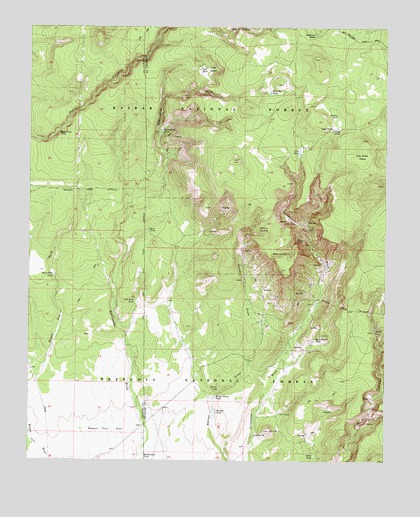
Matterhorn, AZ USGS Topographic Map
Click on map above to begin viewing in our Map Viewer.

This topographic map contains these locations and features:
Feature Name Type Latitude Longitude GNIS ID View Map
Barney TankReservoirN35.0144°W112.3106°25996View Map
Bass Pond TankReservoirN35.0948°W112.3654°26028View Map
Bean Dam TankReservoirN35.0535°W112.3671°26055View Map
Cedar TankReservoirN35.0016°W112.2755°27446View Map
Cow TankReservoirN35.0893°W112.2812°28094View Map
Deadman TanksReservoirN35.1233°W112.2762°28344View Map
Frog PoolReservoirN35.0189°W112.2554°37804View Map
MatterhornSummitN35.0553°W112.2877°31567View Map
Millers PocketBasinN35.0656°W112.2935°31885View Map
Mills QuarryMineN35.0397°W112.2849°37942View Map
Rattlesnake TankReservoirN35.0020°W112.3358°33410View Map
Rattlesnake TankReservoirN35.0952°W112.3295°33411View Map
Rock House TankReservoirN35.0345°W112.2753°33718View Map
Roy TankReservoirN35.0663°W112.3342°33852View Map
S P HillSummitN35.0089°W112.2910°33908View Map
S P TankReservoirN35.0138°W112.2878°33910View Map
Shell Rock TankReservoirN35.0461°W112.3380°34363View Map
Stage StationLocaleN35.0958°W112.2702°34791View Map
Stage TankReservoirN35.0955°W112.2693°34792View Map
Station TankReservoirN35.0996°W112.2679°34805View Map
Tule BasinBasinN35.1139°W112.3146°35498View Map
Tule TankReservoirN35.1132°W112.3162°35515View Map
Wagon Tire FlatFlatN35.0109°W112.3471°35803View Map
West Ike TankReservoirN35.1062°W112.2915°35998View Map
Wild Steer MesaSummitN35.0925°W112.2591°36174View Map
Winter Camp TankReservoirN35.0185°W112.3102°36333View Map
Winter TankReservoirN35.0210°W112.3088°36336View Map

Note: Coordinates in the location and feature list above are referenced to NAD83 datum.


Copyright (C) 2008-2025 Ryan Niemi / Sunset Dynamics ... All Rights Reserved