TopoQuest Logo
Do you find TopoQuest useful?
Help keep TopoQuest running and adding new maps/features by donating!
Bitcoin:  19c7KJd3qBynnjoSw5npx9KScwjBe4ifkT
Litecoin:  LXs6TkuXGGXo1vDsWCkWVdjQX94eUKd6ui
Home View Maps Find Maps Find Places Resources & Links


Mechanicsville, Maryland Topographic Map

USGS Map Title: Mechanicsville, MD
USGS Map MRC: 38076D6
DRG (GeoTIFF) Download: o38076d6.tif


Neighboring USGS Topographic Map Quads:


  Hughesville, MD  
38076E7
 

  Benedict, MD  
38076E6
 

  Prince Frederick, MD  
38076E5
 

  Charlotte Hall, MD  
38076D7
 

  Mechanicsville, MD  
38076D6
 

  Broomes Island, MD  
38076D5
 

  Rock Point, MD  
38076C7
 

  Leonardtown, MD  
38076C6
 

  Hollywood, MD  
38076C5


Map MRC Location:

N39°
W77°
N39°
W76°
H8 H7 H6 H5 H4 H3 H2 H1
G8 G7 G6 G5 G4 G3 G2 G1
F8 F7 F6 F5 F4 F3 F2 F1
E8 E7 E6 E5 E4 E3 E2 E1
D8 D7 D6 D5 D4 D3 D2 D1
C8 C7 C6 C5 C4 C3 C2 C1
B8 B7 B6 B5 B4 B3 B2 B1
A8 A7 A6 A5 A4 A3 A2 A1
N38°
W77°
N38°
W76°

Mechanicsville, MD USGS 1:24K Topographic Map Preview:
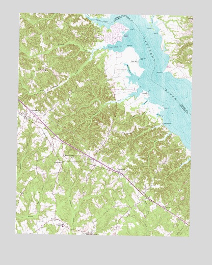
Mechanicsville, MD USGS Topographic Map
Click on map above to begin viewing in our Map Viewer.

This topographic map contains these locations and features:
Feature Name Type Latitude Longitude GNIS ID View Map
All Faith Episcopal CemeteryCemeteryN38.4676°W76.7302°1697298View Map
All Faith Episcopal ChurchChurchN38.4676°W76.7305°1697297View Map
Big OakPopulated PlaceN38.4632°W76.7039°1697309View Map
Billiard PointCapeN38.4823°W76.6700°594591View Map
Birch ManorPopulated PlaceN38.4129°W76.7211°1697311View Map
Burning OaksPopulated PlaceN38.4154°W76.7327°1697323View Map
Buzzard IslandIslandN38.4923°W76.6530°583514View Map
Buzzard Island CreekStreamN38.4954°W76.6544°583516View Map
Cellar HillPopulated PlaceN38.4562°W76.6744°1697331View Map
Coatigan RunStreamN38.4351°W76.6405°594667View Map
Cooney Neck EstatePopulated PlaceN38.4723°W76.7214°1697341View Map
CremonaPopulated PlaceN38.4565°W76.6566°594684View Map
Cremona CreekBayN38.4521°W76.6566°594685View Map
De La BrookeLocaleN38.4404°W76.6486°1697343View Map
District 5, MechanicsvilleCivilN38.4598°W76.7296°1929634View Map
Dukes WharfLocaleN38.4679°W76.6422°1676455View Map
FollywoodsPopulated PlaceN38.4993°W76.6372°1676461View Map
Forrest HallLocaleN38.4154°W76.7169°594711View Map
Forrest Hall EstatesPopulated PlaceN38.4290°W76.7336°1697356View Map
Galilee CemeteryCemeteryN38.3922°W76.6648°1697358View Map
Galilee ChurchChurchN38.3918°W76.6647°1697359View Map
Golden BeachPopulated PlaceN38.4898°W76.6822°594723View Map
Golden Beach Census Designated PlaceCensusN38.4900°W76.7020°2389859View Map
Gospel Light Baptist AcademySchoolN38.4156°W76.7162°2131955View Map
Gravely Knoll School (historical)SchoolN38.4596°W76.6886°1697361View Map
Harpers CornersLocaleN38.4196°W76.7164°594736View Map
HelenPopulated PlaceN38.3829°W76.7216°594742View Map
Helen EstatesPopulated PlaceN38.3898°W76.7180°1697364View Map
Helen FarmettesPopulated PlaceN38.3912°W76.7275°1697365View Map
Helen Post OfficePost OfficeN38.3837°W76.7214°1697366View Map
Hidden RiverPopulated PlaceN38.4957°W76.7222°1697367View Map
Holly AcresPopulated PlaceN38.4779°W76.7358°1697368View Map
Horse LandingPopulated PlaceN38.4385°W76.6450°594756View Map
Horse Landing CreekStreamN38.4393°W76.6450°594757View Map
HuntersvillePopulated PlaceN38.4693°W76.7302°594761View Map
Immaculate Conception Catholic ChurchChurchN38.4426°W76.7475°1697373View Map
Indian CreekStreamN38.4990°W76.6791°594763View Map
Indian River EstatesPopulated PlaceN38.4946°W76.7047°1697374View Map
Killpeck CreekStreamN38.4793°W76.6966°594781View Map
King-Kennedy EstatesPopulated PlaceN38.3871°W76.6686°1697377View Map
Laurel GrovePopulated PlaceN38.4118°W76.6777°594787View Map
Laurel Grove ParkParkN38.4057°W76.6727°1697379View Map
LemingPopulated PlaceN38.4912°W76.6469°1676480View Map
Living Word Community ChurchChurchN38.4190°W76.7077°2507867View Map
Locks Swamp CreekStreamN38.4815°W76.6886°594796View Map
Long PointCapeN38.4926°W76.6708°594803View Map
Loveville AcresPopulated PlaceN38.3898°W76.6614°1697384View Map
Margaret Brent Middle SchoolSchoolN38.3800°W76.7162°594601View Map
Marsh PointCapeN38.4471°W76.6447°594815View Map
MechanicsvillePopulated PlaceN38.4429°W76.7439°594822View Map
Mechanicsville Census Designated PlaceCensusN38.4355°W76.7424°2629801View Map
Mechanicsville Volunteer Fire Department Company 2BuildingN38.4421°W76.7414°2086971View Map
Mechanicsville Volunteer Fire Department Company 22BuildingN38.4877°W76.7039°2086972View Map
Mechanicsville Volunteer Rescue SquadBuildingN38.4402°W76.7386°2131797View Map
MorganzaPopulated PlaceN38.3754°W76.6955°594837View Map
Morsell CreekBayN38.4812°W76.6450°1676487View Map
Mother Catherine Spalding Elementary SchoolSchoolN38.3773°W76.7327°1697399View Map
Mount Zion Methodist CemeteryCemeteryN38.4133°W76.6817°1697401View Map
Mount Zion United Methodist ChurchChurchN38.4132°W76.6808°1697402View Map
Mud CreekStreamN38.4512°W76.6566°594839View Map
Oaks School (historical)SchoolN38.4871°W76.7330°1697409View Map
OakvillePopulated PlaceN38.3912°W76.6436°594853View Map
Oakville Elementary SchoolSchoolN38.3944°W76.6465°1697410View Map
Oakville Post Office (historical)Post OfficeN38.3912°W76.6433°1697411View Map
Old Saint Joseph's CemeteryCemeteryN38.3750°W76.6932°594855View Map
OravillePopulated PlaceN38.4179°W76.6941°594856View Map
Oraville Post Office (historical)Post OfficeN38.4179°W76.6950°1697415View Map
Parson HomeLocaleN38.3926°W76.6411°1697416View Map
Patuxent KnollsPopulated PlaceN38.4901°W76.7039°1697417View Map
Persimmon CreekStreamN38.4596°W76.6616°594871View Map
PinemorePopulated PlaceN38.3821°W76.6941°1697419View Map
Queen of Peace CemeteryCemeteryN38.3754°W76.7329°1697626View Map
Quiet AcresPopulated PlaceN38.4837°W76.7316°1697422View Map
Reeder WharfLocaleN38.4571°W76.6561°1697424View Map
Rolling AcresPopulated PlaceN38.4923°W76.7325°1697428View Map
Rustic HillsPopulated PlaceN38.4882°W76.7283°1697430View Map
Saint Joseph Catholic ChurchChurchN38.3757°W76.6972°1697434View Map
Saint Joseph's CemeteryCemeteryN38.3768°W76.6969°1697435View Map
Saint Marys AbbeyChurchN38.4015°W76.6322°1697436View Map
Sandy PointCapeN38.4904°W76.6488°587213View Map
Sandy Point AirportAirportN38.4884°W76.6431°2443784View Map
Shady DalePopulated PlaceN38.4557°W76.7130°1697443View Map
Sheridan PointCapeN38.4687°W76.6441°587327View Map
Spaldings ComfortLocaleN38.3823°W76.6344°1697449View Map
Spring CreekBayN38.4435°W76.6483°594969View Map
SummerseatPopulated PlaceN38.3968°W76.6622°1697450View Map
Summerseat VillagePopulated PlaceN38.3985°W76.6577°1697452View Map
Tenn Wood AcresPopulated PlaceN38.4007°W76.7244°1697453View Map
The Plains (historical)LocaleN38.4871°W76.6789°1697455View Map
Trent HallLocaleN38.4746°W76.6644°594995View Map
Trent Hall CreekBayN38.4832°W76.6797°594996View Map
Trent Hall PointCapeN38.4765°W76.6630°594997View Map
Trent Hall WharfLocaleN38.4760°W76.6627°1697456View Map
Turkey Buzzard PointCapeN38.4985°W76.6627°1676525View Map
Washington CreekBayN38.4696°W76.6708°595005View Map
WestfieldLocaleN38.4065°W76.6766°1697461View Map
Widow WoodsPopulated PlaceN38.4137°W76.6497°1697465View Map

Note: Coordinates in the location and feature list above are referenced to NAD83 datum.


Copyright (C) 2008-2024 Ryan Niemi / Sunset Dynamics ... All Rights Reserved