TopoQuest Logo
Do you find TopoQuest useful?
Help keep TopoQuest running and adding new maps/features by donating!
Bitcoin:  19c7KJd3qBynnjoSw5npx9KScwjBe4ifkT
Litecoin:  LXs6TkuXGGXo1vDsWCkWVdjQX94eUKd6ui
Home View Maps Find Maps Find Places Resources & Links


Mecosta NW, Michigan Topographic Map

USGS Map Title: Mecosta NW, MI
USGS Map MRC: 43085F2
DRG (GeoTIFF) Download: o43085f2.tif


Neighboring USGS Topographic Map Quads:


  Chippewa Lake South, MI  
43085F3
 

  Mecosta NW, MI  
43085F2
 

  Sherman City, MI  
43085F1
 

  Altona, MI  
43085E3
 

  Mecosta, MI  
43085E2
 

  Blanchard, MI  
43085E1


Map MRC Location:

N44°
W86°
N44°
W85°
H8 H7 H6 H5 H4 H3 H2 H1
G8 G7 G6 G5 G4 G3 G2 G1
F8 F7 F6 F5 F4 F3 F2 F1
E8 E7 E6 E5 E4 E3 E2 E1
D8 D7 D6 D5 D4 D3 D2 D1
C8 C7 C6 C5 C4 C3 C2 C1
B8 B7 B6 B5 B4 B3 B2 B1
A8 A7 A6 A5 A4 A3 A2 A1
N43°
W86°
N43°
W85°

Mecosta NW, MI USGS 1:24K Topographic Map Preview:
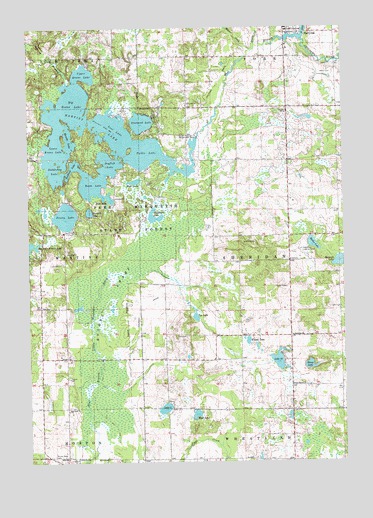
Mecosta NW, MI USGS Topographic Map
Click on map above to begin viewing in our Map Viewer.

This topographic map contains these locations and features:
Feature Name Type Latitude Longitude GNIS ID View Map
Barryton Police DepartmentBuildingN43.7481°W85.1466°2737639View Map
Bass LakeLakeN43.7012°W85.2178°620693View Map
Big Evans LakeLakeN43.7278°W85.2327°621318View Map
Big John Brown LakeLakeN43.6876°W85.2496°621323View Map
Blue Gill Lake CampgroundLocaleN43.6967°W85.2283°2519023View Map
Bluegill LakeLakeN43.6971°W85.2258°621651View Map
Boom LakeLakeN43.7048°W85.2254°621722View Map
Brown CreekStreamN43.7453°W85.1592°619742View Map
Bullhead LakeLakeN43.7072°W85.2345°622233View Map
Chippewa CreekStreamN43.7114°W85.2450°623216View Map
Chippewa Hills High SchoolSchoolN43.6611°W85.1483°2518880View Map
Chippewa Hills Intermediate SchoolSchoolN43.6611°W85.1472°2518881View Map
Church of ChristChurchN43.7417°W85.1472°2519043View Map
Diamond LakeLakeN43.7228°W85.2049°624636View Map
Dogfish LakeLakeN43.7117°W85.2177°624744View Map
Dye CemeteryCemeteryN43.6611°W85.1878°625049View Map
Dye CreekStreamN43.6250°W85.2278°625050View Map
Dye LakeLakeN43.6669°W85.1840°625052View Map
Flake CemeteryCemeteryN43.7372°W85.1281°626132View Map
Halfmoon LakeLakeN43.6958°W85.2000°627627View Map
Hannah LakeLakeN43.6824°W85.1269°627734View Map
Helmer CreekStreamN43.7434°W85.1606°628067View Map
Holiday Terrace Mobile Home ParkPopulated PlaceN43.6733°W85.2458°2519024View Map
Hughes SwampSwampN43.6728°W85.2195°628785View Map
Jehovah's Witnesses ChurchChurchN43.6683°W85.1469°2518872View Map
Lake SixLakeN43.6404°W85.1967°638023View Map
Lake TwentyeightLakeN43.6542°W85.1514°1615224View Map
Lost LakeLakeN43.7228°W85.2187°631082View Map
Lower Evans LakeLakeN43.7140°W85.2391°631165View Map
Manake LakeLakeN43.7171°W85.2337°631371View Map
Martiny LakeReservoirN43.7173°W85.1833°631680View Map
Martiny Lake State Game AreaParkN43.6736°W85.2222°2518998View Map
Moiles LakeLakeN43.6876°W85.1370°632547View Map
Mount Hope CemeteryCemeteryN43.6261°W85.2406°632807View Map
Mud LakeLakeN43.6388°W85.1843°632971View Map
Mud LakeLakeN43.7057°W85.2077°632974View Map
North Branch Chippewa RiverStreamN43.7470°W85.1406°633499View Map
Pine Grove ChurchChurchN43.6470°W85.1456°634934View Map
Pretty LakeLakeN43.6958°W85.2354°635444View Map
Remus Church of GodChurchN43.6397°W85.1261°2518878View Map
Roundy BranchStreamN43.7345°W85.2348°636334View Map
Saddlebag LakeLakeN43.7071°W85.2369°636481View Map
Sheridan ChurchChurchN43.6614°W85.1456°637748View Map
Stony LakeLakeN43.6525°W85.1389°638912View Map
Township of SheridanCivilN43.6833°W85.1463°1627068View Map
Tubbs LakeLakeN43.7134°W85.2040°1615144View Map
Tubbs Lake State Forest CampgroundLocaleN43.7144°W85.2100°2518830View Map
United Methodist ChurchChurchN43.7494°W85.1467°2519042View Map
Upper Evans LakeLakeN43.7369°W85.2278°1615399View Map
West Branch Chippewa RiverStreamN43.7470°W85.1406°1616028View Map
Wilson LakeLakeN43.6597°W85.1631°1616581View Map
Winchester DamDamN43.7184°W85.1828°1616611View Map

Note: Coordinates in the location and feature list above are referenced to NAD83 datum.


Copyright (C) 2008-2025 Ryan Niemi / Sunset Dynamics ... All Rights Reserved