TopoQuest Logo
Do you find TopoQuest useful?
Help keep TopoQuest running and adding new maps/features by donating!
Bitcoin:  19c7KJd3qBynnjoSw5npx9KScwjBe4ifkT
Litecoin:  LXs6TkuXGGXo1vDsWCkWVdjQX94eUKd6ui
Home View Maps Find Maps Find Places Resources & Links


Altona, Michigan Topographic Map

USGS Map Title: Altona, MI
USGS Map MRC: 43085E3
DRG (GeoTIFF) Download: o43085e3.tif


Neighboring USGS Topographic Map Quads:


  Big Rapids, MI  
43085F4
 

  Chippewa Lake South, MI  
43085F3
 

  Mecosta NW, MI  
43085F2
 

  Stanwood, MI  
43085E4
 

  Altona, MI  
43085E3
 

  Mecosta, MI  
43085E2
 

  Howard City, MI  
43085D4
 

  Lakeview, MI  
43085D3
 

  Six Lakes, MI  
43085D2


Map MRC Location:

N44°
W86°
N44°
W85°
H8 H7 H6 H5 H4 H3 H2 H1
G8 G7 G6 G5 G4 G3 G2 G1
F8 F7 F6 F5 F4 F3 F2 F1
E8 E7 E6 E5 E4 E3 E2 E1
D8 D7 D6 D5 D4 D3 D2 D1
C8 C7 C6 C5 C4 C3 C2 C1
B8 B7 B6 B5 B4 B3 B2 B1
A8 A7 A6 A5 A4 A3 A2 A1
N43°
W86°
N43°
W85°

Altona, MI USGS 1:24K Topographic Map Preview:
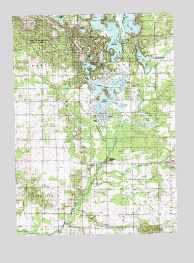
Altona, MI USGS Topographic Map
Click on map above to begin viewing in our Map Viewer.

This topographic map contains these locations and features:
Feature Name Type Latitude Longitude GNIS ID View Map
AltonaPopulated PlaceN43.5398°W85.3136°620033View Map
Altona CemeteryCemeteryN43.5395°W85.3003°620034View Map
Altona Post Office (historical)Post OfficeN43.5397°W85.3136°2518861View Map
Altona Riverside ParkParkN43.5417°W85.3022°2106668View Map
Austin ChurchChurchN43.5689°W85.3539°620357View Map
Beaver LakeLakeN43.5665°W85.3041°2106670View Map
Blue LakeLakeN43.6190°W85.2833°621640View Map
Brockway Christian AcademySchoolN43.5106°W85.3036°2519021View Map
Brockway ChurchChurchN43.5106°W85.3036°622018View Map
Burden LakeLakeN43.6231°W85.3388°622268View Map
Camper LakeLakeN43.5636°W85.3076°2106671View Map
Canadian LakesLakeN43.5834°W85.3018°1618850View Map
Canadian LakesPopulated PlaceN43.5792°W85.3017°1852242View Map
Canadian Lakes AirportAirportN43.5730°W85.2839°1624039View Map
Canadian Lakes Census Designated PlaceCensusN43.5789°W85.2973°2393364View Map
Canadian Lakes Country ClubLocaleN43.5736°W85.2875°2518981View Map
Capen AirportAirportN43.6242°W85.3178°1624038View Map
Cedar CreekStreamN43.5606°W85.2948°622895View Map
Dukes LakeLakeN43.5728°W85.2922°2106672View Map
East Branch Little Muskegon RiverStreamN43.5756°W85.2761°625138View Map
East Canadian LakeLakeN43.5838°W85.3098°2106674View Map
Eastside Family Medical ClinicHospitalN43.5939°W85.2944°2518869View Map
Gilbert CreekStreamN43.6164°W85.2928°626803View Map
Hinton CemeteryCemeteryN43.5220°W85.2645°628347View Map
Indian CemeteryCemeteryN43.5903°W85.2533°2519048View Map
Lake LauraLakeN43.5611°W85.2678°2106669View Map
Lake MecostaLakeN43.6011°W85.2954°632067View Map
Lake of the CloudsLakeN43.5950°W85.3169°2106677View Map
Lost Canyon LakeLakeN43.6158°W85.3215°2106679View Map
Lost LakeLakeN43.5958°W85.3083°2106676View Map
Morton Township Fire and Rescue Canadian Lakes StationBuildingN43.5873°W85.2843°2626846View Map
Negro Settlers Historical MarkerParkN43.5986°W85.2689°2519061View Map
Olin CemeteryCemeteryN43.5908°W85.3742°2519047View Map
Ranger LakeLakeN43.6044°W85.3144°2106678View Map
Round LakeLakeN43.6210°W85.3089°636326View Map
RustfordPopulated PlaceN43.5125°W85.3428°1617830View Map
Rustford DamDamN43.5075°W85.3378°636417View Map
Rustford Post Office (historical)Post OfficeN43.5125°W85.3428°2518843View Map
Saint Ives Golf ClubLocaleN43.6119°W85.3028°2518979View Map
Satterlee's Mills Post Office (historical)Post OfficeN43.5075°W85.3389°2518841View Map
School Section LakeLakeN43.5962°W85.2737°637417View Map
School Section Lake ParkParkN43.5997°W85.2656°2106673View Map
Shinglebolt CreekStreamN43.5461°W85.3025°637810View Map
Stanwood CemeteryCemeteryN43.5761°W85.3239°2519046View Map
SylvesterPopulated PlaceN43.5398°W85.2545°1617887View Map
Sylvester Community ChurchChurchN43.5394°W85.2508°2519027View Map
Sylvester CreekStreamN43.5342°W85.3123°1614522View Map
Sylvester Post Office (historical)Post OfficeN43.5397°W85.2544°2518839View Map
Township of HintonCivilN43.5110°W85.2641°1626476View Map
Township of MortonCivilN43.5975°W85.2646°1626768View Map
Tullymore Golf CourseLocaleN43.5636°W85.3222°2518980View Map
West Branch Little Muskegon RiverStreamN43.5753°W85.2767°1616049View Map
West Canadian LakeLakeN43.5744°W85.3063°2106675View Map

Note: Coordinates in the location and feature list above are referenced to NAD83 datum.


Copyright (C) 2008-2024 Ryan Niemi / Sunset Dynamics ... All Rights Reserved