TopoQuest Logo
Do you find TopoQuest useful?
Help keep TopoQuest running and adding new maps/features by donating!
Bitcoin:  19c7KJd3qBynnjoSw5npx9KScwjBe4ifkT
Litecoin:  LXs6TkuXGGXo1vDsWCkWVdjQX94eUKd6ui
Home View Maps Find Maps Find Places Resources & Links


Medicine Tree Hill, Montana Topographic Map

USGS Map Title: Medicine Tree Hill, MT
USGS Map MRC: 46113F4
DRG (GeoTIFF) Download: o46113f4.tif


Neighboring USGS Topographic Map Quads:


  Mineral Ridge, MT  
46113G5
 

  Union Peak, MT  
46113G4
 

  Elevation Mountain, MT  
46113G3
 

  Ravenna, MT  
46113F5
 

  Medicine Tree Hill, MT  
46113F4
 

  Bearmouth, MT  
46113F3
 

  Spink Point, MT  
46113E5
 

  Harvey Point, MT  
46113E4
 

  Nirling Hill, MT  
46113E3


Map MRC Location:

N47°
W114°
N47°
W113°
H8 H7 H6 H5 H4 H3 H2 H1
G8 G7 G6 G5 G4 G3 G2 G1
F8 F7 F6 F5 F4 F3 F2 F1
E8 E7 E6 E5 E4 E3 E2 E1
D8 D7 D6 D5 D4 D3 D2 D1
C8 C7 C6 C5 C4 C3 C2 C1
B8 B7 B6 B5 B4 B3 B2 B1
A8 A7 A6 A5 A4 A3 A2 A1
N46°
W114°
N46°
W113°

Medicine Tree Hill, MT USGS 1:24K Topographic Map Preview:
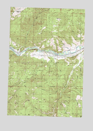
Medicine Tree Hill, MT USGS Topographic Map
Click on map above to begin viewing in our Map Viewer.

This topographic map contains these locations and features:
Feature Name Type Latitude Longitude GNIS ID View Map
11N14W17CDCB01 WellWellN46.7030°W113.3917°817860View Map
11N14W17CDDB01 WellWellN46.7033°W113.3895°817862View Map
11N14W17CDDD01 WellWellN46.7027°W113.3884°817856View Map
11N14W18DDCC01 WellWellN46.7024°W113.4020°817854View Map
11N14W18DDDD01 WellWellN46.7022°W113.3987°817853View Map
11N15W14CAC_01 SpringSpringN46.7035°W113.4545°817865View Map
11N15W24ADAA01 WellWellN46.6974°W113.4204°817837View Map
11N15W24ADDB01 WellWellN46.6958°W113.4209°817829View Map
11N15W24ADDB02 WellWellN46.6958°W113.4209°817830View Map
Bateman CreekStreamN46.6969°W113.4915°779434View Map
Bearmouth Fishing Access SiteLocaleN46.6991°W113.4229°1744412View Map
Blakeley (historical)LocaleN46.6963°W113.4231°1781861View Map
ByrnePopulated PlaceN46.7038°W113.4534°780714View Map
Chalet BearmouthLocaleN46.6985°W113.4231°1781855View Map
Clute GulchValleyN46.6521°W113.4873°781424View Map
Dooley GulchValleyN46.6613°W113.4765°782477View Map
Dry GulchValleyN46.6977°W113.4848°782635View Map
Genoa GulchValleyN46.6916°W113.4223°783889View Map
Grouse GulchValleyN46.6574°W113.4070°784379View Map
Interchange 138CrossingN46.6991°W113.4315°1781850View Map
Komich GulchValleyN46.6519°W113.4131°785829View Map
Left Fork Little Bear CreekStreamN46.7144°W113.3842°786029View Map
Little Bear CreekStreamN46.7072°W113.3826°773394View Map
Ludwell (historical)LocaleN46.6972°W113.4315°1781878View Map
McKnight GulchValleyN46.6844°W113.3848°787088View Map
Medicine Tree Fishing Access SiteLocaleN46.7010°W113.4923°1744411View Map
Medicine Tree HillSummitN46.6994°W113.4670°774085View Map
Mount BaldySummitN46.7380°W113.4204°779306View Map
Moyie GulchValleyN46.6288°W113.4242°787777View Map
Moyie SpringSpringN46.6258°W113.4662°793891View Map
NimrodPopulated PlaceN46.7002°W113.4773°788004View Map
NimrodLocaleN46.7002°W113.4773°1781882View Map
Nimrod Post Office (historical)Post OfficeN46.7002°W113.4773°1781804View Map
Tank GulchValleyN46.6430°W113.4176°791890View Map
Teakan GulchValleyN46.6263°W113.4242°791930View Map
Tendoy GulchValleyN46.6919°W113.4281°791954View Map
Tyler (historical)LocaleN46.6999°W113.4481°1781894View Map
Tyler CreekStreamN46.6997°W113.4479°792571View Map
Tyler PointSummitN46.6424°W113.4670°793895View Map
Van Curan GulchValleyN46.7035°W113.4017°792674View Map
Welch GulchValleyN46.6758°W113.3951°792929View Map
West Fork Tyler CreekStreamN46.6647°W113.4712°793093View Map

Note: Coordinates in the location and feature list above are referenced to NAD83 datum.


Copyright (C) 2008-2025 Ryan Niemi / Sunset Dynamics ... All Rights Reserved