TopoQuest Logo
Do you find TopoQuest useful?
Help keep TopoQuest running and adding new maps/features by donating!
Bitcoin:  19c7KJd3qBynnjoSw5npx9KScwjBe4ifkT
Litecoin:  LXs6TkuXGGXo1vDsWCkWVdjQX94eUKd6ui
Home View Maps Find Maps Find Places Resources & Links


Nirling Hill, Montana Topographic Map

USGS Map Title: Nirling Hill, MT
USGS Map MRC: 46113E3
DRG (GeoTIFF) Download: o46113e3.tif


Neighboring USGS Topographic Map Quads:


  Medicine Tree Hill, MT  
46113F4
 

  Bearmouth, MT  
46113F3
 

  Drummond, MT  
46113F2
 

  Harvey Point, MT  
46113E4
 

  Nirling Hill, MT  
46113E3
 

  Hall, MT  
46113E2
 

  Black Pine Ridge, MT  
46113D4
 

  Henderson Mountain, MT  
46113D3
 

  Maxville, MT  
46113D2


Map MRC Location:

N47°
W114°
N47°
W113°
H8 H7 H6 H5 H4 H3 H2 H1
G8 G7 G6 G5 G4 G3 G2 G1
F8 F7 F6 F5 F4 F3 F2 F1
E8 E7 E6 E5 E4 E3 E2 E1
D8 D7 D6 D5 D4 D3 D2 D1
C8 C7 C6 C5 C4 C3 C2 C1
B8 B7 B6 B5 B4 B3 B2 B1
A8 A7 A6 A5 A4 A3 A2 A1
N46°
W114°
N46°
W113°

Nirling Hill, MT USGS 1:24K Topographic Map Preview:
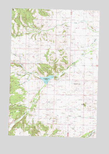
Nirling Hill, MT USGS Topographic Map
Click on map above to begin viewing in our Map Viewer.

This topographic map contains these locations and features:
Feature Name Type Latitude Longitude GNIS ID View Map
10N13W29ABDD01 WellWellN46.5980°W113.2556°817035View Map
Allen Dale DitchCanalN46.6047°W113.2565°778957View Map
Conn DitchCanalN46.5316°W113.3092°781577View Map
Conn RanchLocaleN46.5091°W113.2828°781579View Map
Cottonwood CreekStreamN46.5285°W113.3431°781724View Map
Dooley DitchCanalN46.5844°W113.2787°782476View Map
Gaylord GulchValleyN46.5235°W113.3465°783871View Map
Lower Willow Creek DamDamN46.5616°W113.3076°796271View Map
Lower Willow Creek ReservoirReservoirN46.5565°W113.3232°801868View Map
McLean CreekStreamN46.5627°W113.3506°787097View Map
Nirling HillSummitN46.5655°W113.3212°788023View Map
North Fork Lower Willow CreekStreamN46.5594°W113.3181°788205View Map
Red Cloud MineMineN46.5171°W113.2559°803119View Map
South Fork Lower Willow CreekStreamN46.5596°W113.3184°791008View Map
Spring CreekStreamN46.5685°W113.3590°791252View Map
SugarloafSummitN46.5530°W113.2795°791628View Map
The EyebrowSummitN46.5324°W113.2692°792033View Map
West Fork Lower Willow CreekStreamN46.5619°W113.3481°793044View Map

Note: Coordinates in the location and feature list above are referenced to NAD83 datum.


Copyright (C) 2008-2025 Ryan Niemi / Sunset Dynamics ... All Rights Reserved