TopoQuest Logo
Do you find TopoQuest useful?
Help keep TopoQuest running and adding new maps/features by donating!
Bitcoin:  19c7KJd3qBynnjoSw5npx9KScwjBe4ifkT
Litecoin:  LXs6TkuXGGXo1vDsWCkWVdjQX94eUKd6ui
Home View Maps Find Maps Find Places Resources & Links


Mendota West, Illinois Topographic Map

USGS Map Title: Mendota West, IL
USGS Map MRC: 41089E2
DRG (GeoTIFF) Download: o41089e2.tif


Neighboring USGS Topographic Map Quads:


  Amboy, IL  
41089F3
 

  Sublette, IL  
41089F2
 

  Compton, IL  
41089F1
 

  La Moille, IL  
41089E3
 

  Mendota West, IL  
41089E2
 

  Mendota East, IL  
41089E1
 

  Malden, IL  
41089D3
 

  Ladd, IL  
41089D2
 

  Troy Grove, IL  
41089D1


Map MRC Location:

N42°
W90°
N42°
W89°
H8 H7 H6 H5 H4 H3 H2 H1
G8 G7 G6 G5 G4 G3 G2 G1
F8 F7 F6 F5 F4 F3 F2 F1
E8 E7 E6 E5 E4 E3 E2 E1
D8 D7 D6 D5 D4 D3 D2 D1
C8 C7 C6 C5 C4 C3 C2 C1
B8 B7 B6 B5 B4 B3 B2 B1
A8 A7 A6 A5 A4 A3 A2 A1
N41°
W90°
N41°
W89°

Mendota West, IL USGS 1:24K Topographic Map Preview:
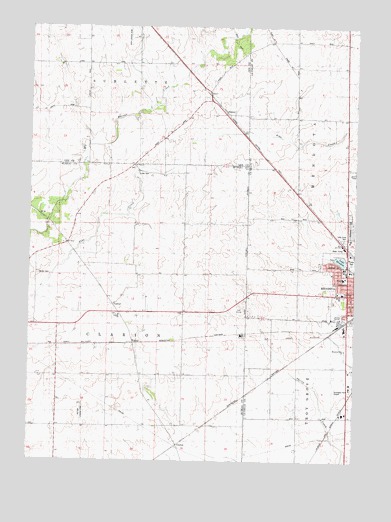
Mendota West, IL USGS Topographic Map
Click on map above to begin viewing in our Map Viewer.

This topographic map contains these locations and features:
Feature Name Type Latitude Longitude GNIS ID View Map
Bartlett Woods Nature PreserveParkN41.6195°W89.1687°2013868View Map
Bauer School (historical)SchoolN41.5109°W89.1976°403968View Map
Blackstone Elementary SchoolSchoolN41.5411°W89.1309°404532View Map
Church of the NazareneChurchN41.5473°W89.1273°1816026View Map
ClarionPopulated PlaceN41.5050°W89.1920°422554View Map
Clarion ChurchChurchN41.5420°W89.2156°406145View Map
Clarion FieldAirportN41.5339°W89.2091°2679056View Map
Clarion Lutheran CemeteryCemeteryN41.5423°W89.2162°1822642View Map
Erbes CemeteryCemeteryN41.5825°W89.2081°408052View Map
German Evangelical CemeteryCemeteryN41.5845°W89.2104°1822655View Map
Grandpa's Farm Mendota AirportAirportN41.5190°W89.1311°427532View Map
HenkelPopulated PlaceN41.6003°W89.1737°422800View Map
Hetzler CemeteryCemeteryN41.5535°W89.2467°410126View Map
Hetzler Cemetery Prairie Nature PreserveParkN41.5536°W89.2468°2013866View Map
Holy Cross CemeteryCemeteryN41.5642°W89.1290°410430View Map
Keutzer Airport (historical)AirportN41.5134°W89.2295°427433View Map
Knoxe GroveWoodsN41.6181°W89.1729°411591View Map
Lake MendotaLakeN41.5582°W89.1306°413399View Map
Lake Mendota DamDamN41.5578°W89.1312°1691203View Map
Mendota Bible ChurchChurchN41.5323°W89.1290°1718887View Map
Mendota Community Hospital HeliportAirportN41.5520°W89.1315°427530View Map
Mendota Golf ClubLocaleN41.5436°W89.1693°1822686View Map
Mendota Lake ParkParkN41.5584°W89.1312°1816104View Map
Otterbach Farm AirportAirportN41.5701°W89.1715°427531View Map
Rapp Landing Strip (historical)AirportN41.6225°W89.2123°1718886View Map
Restland CemeteryCemeteryN41.5674°W89.1266°416549View Map
Saint Paul ChurchChurchN41.5845°W89.2098°417703View Map
Township of ClarionCivilN41.5404°W89.2216°428814View Map
WendelPopulated PlaceN41.5331°W89.2101°423296View Map
WGLC-AM (Mendota)TowerN41.5828°W89.1259°428435View Map

Note: Coordinates in the location and feature list above are referenced to NAD83 datum.


Copyright (C) 2008-2025 Ryan Niemi / Sunset Dynamics ... All Rights Reserved