TopoQuest Logo
Do you find TopoQuest useful?
Help keep TopoQuest running and adding new maps/features by donating!
Bitcoin:  19c7KJd3qBynnjoSw5npx9KScwjBe4ifkT
Litecoin:  LXs6TkuXGGXo1vDsWCkWVdjQX94eUKd6ui
Home View Maps Find Maps Find Places Resources & Links


Sublette, Illinois Topographic Map

USGS Map Title: Sublette, IL
USGS Map MRC: 41089F2
DRG (GeoTIFF) Download: o41089f2.tif


Neighboring USGS Topographic Map Quads:


  Franklin Grove, IL  
41089G3
 

  Ashton, IL  
41089G2
 

  Steward, IL  
41089G1
 

  Amboy, IL  
41089F3
 

  Sublette, IL  
41089F2
 

  Compton, IL  
41089F1
 

  La Moille, IL  
41089E3
 

  Mendota West, IL  
41089E2
 

  Mendota East, IL  
41089E1


Map MRC Location:

N42°
W90°
N42°
W89°
H8 H7 H6 H5 H4 H3 H2 H1
G8 G7 G6 G5 G4 G3 G2 G1
F8 F7 F6 F5 F4 F3 F2 F1
E8 E7 E6 E5 E4 E3 E2 E1
D8 D7 D6 D5 D4 D3 D2 D1
C8 C7 C6 C5 C4 C3 C2 C1
B8 B7 B6 B5 B4 B3 B2 B1
A8 A7 A6 A5 A4 A3 A2 A1
N41°
W90°
N41°
W89°

Sublette, IL USGS 1:24K Topographic Map Preview:
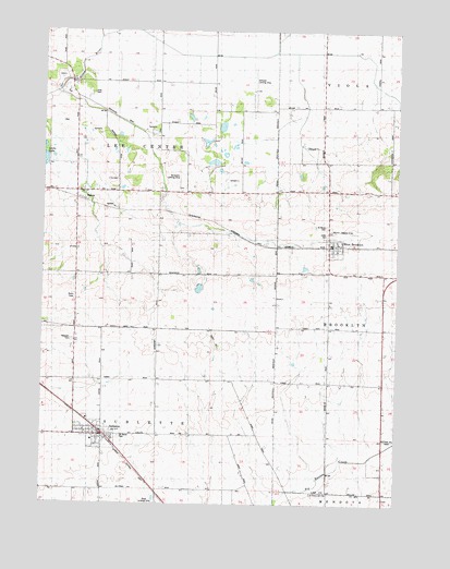
Sublette, IL USGS Topographic Map
Click on map above to begin viewing in our Map Viewer.

This topographic map contains these locations and features:
Feature Name Type Latitude Longitude GNIS ID View Map
Bernardin HeliportAirportN41.7084°W89.2029°427911View Map
Bernardin Landing Strip (historical)AirportN41.7120°W89.2020°1718890View Map
Bonnell FarmsLocaleN41.6814°W89.2025°2681077View Map
Borell FarmsLocaleN41.7406°W89.2408°2703987View Map
Butler Hill RLA AirportAirportN41.7342°W89.1622°2679096View Map
Connell FarmLocaleN41.7100°W89.1597°2681076View Map
Delhotal AirportAirportN41.7344°W89.1763°427910View Map
Gehant AirportAirportN41.6976°W89.1487°427909View Map
InletPopulated PlaceN41.7350°W89.2404°1816554View Map
Inlet CemeteryCemeteryN41.7336°W89.2329°410904View Map
Inlet QuarryMineN41.7373°W89.2440°1985559View Map
Our Lady of Perpetual Help ChurchChurchN41.6428°W89.2245°2042243View Map
Peterson CemeteryCemeteryN41.6684°W89.2393°415582View Map
Saint Mary's CemeteryCemeteryN41.6986°W89.1498°417575View Map
Saint Mary's ChurchChurchN41.6939°W89.1462°2042245View Map
Saint Marys CemeteryCemeteryN41.6428°W89.2143°1718889View Map
Shaw Post Office (historical)Post OfficeN41.7078°W89.2379°1816586View Map
ShawsPopulated PlaceN41.7075°W89.2354°418320View Map
SublettePopulated PlaceN41.6431°W89.2279°419248View Map
Sublette Fire DepartmentBuildingN41.6444°W89.2318°2640871View Map
Sublette Post OfficePost OfficeN41.6430°W89.2289°2788589View Map
Sublette Union ChurchChurchN41.6436°W89.2340°2042244View Map
Township of Lee CenterCivilN41.7145°W89.2267°422223View Map
Township of SubletteCivilN41.6282°W89.2266°429806View Map
Union CemeteryCemeteryN41.6967°W89.1490°420027View Map
Village of SubletteCivilN41.6437°W89.2312°2399924View Map
Village of West BrooklynCivilN41.6928°W89.1473°2400127View Map
West BrooklynPopulated PlaceN41.6928°W89.1470°420799View Map
West Brooklyn Fire DepartmentBuildingN41.6940°W89.1485°2640702View Map
West Brooklyn Post OfficePost OfficeN41.6935°W89.1470°2788831View Map

Note: Coordinates in the location and feature list above are referenced to NAD83 datum.


Copyright (C) 2008-2025 Ryan Niemi / Sunset Dynamics ... All Rights Reserved