TopoQuest Logo
Do you find TopoQuest useful?
Help keep TopoQuest running and adding new maps/features by donating!
Bitcoin:  19c7KJd3qBynnjoSw5npx9KScwjBe4ifkT
Litecoin:  LXs6TkuXGGXo1vDsWCkWVdjQX94eUKd6ui
Home View Maps Find Maps Find Places Resources & Links


Metallak Mountain, Maine Topographic Map

USGS Map Title: Metallak Mountain, ME
USGS Map MRC: 44070G7
DRG (GeoTIFF) Download: o44070g7.tif


Neighboring USGS Topographic Map Quads:


  Richardson Pond, ME  
44070H8
 

  Oquossoc, ME  
44070H7
 

  Rangeley, ME  
44070H6
 

  Middle Dam, ME  
44070G8
 

  Metallak Mountain, ME  
44070G7
 

  Houghton, ME  
44070G6
 

  B Pond, ME  
44070F8
 

  Andover, ME  
44070F7
 

  Ellis Pond, ME  
44070F6


Map MRC Location:

N45°
W71°
N45°
W70°
H8 H7 H6 H5 H4 H3 H2 H1
G8 G7 G6 G5 G4 G3 G2 G1
F8 F7 F6 F5 F4 F3 F2 F1
E8 E7 E6 E5 E4 E3 E2 E1
D8 D7 D6 D5 D4 D3 D2 D1
C8 C7 C6 C5 C4 C3 C2 C1
B8 B7 B6 B5 B4 B3 B2 B1
A8 A7 A6 A5 A4 A3 A2 A1
N44°
W71°
N44°
W70°

Metallak Mountain, ME USGS 1:24K Topographic Map Preview:
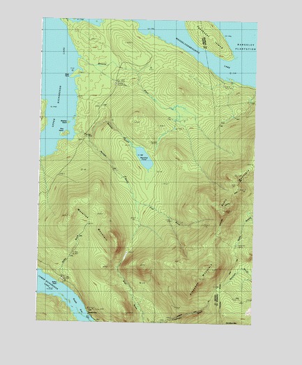
Metallak Mountain, ME USGS Topographic Map
Click on map above to begin viewing in our Map Viewer.

This topographic map contains these locations and features:
Feature Name Type Latitude Longitude GNIS ID View Map
Bailey BrookStreamN44.7664°W70.8617°561434View Map
Bailey PointCapeN44.7651°W70.8623°561446View Map
Bemis MountainSummitN44.7949°W70.7682°562033View Map
Black PointCapeN44.8503°W70.8598°562481View Map
Elephant MountainSummitN44.7681°W70.7816°565831View Map
Icicle BrookStreamN44.7981°W70.8162°568548View Map
Metallak BrookStreamN44.8262°W70.8487°571187View Map
Metallak IslandIslandN44.8323°W70.8592°571188View Map
Metallak MountainSummitN44.7857°W70.8311°571189View Map
Metallak PondLakeN44.8181°W70.8143°571190View Map
Metallak StreamStreamN44.8278°W70.8545°571191View Map
Mosquito BrookStreamN44.8578°W70.8537°571725View Map
Pine IslandIslandN44.8270°W70.8609°573382View Map
Richardsontown TownshipCivilN44.8658°W70.8488°1987282View Map
South ArmPopulated PlaceN44.7553°W70.8456°579711View Map
South Arm CampgroundLocaleN44.7528°W70.8426°1908190View Map
South Arm Lower Richardson LakeBayN44.7551°W70.8517°575748View Map
Toothaker IslandIslandN44.8681°W70.7790°577199View Map
Upper Richardson LakeLakeN44.8244°W70.8708°577652View Map
Whitneys PointCapeN44.8614°W70.8528°1908256View Map

Note: Coordinates in the location and feature list above are referenced to NAD83 datum.


Copyright (C) 2008-2024 Ryan Niemi / Sunset Dynamics ... All Rights Reserved