TopoQuest Logo
Do you find TopoQuest useful?
Help keep TopoQuest running and adding new maps/features by donating!
Bitcoin:  19c7KJd3qBynnjoSw5npx9KScwjBe4ifkT
Litecoin:  LXs6TkuXGGXo1vDsWCkWVdjQX94eUKd6ui
Home View Maps Find Maps Find Places Resources & Links


Beauford, Minnesota Topographic Map

USGS Map Title: Beauford, MN
USGS Map MRC: 44093A8
DRG (GeoTIFF) Download: o44093a8.tif


Neighboring USGS Topographic Map Quads:


  Mankato West, MN  
44094B1
 

  Mankato East, MN  
44093B8
 

  Madison Lake, MN  
44093B7
 

  Good Thunder, MN  
44094A1
 

  Beauford, MN  
44093A8
 

  Saint Clair, MN  
44093A7
 

  Sterling Center, MN  
43094H1
 

  Mapleton, MN  
43093H8
 

  Mapleton NE, MN  
43093H7


Map MRC Location:

N45°
W94°
N45°
W93°
H8 H7 H6 H5 H4 H3 H2 H1
G8 G7 G6 G5 G4 G3 G2 G1
F8 F7 F6 F5 F4 F3 F2 F1
E8 E7 E6 E5 E4 E3 E2 E1
D8 D7 D6 D5 D4 D3 D2 D1
C8 C7 C6 C5 C4 C3 C2 C1
B8 B7 B6 B5 B4 B3 B2 B1
A8 A7 A6 A5 A4 A3 A2 A1
N44°
W94°
N44°
W93°

Beauford, MN USGS 1:24K Topographic Map Preview:
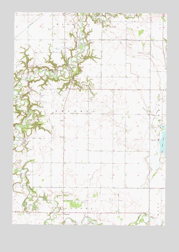
Beauford, MN USGS Topographic Map
Click on map above to begin viewing in our Map Viewer.

This topographic map contains these locations and features:
Feature Name Type Latitude Longitude GNIS ID View Map
Bearford United Methodist ChurchChurchN44.0069°W93.9577°2051553View Map
BeaufordPopulated PlaceN44.0075°W93.9586°654591View Map
Beauford Post Office (historical)Post OfficeN44.0075°W93.9586°2051674View Map
County Ditch Number EightyeightCanalN44.0697°W93.8808°642354View Map
County Ditch Number TwentyfiveCanalN44.1005°W93.8880°641858View Map
Decoria CemeteryCemeteryN44.0614°W93.9591°642697View Map
Hoppe Sky Ranch AirportAirportN44.0356°W93.9481°2676834View Map
Hungry HollowValleyN44.0913°W93.9540°645288View Map
Mankato Farmstrip Airport (historical)AirportN44.0997°W93.9169°660272View Map
Oak Hill CemeteryCemeteryN44.0016°W93.9588°2051633View Map
Redeemer ChurchChurchN44.0516°W93.9591°649891View Map
Rice LakeReservoirN44.0455°W93.8786°650031View Map
Terrace View Golf CourseLocaleN44.1041°W93.9586°2051471View Map
Township of DecoriaCivilN44.0656°W93.9485°663938View Map
Victory Memorial Rest Area Historical MarkerParkN44.0866°W93.9530°2051644View Map

Note: Coordinates in the location and feature list above are referenced to NAD83 datum.


Copyright (C) 2008-2025 Ryan Niemi / Sunset Dynamics ... All Rights Reserved