TopoQuest Logo
Do you find TopoQuest useful?
Help keep TopoQuest running and adding new maps/features by donating!
Bitcoin:  19c7KJd3qBynnjoSw5npx9KScwjBe4ifkT
Litecoin:  LXs6TkuXGGXo1vDsWCkWVdjQX94eUKd6ui
Home View Maps Find Maps Find Places Resources & Links


Middletown, Kansas Topographic Map

USGS Map Title: Middletown, KS
USGS Map MRC: 37095F7
DRG (GeoTIFF) Download: o37095f7.tif


Neighboring USGS Topographic Map Quads:


  Toronto, KS  
37095G8
 

  Toronto SE, KS  
37095G7
 

  Rose, KS  
37095G6
 

  Coyville, KS  
37095F8
 

  Middletown, KS  
37095F7
 

  Buffalo, KS  
37095F6
 

  New Albany, KS  
37095E8
 

  Fredonia, KS  
37095E7
 

  Altoona, KS  
37095E6


Map MRC Location:

N38°
W96°
N38°
W95°
H8 H7 H6 H5 H4 H3 H2 H1
G8 G7 G6 G5 G4 G3 G2 G1
F8 F7 F6 F5 F4 F3 F2 F1
E8 E7 E6 E5 E4 E3 E2 E1
D8 D7 D6 D5 D4 D3 D2 D1
C8 C7 C6 C5 C4 C3 C2 C1
B8 B7 B6 B5 B4 B3 B2 B1
A8 A7 A6 A5 A4 A3 A2 A1
N37°
W96°
N37°
W95°

Middletown, KS USGS 1:24K Topographic Map Preview:
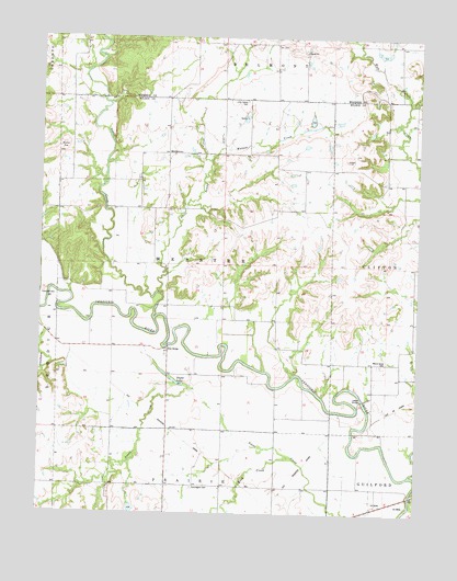
Middletown, KS USGS Topographic Map
Click on map above to begin viewing in our Map Viewer.

This topographic map contains these locations and features:
Feature Name Type Latitude Longitude GNIS ID View Map
BenedictPopulated PlaceN37.6253°W95.7505°474918View Map
Buffalo CreekStreamN37.6356°W95.7519°474920View Map
Farmdale (historical)LocaleN37.6470°W95.8319°484168View Map
Farmington CemeteryCemeteryN37.6319°W95.8241°474908View Map
Farmington Church (historical)ChurchN37.6325°W95.8239°484169View Map
Greystone (historical)LocaleN37.6584°W95.7641°482686View Map
Independence School (historical)SchoolN37.6792°W95.8105°484181View Map
Lamb School (historical)SchoolN37.6362°W95.8514°484183View Map
Leeper BridgeBridgeN37.6550°W95.7678°474903View Map
Little Sandy CemeteryCemeteryN37.7336°W95.8074°474913View Map
Little Sandy CreekStreamN37.6823°W95.8344°474680View Map
Little Sandy School (historical)SchoolN37.7339°W95.8155°484242View Map
Maple Grove CemeteryCemeteryN37.6643°W95.7617°474910View Map
Maple Grove School (historical)SchoolN37.6678°W95.7561°484187View Map
MiddletownPopulated PlaceN37.7198°W95.8333°484702View Map
Moss BridgeBridgeN37.6689°W95.8328°474902View Map
North Clark School (historical)SchoolN37.6539°W95.7964°484193View Map
Rock CreekStreamN37.6400°W95.7922°474915View Map
Round TopSummitN37.7217°W95.8680°474912View Map
Sandy CreekStreamN37.6756°W95.8372°474679View Map
Shafer LakeLakeN37.6600°W95.8308°474909View Map
Township of WebsterCivilN37.6904°W95.8243°474914View Map
Trimmell CemeteryCemeteryN37.6829°W95.8742°474901View Map
Walnut CreekStreamN37.7175°W95.8194°474911View Map
West Buffalo School (historical)SchoolN37.7484°W95.7519°484277View Map

Note: Coordinates in the location and feature list above are referenced to NAD83 datum.


Copyright (C) 2008-2024 Ryan Niemi / Sunset Dynamics ... All Rights Reserved