TopoQuest Logo
Do you find TopoQuest useful?
Help keep TopoQuest running and adding new maps/features by donating!
Bitcoin:  19c7KJd3qBynnjoSw5npx9KScwjBe4ifkT
Litecoin:  LXs6TkuXGGXo1vDsWCkWVdjQX94eUKd6ui
Home View Maps Find Maps Find Places Resources & Links


Midway, New Mexico Topographic Map

USGS Map Title: Midway, NM
USGS Map MRC: 34103C2
DRG (GeoTIFF) Download: o34103c2.tif


Neighboring USGS Topographic Map Quads:


  Portair, NM  
34103D3
 

  Clovis, NM  
34103D2
 

  Farwell, TX  
34103D1
 

  Oasis State Park, NM  
34103C3
 

  Midway, NM  
34103C2
 

  Pleasure Lake, NM  
34103C1
 

  Portales, NM  
34103B3
 

  Arch NW, NM  
34103B2
 

  Arch NE, NM  
34103B1


Map MRC Location:

N35°
W104°
N35°
W103°
H8 H7 H6 H5 H4 H3 H2 H1
G8 G7 G6 G5 G4 G3 G2 G1
F8 F7 F6 F5 F4 F3 F2 F1
E8 E7 E6 E5 E4 E3 E2 E1
D8 D7 D6 D5 D4 D3 D2 D1
C8 C7 C6 C5 C4 C3 C2 C1
B8 B7 B6 B5 B4 B3 B2 B1
A8 A7 A6 A5 A4 A3 A2 A1
N34°
W104°
N34°
W103°

Midway, NM USGS 1:24K Topographic Map Preview:
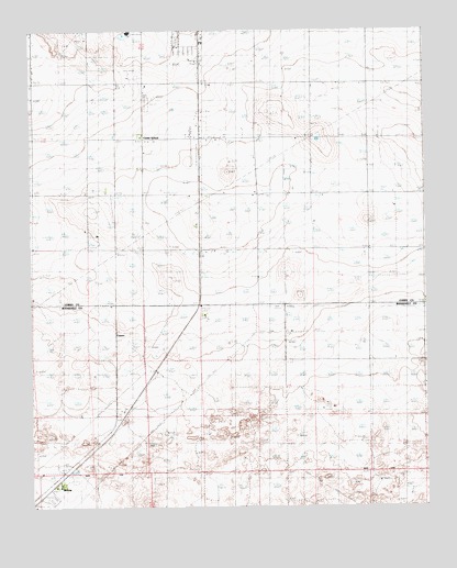
Midway, NM USGS Topographic Map
Click on map above to begin viewing in our Map Viewer.

This topographic map contains these locations and features:
Feature Name Type Latitude Longitude GNIS ID View Map
10022 Water WellWellN34.3145°W103.1524°936195View Map
10069 Water WellWellN34.2515°W103.2500°936235View Map
10807 Water WellWellN34.2537°W103.2291°936227View Map
10831 Water WellWellN34.2542°W103.1388°936229View Map
10833 Water WellWellN34.2515°W103.1869°936234View Map
11635 Water WellWellN34.2917°W103.2188°936196View Map
11696 Water WellWellN34.2784°W103.1905°936129View Map
11710 Water WellWellN34.2845°W103.1727°936205View Map
11711 Water WellWellN34.2740°W103.1975°936210View Map
11712 Water WellWellN34.2631°W103.1811°936117View Map
11730 Water WellWellN34.2537°W103.1733°936226View Map
12002 Water WellWellN34.2740°W103.2150°936211View Map
12167 Water WellWellN34.2542°W103.1386°936228View Map
12188 Water WellWellN34.2534°W103.2300°936106View Map
12241 Water WellWellN34.2692°W103.2058°936219View Map
12260 Water WellWellN34.2656°W103.1649°936215View Map
12385 Water WellWellN34.2542°W103.1449°936230View Map
12691 Water WellWellN34.2848°W103.1463°936207View Map
12710 Water WellWellN34.2809°W103.2397°936130View Map
A and T DairyLocaleN34.3572°W103.2253°2705263View Map
CameoPopulated PlaceN34.2876°W103.2233°898525View Map
CC-575 Water WellWellN34.3195°W103.2322°922953View Map
Center SchoolSchoolN34.3476°W103.2149°887377View Map
Cooper - Legacy DairyLocaleN34.2992°W103.1372°2705324View Map
Eastern New Mexico State Park (historical)ParkN34.2529°W103.2450°920851View Map
Grande Vida DairyLocaleN34.2719°W103.1769°2706632View Map
Hardwick RanchLocaleN34.3042°W103.2497°889772View Map
Heritage DairyLocaleN34.3500°W103.1297°2705269View Map
KTQM-FM (Clovis)TowerN34.3634°W103.2186°938760View Map
KWKA-AM (Clovis)TowerN34.3634°W103.2186°938738View Map
Launchpad DairyLocaleN34.2753°W103.2147°2706914View Map
MidwayPopulated PlaceN34.2562°W103.2436°899796View Map
Midway DairyLocaleN34.2864°W103.2072°2706915View Map
Native PasturesLocaleN34.3214°W103.2297°2705479View Map
Opportunity DairyLocaleN34.3000°W103.2189°2706918View Map
Powerline DairyLocaleN34.3139°W103.2475°2705481View Map
Rio Leche DairyLocaleN34.3722°W103.1367°2705320View Map
Stewart RanchLocaleN34.2740°W103.2355°895346View Map

Note: Coordinates in the location and feature list above are referenced to NAD83 datum.


Copyright (C) 2008-2025 Ryan Niemi / Sunset Dynamics ... All Rights Reserved