TopoQuest Logo
Do you find TopoQuest useful?
Help keep TopoQuest running and adding new maps/features by donating!
Bitcoin:  19c7KJd3qBynnjoSw5npx9KScwjBe4ifkT
Litecoin:  LXs6TkuXGGXo1vDsWCkWVdjQX94eUKd6ui
Home View Maps Find Maps Find Places Resources & Links


Oasis State Park, New Mexico Topographic Map

USGS Map Title: Oasis State Park, NM
USGS Map MRC: 34103C3
DRG (GeoTIFF) Download: o34103c3.tif


Neighboring USGS Topographic Map Quads:


  Saint Vrain, NM  
34103D4
 

  Portair, NM  
34103D3
 

  Clovis, NM  
34103D2
 

  Portair SW, NM  
34103C4
 

  Oasis State Park, NM  
34103C3
 

  Midway, NM  
34103C2
 

  Bethel, NM  
34103B4
 

  Portales, NM  
34103B3
 

  Arch NW, NM  
34103B2


Map MRC Location:

N35°
W104°
N35°
W103°
H8 H7 H6 H5 H4 H3 H2 H1
G8 G7 G6 G5 G4 G3 G2 G1
F8 F7 F6 F5 F4 F3 F2 F1
E8 E7 E6 E5 E4 E3 E2 E1
D8 D7 D6 D5 D4 D3 D2 D1
C8 C7 C6 C5 C4 C3 C2 C1
B8 B7 B6 B5 B4 B3 B2 B1
A8 A7 A6 A5 A4 A3 A2 A1
N34°
W104°
N34°
W103°

Oasis State Park, NM USGS 1:24K Topographic Map Preview:
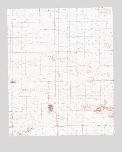
Oasis State Park, NM USGS Topographic Map
Click on map above to begin viewing in our Map Viewer.

This topographic map contains these locations and features:
Feature Name Type Latitude Longitude GNIS ID View Map
10020 Water WellWellN34.2626°W103.3408°936116View Map
10021 Water WellWellN34.2709°W103.3130°936122View Map
10070 Water WellWellN34.2556°W103.2755°936108View Map
10071 Water WellWellN34.2584°W103.3075°936224View Map
10072 Water WellWellN34.2501°W103.3058°936100View Map
10691 Water WellWellN34.2665°W103.3619°936216View Map
10707 Water WellWellN34.2884°W103.2502°936134View Map
10784 Water WellWellN34.2531°W103.3750°936105View Map
10809 Water WellWellN34.2556°W103.3130°936109View Map
11041 Water WellWellN34.2531°W103.3386°936104View Map
11538 Water WellWellN34.2584°W103.2886°936223View Map
11539 Water WellWellN34.2529°W103.3172°936102View Map
11540 Water WellWellN34.2529°W103.3169°936101View Map
11634 Water WellWellN34.2884°W103.2502°936135View Map
11667 Water WellWellN34.2779°W103.3488°936127View Map
11745 Water WellWellN34.2559°W103.3394°936111View Map
12162 Water WellWellN34.2551°W103.3238°936231View Map
12258 Water WellWellN34.2717°W103.3555°936124View Map
12259 Water WellWellN34.2626°W103.3408°936115View Map
12520 Water WellWellN34.2998°W103.3663°936138View Map
12716 Water WellWellN34.2584°W103.2725°936222View Map
Arrowhead DairyLocaleN34.3431°W103.3325°2705323View Map
Blackwater Draw DairyLocaleN34.2650°W103.2819°2706638View Map
Day Star DairyLocaleN34.3581°W103.2603°2705265View Map
Do Rene DairyLocaleN34.3433°W103.2781°2705267View Map
El Dorado DairyLocaleN34.3397°W103.2561°2705268View Map
Four Way DairyLocaleN34.2697°W103.3053°2706619View Map
Highland DairyLocaleN34.3575°W103.2911°2705270View Map
Mitchell DairyLocaleN34.2864°W103.3300°2706917View Map
Oasis State ParkParkN34.2565°W103.3488°900370View Map
Sas DairyLocaleN34.3344°W103.3228°2705485View Map

Note: Coordinates in the location and feature list above are referenced to NAD83 datum.


Copyright (C) 2008-2024 Ryan Niemi / Sunset Dynamics ... All Rights Reserved