TopoQuest Logo
Do you find TopoQuest useful?
Help keep TopoQuest running and adding new maps/features by donating!
Bitcoin:  19c7KJd3qBynnjoSw5npx9KScwjBe4ifkT
Litecoin:  LXs6TkuXGGXo1vDsWCkWVdjQX94eUKd6ui
Home View Maps Find Maps Find Places Resources & Links


Midway, Mississippi Topographic Map

USGS Map Title: Midway, MS
USGS Map MRC: 31090F5
DRG (GeoTIFF) Download: o31090f5.tif


Neighboring USGS Topographic Map Quads:


  Barlow, MS  
31090G6
 

  Smyrna, MS  
31090G5
 

  Hazlehurst, MS  
31090G4
 

  Caseyville, MS  
31090F6
 

  Midway, MS  
31090F5
 

  Wesson, MS  
31090F4
 

  McCall Creek, MS  
31090E6
 

  Zetus, MS  
31090E5
 

  Brookhaven, MS  
31090E4


Map MRC Location:

N32°
W91°
N32°
W90°
H8 H7 H6 H5 H4 H3 H2 H1
G8 G7 G6 G5 G4 G3 G2 G1
F8 F7 F6 F5 F4 F3 F2 F1
E8 E7 E6 E5 E4 E3 E2 E1
D8 D7 D6 D5 D4 D3 D2 D1
C8 C7 C6 C5 C4 C3 C2 C1
B8 B7 B6 B5 B4 B3 B2 B1
A8 A7 A6 A5 A4 A3 A2 A1
N31°
W91°
N31°
W90°

Midway, MS USGS 1:24K Topographic Map Preview:
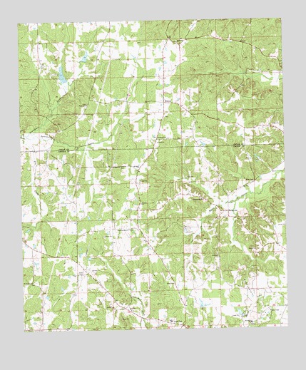
Midway, MS USGS Topographic Map
Click on map above to begin viewing in our Map Viewer.

This topographic map contains these locations and features:
Feature Name Type Latitude Longitude GNIS ID View Map
Boys Club Lake DamDamN31.7235°W90.6034°680851View Map
Dry CreekStreamN31.7038°W90.6243°669413View Map
Garland Brookline Lake DamDamN31.7318°W90.5934°680861View Map
Goodman School (historical)SchoolN31.6604°W90.5315°686230View Map
Grafton Hall School (historical)SchoolN31.6954°W90.5184°686231View Map
I O Smith Lake DamDamN31.6335°W90.5184°680795View Map
Jericho ChurchChurchN31.6549°W90.5326°671846View Map
Latter Day Saints ChurchChurchN31.6657°W90.5740°672315View Map
Lloyd Hall School (historical)SchoolN31.6266°W90.5937°686249View Map
Lloyd Star Consolidated SchoolSchoolN31.6285°W90.5551°686250View Map
Loyd StarPopulated PlaceN31.6266°W90.5501°672938View Map
Loyd Star Volunteer Fire DepartmentBuildingN31.6287°W90.5585°2667914View Map
Macedonia CemeteryCemeteryN31.6271°W90.5168°1805880View Map
Macedonia ChurchChurchN31.6274°W90.5173°673001View Map
Mercy Seat CemeteryCemeteryN31.7168°W90.5934°708031View Map
Mercy Seat ChurchChurchN31.7166°W90.5929°673484View Map
MidwayPopulated PlaceN31.7168°W90.5565°673540View Map
Mount Pisgah ChurchChurchN31.6910°W90.5776°674196View Map
Mount Salem ChurchChurchN31.6907°W90.5687°674258View Map
Mount Zion ChurchChurchN31.6446°W90.6204°674338View Map
New Hope ChurchChurchN31.6329°W90.5740°674684View Map
New Hope ChurchChurchN31.7410°W90.5495°674686View Map
Newell CemeteryCemeteryN31.6843°W90.5148°674900View Map
Old Red StarLocaleN31.6724°W90.5273°675227View Map
Peets CemeteryCemeteryN31.7113°W90.5565°708042View Map
Pleasant Ridge ChurchChurchN31.6777°W90.5395°676105View Map
Providence CreekStreamN31.7043°W90.6245°676399View Map
Reed School (historical)SchoolN31.6777°W90.5684°686270View Map
Searchlight School (historical)SchoolN31.6971°W90.6234°686279View Map
South Fork Homochitto RiverStreamN31.6993°W90.5982°686283View Map
Sweetwater CemeteryCemeteryN31.7029°W90.5593°708060View Map
Sweetwater ChurchChurchN31.7027°W90.5598°678494View Map
Sweetwater CreekStreamN31.7043°W90.6245°678498View Map

Note: Coordinates in the location and feature list above are referenced to NAD83 datum.


Copyright (C) 2008-2025 Ryan Niemi / Sunset Dynamics ... All Rights Reserved