TopoQuest Logo
Do you find TopoQuest useful?
Help keep TopoQuest running and adding new maps/features by donating!
Bitcoin:  19c7KJd3qBynnjoSw5npx9KScwjBe4ifkT
Litecoin:  LXs6TkuXGGXo1vDsWCkWVdjQX94eUKd6ui
Home View Maps Find Maps Find Places Resources & Links


Smyrna, Mississippi Topographic Map

USGS Map Title: Smyrna, MS
USGS Map MRC: 31090G5
DRG (GeoTIFF) Download: o31090g5.tif


Neighboring USGS Topographic Map Quads:


  Dentville NW, MS  
31090H6
 

  Dentville, MS  
31090H5
 

  Gallman, MS  
31090H4
 

  Barlow, MS  
31090G6
 

  Smyrna, MS  
31090G5
 

  Hazlehurst, MS  
31090G4
 

  Caseyville, MS  
31090F6
 

  Midway, MS  
31090F5
 

  Wesson, MS  
31090F4


Map MRC Location:

N32°
W91°
N32°
W90°
H8 H7 H6 H5 H4 H3 H2 H1
G8 G7 G6 G5 G4 G3 G2 G1
F8 F7 F6 F5 F4 F3 F2 F1
E8 E7 E6 E5 E4 E3 E2 E1
D8 D7 D6 D5 D4 D3 D2 D1
C8 C7 C6 C5 C4 C3 C2 C1
B8 B7 B6 B5 B4 B3 B2 B1
A8 A7 A6 A5 A4 A3 A2 A1
N31°
W91°
N31°
W90°

Smyrna, MS USGS 1:24K Topographic Map Preview:
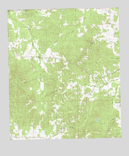
Smyrna, MS USGS Topographic Map
Click on map above to begin viewing in our Map Viewer.

This topographic map contains these locations and features:
Feature Name Type Latitude Longitude GNIS ID View Map
Antioch Baptist ChurchChurchN31.7963°W90.5726°666305View Map
Antioch CemeteryCemeteryN31.7965°W90.5734°708011View Map
Bishop CreekStreamN31.8013°W90.5387°667188View Map
BowertonPopulated PlaceN31.7563°W90.5695°667473View Map
Browns WellsPopulated PlaceN31.7752°W90.5015°686708View Map
Hall Hill ChurchChurchN31.8743°W90.6040°670842View Map
Jackson CreekStreamN31.8746°W90.6232°671775View Map
Kaywood PlantationLocaleN31.7827°W90.5020°672069View Map
Kaywood Plantation Airport (historical)AirportN31.7821°W90.5070°680325View Map
Kaywood Plantation Lake DamDamN31.7652°W90.5234°680881View Map
Millsaps CemeteryCemeteryN31.7727°W90.5441°708286View Map
Mount Olive ChurchChurchN31.8288°W90.5890°674124View Map
New Zion ChurchChurchN31.7946°W90.5740°674875View Map
Pineleaf ChurchChurchN31.7679°W90.5070°675885View Map
Pleasant Valley CemeteryCemeteryN31.7604°W90.5537°708047View Map
Pleasant Valley ChurchChurchN31.7607°W90.5537°676135View Map
Potter CreekStreamN31.8029°W90.5132°676279View Map
Saint Morris ChurchChurchN31.8113°W90.5123°677174View Map
SmyrnaPopulated PlaceN31.8702°W90.5093°692237View Map
Smyrna Baptist ChurchChurchN31.8593°W90.5095°677949View Map
Smyrna CemeteryCemeteryN31.8593°W90.5101°708056View Map
Smyrna Volunteer Fire DepartmentBuildingN31.8665°W90.5101°2668008View Map
Supervisor District 3CivilN31.7904°W90.5691°711830View Map
Thompson CreekStreamN31.7988°W90.5223°678704View Map
Valley CreekStreamN31.7988°W90.5223°679170View Map
Wilderness ChurchChurchN31.8416°W90.5309°679678View Map

Note: Coordinates in the location and feature list above are referenced to NAD83 datum.


Copyright (C) 2008-2025 Ryan Niemi / Sunset Dynamics ... All Rights Reserved