TopoQuest Logo
Do you find TopoQuest useful?
Help keep TopoQuest running and adding new maps/features by donating!
Bitcoin:  19c7KJd3qBynnjoSw5npx9KScwjBe4ifkT
Litecoin:  LXs6TkuXGGXo1vDsWCkWVdjQX94eUKd6ui
Home View Maps Find Maps Find Places Resources & Links


Midway, North Carolina Topographic Map

USGS Map Title: Midway, NC
USGS Map MRC: 35080H2
DRG (GeoTIFF) Download: o35080h2.tif


Neighboring USGS Topographic Map Quads:


  Winston-Salem West, NC  
36080A3
 

  Winston-Salem East, NC  
36080A2
 

  Kernersville, NC  
36080A1
 

  Welcome, NC  
35080H3
 

  Midway, NC  
35080H2
 

  High Point West, NC  
35080H1
 

  Lexington West, NC  
35080G3
 

  Lexington East, NC  
35080G2
 

  Fair Grove, NC  
35080G1


Map MRC Location:

N36°
W81°
N36°
W80°
H8 H7 H6 H5 H4 H3 H2 H1
G8 G7 G6 G5 G4 G3 G2 G1
F8 F7 F6 F5 F4 F3 F2 F1
E8 E7 E6 E5 E4 E3 E2 E1
D8 D7 D6 D5 D4 D3 D2 D1
C8 C7 C6 C5 C4 C3 C2 C1
B8 B7 B6 B5 B4 B3 B2 B1
A8 A7 A6 A5 A4 A3 A2 A1
N35°
W81°
N35°
W80°

Midway, NC USGS 1:24K Topographic Map Preview:
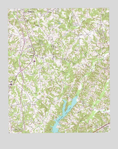
Midway, NC USGS Topographic Map
Click on map above to begin viewing in our Map Viewer.

This topographic map contains these locations and features:
Feature Name Type Latitude Longitude GNIS ID View Map
Ashmore Business CollegeSchoolN35.8854°W80.1262°1023464View Map
Bethany (historical)Populated PlaceN35.9574°W80.1642°1023369View Map
Bethany CemeteryCemeteryN35.9571°W80.1634°1954386View Map
Bethany ChurchChurchN35.9576°W80.1639°981087View Map
BethesdaPopulated PlaceN35.8796°W80.2409°1019113View Map
Bethesda United Methodist ChurchChurchN35.9035°W80.2187°981194View Map
Bethlehem United Church of ChristChurchN35.9987°W80.2006°981226View Map
Brooks TempleChurchN35.9507°W80.2089°981985View Map
Brushy ForkStreamN35.9085°W80.1828°982065View Map
Buck BranchStreamN35.9160°W80.1828°982094View Map
Cain CreekStreamN35.9101°W80.2148°982403View Map
Canaan Methodist ChurchChurchN35.9735°W80.1603°982574View Map
Cool BranchStreamN35.9385°W80.1739°983481View Map
Easter CreekStreamN35.8832°W80.2312°984548View Map
EbenezersPopulated PlaceN35.9035°W80.2195°1954407View Map
Fairview Methodist ChurchChurchN35.8957°W80.1645°984920View Map
Faith Alliance ChurchChurchN35.9821°W80.2117°984939View Map
Friendship Elementary SchoolSchoolN35.9598°W80.1402°2749374View Map
Gates ChurchChurchN35.9496°W80.1945°985609View Map
Gum TreePopulated PlaceN35.9962°W80.2000°1006225View Map
Gumtree Fire and RescueBuildingN35.9966°W80.1981°2639764View Map
Hebron ChurchChurchN35.9879°W80.2273°986582View Map
Hilltop Baptist ChurchChurchN35.9001°W80.1312°1954330View Map
Hunts ForkStreamN35.8946°W80.1428°1027413View Map
Ledford Senior High SchoolSchoolN35.9660°W80.1320°1002068View Map
Little Brushy ForkStreamN35.9574°W80.1814°988556View Map
Long BranchStreamN35.9801°W80.1723°988926View Map
MidwayPopulated PlaceN35.9535°W80.2181°1021443View Map
Midway Baptist ChurchChurchN35.9407°W80.2092°989829View Map
Midway Christian ChurchChurchN35.9512°W80.2198°1954354View Map
Midway Elementary SchoolSchoolN35.9526°W80.2142°1023471View Map
Midway Fire and Rescue Department Station 86BuildingN35.9530°W80.2160°2638088View Map
Mount Pleasant ChurchChurchN35.9385°W80.1320°990547View Map
North Davidson High SchoolSchoolN35.9240°W80.2462°991213View Map
North Davidson Junior High SchoolSchoolN35.9271°W80.2456°1023472View Map
Oil Mill BranchStreamN35.9293°W80.1789°991525View Map
Our Saviours ChurchChurchN35.9287°W80.2414°991725View Map
PilotPopulated PlaceN35.8801°W80.1295°1021897View Map
Pilot Elementary SchoolSchoolN35.8793°W80.1342°1002091View Map
Pilot Fire Department Station 54BuildingN35.8784°W80.1366°2638269View Map
Reedy RunStreamN35.9476°W80.1400°993208View Map
Rich Fork ChurchChurchN35.8762°W80.1400°993287View Map
Ridgeview AcresPopulated PlaceN35.9968°W80.1931°1002099View Map
Saints Delite ChurchChurchN35.9624°W80.1928°994152View Map
Shady Grove Methodist ChurchChurchN35.9829°W80.1353°994554View Map
Snyders LakeReservoirN35.9852°W80.1861°999850View Map
Snyders Lake DamDamN35.9851°W80.1848°999851View Map
The OaksPopulated PlaceN35.9946°W80.2089°1002113View Map
Town of MidwayCivilN35.9751°W80.2201°2424935View Map
Town of WallburgCivilN35.9898°W80.1283°2406823View Map
Township of MidwayCivilN35.9615°W80.1998°1026626View Map
Victory Baptist ChurchChurchN35.9049°W80.1589°996624View Map

Note: Coordinates in the location and feature list above are referenced to NAD83 datum.


Copyright (C) 2008-2025 Ryan Niemi / Sunset Dynamics ... All Rights Reserved