TopoQuest Logo
Do you find TopoQuest useful?
Help keep TopoQuest running and adding new maps/features by donating!
Bitcoin:  19c7KJd3qBynnjoSw5npx9KScwjBe4ifkT
Litecoin:  LXs6TkuXGGXo1vDsWCkWVdjQX94eUKd6ui
Home View Maps Find Maps Find Places Resources & Links


Milaca, Minnesota Topographic Map

USGS Map Title: Milaca, MN
USGS Map MRC: 45093G6
DRG (GeoTIFF) Download: o45093g6.tif


Neighboring USGS Topographic Map Quads:


  Ramey NE, MN  
45093H7
 

  Page, MN  
45093H6
 

  Milaca NE, MN  
45093H5
 

  Rum River, MN  
45093G7
 

  Milaca, MN  
45093G6
 

  Bock, MN  
45093G5
 

  Ronneby, MN  
45093F7
 

  Foreston, MN  
45093F6
 

  Princeton NE, MN  
45093F5


Map MRC Location:

N46°
W94°
N46°
W93°
H8 H7 H6 H5 H4 H3 H2 H1
G8 G7 G6 G5 G4 G3 G2 G1
F8 F7 F6 F5 F4 F3 F2 F1
E8 E7 E6 E5 E4 E3 E2 E1
D8 D7 D6 D5 D4 D3 D2 D1
C8 C7 C6 C5 C4 C3 C2 C1
B8 B7 B6 B5 B4 B3 B2 B1
A8 A7 A6 A5 A4 A3 A2 A1
N45°
W94°
N45°
W93°

Milaca, MN USGS 1:24K Topographic Map Preview:
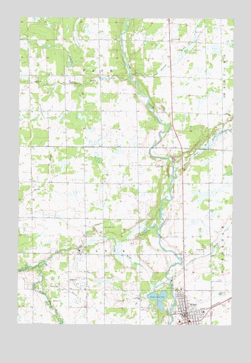
Milaca, MN USGS Topographic Map
Click on map above to begin viewing in our Map Viewer.

This topographic map contains these locations and features:
Feature Name Type Latitude Longitude GNIS ID View Map
Chase BrookStreamN45.7669°W93.6616°641123View Map
Chase Brook CemeteryCemeteryN45.7808°W93.7111°641125View Map
Chase Brook CemeteryCemeteryN45.7897°W93.7013°641126View Map
City of MilacaCivilN45.7574°W93.6520°2395318View Map
Forest Hill CemeteryCemeteryN45.7555°W93.6625°643801View Map
Mike Drew BrookStreamN45.8100°W93.6597°647831View Map
MilacaPopulated PlaceN45.7558°W93.6544°647836View Map
Milaca Municipal AirportAirportN45.7725°W93.6322°660289View Map
Milaca Police DepartmentBuildingN45.7552°W93.6489°2758614View Map
Milaca Volunteer Fire DepartmentBuildingN45.7647°W93.6525°2666143View Map
Mille Lacs County JailBuildingN45.7537°W93.6431°2758640View Map
Mille Lacs County Sheriff's OfficeBuildingN45.7537°W93.6430°2758550View Map
O'Neill BrookStreamN45.7680°W93.6608°648789View Map
Saint Marys CemeteryCemeteryN45.7591°W93.6300°650864View Map
Tibbetts BrookStreamN45.8511°W93.6858°653192View Map
Township of MilacaCivilN45.7814°W93.7044°664971View Map
Township of PageCivilN45.8656°W93.7043°665248View Map
Whitney BrookStreamN45.8525°W93.6861°654112View Map
Whitney Brook SchoolSchoolN45.8661°W93.6619°654113View Map

Note: Coordinates in the location and feature list above are referenced to NAD83 datum.


Copyright (C) 2008-2025 Ryan Niemi / Sunset Dynamics ... All Rights Reserved