TopoQuest Logo
Do you find TopoQuest useful?
Help keep TopoQuest running and adding new maps/features by donating!
Bitcoin:  19c7KJd3qBynnjoSw5npx9KScwjBe4ifkT
Litecoin:  LXs6TkuXGGXo1vDsWCkWVdjQX94eUKd6ui
Home View Maps Find Maps Find Places Resources & Links


Ronneby, Minnesota Topographic Map

USGS Map Title: Ronneby, MN
USGS Map MRC: 45093F7
DRG (GeoTIFF) Download: o45093f7.tif


Neighboring USGS Topographic Map Quads:


  Ramey, MN  
45093G8
 

  Rum River, MN  
45093G7
 

  Milaca, MN  
45093G6
 

  Foley, MN  
45093F8
 

  Ronneby, MN  
45093F7
 

  Foreston, MN  
45093F6
 

  Duelm, MN  
45093E8
 

  Santiago, MN  
45093E7
 

  Princeton SW, MN  
45093E6


Map MRC Location:

N46°
W94°
N46°
W93°
H8 H7 H6 H5 H4 H3 H2 H1
G8 G7 G6 G5 G4 G3 G2 G1
F8 F7 F6 F5 F4 F3 F2 F1
E8 E7 E6 E5 E4 E3 E2 E1
D8 D7 D6 D5 D4 D3 D2 D1
C8 C7 C6 C5 C4 C3 C2 C1
B8 B7 B6 B5 B4 B3 B2 B1
A8 A7 A6 A5 A4 A3 A2 A1
N45°
W94°
N45°
W93°

Ronneby, MN USGS 1:24K Topographic Map Preview:
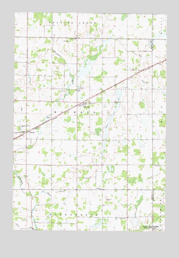
Ronneby, MN USGS Topographic Map
Click on map above to begin viewing in our Map Viewer.

This topographic map contains these locations and features:
Feature Name Type Latitude Longitude GNIS ID View Map
City of Ronneby (historical)CivilN45.6824°W93.8662°2396423View Map
County Ditch Number FourteenCanalN45.6986°W93.8130°641678View Map
Elwell CemeteryCemeteryN45.7338°W93.8344°643322View Map
Estes Brook ChurchChurchN45.6627°W93.7591°643420View Map
Hanenburg FarmsLocaleN45.6292°W93.7761°2674522View Map
Maywood CemeteryCemeteryN45.6553°W93.8165°647645View Map
Maywood ChurchChurchN45.6489°W93.8030°647646View Map
Maywood Post Office (historical)Post OfficeN45.6500°W93.8083°2069599View Map
Oak ParkPopulated PlaceN45.6977°W93.8180°648844View Map
Oak Park (historical)LocaleN45.6969°W93.8214°2069613View Map
Oak Park Post Office (historical)Post OfficeN45.6978°W93.8178°2069614View Map
Riverside CemeteryCemeteryN45.6845°W93.8691°650119View Map
RonnebyPopulated PlaceN45.6814°W93.8647°650235View Map
Ronneby Census Designated PlaceCensusN45.6853°W93.8601°2628690View Map
Ronneby Post Office (historical)Post OfficeN45.6814°W93.8644°2069594View Map
School Number 100SchoolN45.6327°W93.7825°651326View Map
School Number 101SchoolN45.6983°W93.8130°651330View Map
School Number 126SchoolN45.7350°W93.8239°651368View Map
Township of MaywoodCivilN45.6919°W93.8228°664938View Map
West Branch Saint Francis RiverStreamN45.6727°W93.8605°653938View Map

Note: Coordinates in the location and feature list above are referenced to NAD83 datum.


Copyright (C) 2008-2025 Ryan Niemi / Sunset Dynamics ... All Rights Reserved