TopoQuest Logo
Do you find TopoQuest useful?
Help keep TopoQuest running and adding new maps/features by donating!
Bitcoin:  19c7KJd3qBynnjoSw5npx9KScwjBe4ifkT
Litecoin:  LXs6TkuXGGXo1vDsWCkWVdjQX94eUKd6ui
Home View Maps Find Maps Find Places Resources & Links


Beaver Creek, Wyoming Topographic Map

USGS Map Title: Beaver Creek, WY
USGS Map MRC: 42106B6
DRG (GeoTIFF) Download: o42106b6.tif


Neighboring USGS Topographic Map Quads:


  Leo, WY  
42106C7
 

  Fourmile Ridge, WY  
42106C6
 

  Fourmile Point, WY  
42106C5
 

  Seminoe Dam NE, WY  
42106B7
 

  Beaver Creek, WY  
42106B6
 

  The Q Ranch, WY  
42106B5
 

  Seminoe Dam SE, WY  
42106A7
 

  Schneider Ridge, WY  
42106A6
 

  T E Ranch, WY  
42106A5


Map MRC Location:

N43°
W107°
N43°
W106°
H8 H7 H6 H5 H4 H3 H2 H1
G8 G7 G6 G5 G4 G3 G2 G1
F8 F7 F6 F5 F4 F3 F2 F1
E8 E7 E6 E5 E4 E3 E2 E1
D8 D7 D6 D5 D4 D3 D2 D1
C8 C7 C6 C5 C4 C3 C2 C1
B8 B7 B6 B5 B4 B3 B2 B1
A8 A7 A6 A5 A4 A3 A2 A1
N42°
W107°
N42°
W106°

Beaver Creek, WY USGS 1:24K Topographic Map Preview:
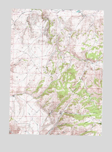
Beaver Creek, WY USGS Topographic Map
Click on map above to begin viewing in our Map Viewer.

This topographic map contains these locations and features:
Feature Name Type Latitude Longitude GNIS ID View Map
A Number One ClaimMineN42.2497°W106.6389°1746815View Map
Balsam DrawValleyN42.1797°W106.6545°1585090View Map
Beaver CreekStreamN42.2000°W106.6450°1585300View Map
Beaver Number One ClaimMineN42.2497°W106.6583°1746816View Map
Button MeadowsFlatN42.1464°W106.6350°1586220View Map
Campbell Headquarters CampLocaleN42.1369°W106.6256°1586318View Map
Cowden ReservoirReservoirN42.2483°W106.6602°1587126View Map
Dee Number One ClaimMineN42.2497°W106.6389°1746817View Map
Headquarters ParkFlatN42.1409°W106.6413°1589451View Map
Johnson CanyonValleyN42.1463°W106.6781°1590152View Map
Johnson MeadowsFlatN42.1463°W106.6595°1590181View Map
Norbacher CanyonValleyN42.1311°W106.7100°1592083View Map
Salmi RanchLocaleN42.1469°W106.6798°1593805View Map
Schoolhouse CanyonValleyN42.1347°W106.6861°1594023View Map
Sullivan SpringSpringN42.2253°W106.6697°1595172View Map
Tikkinen RanchLocaleN42.1638°W106.7431°1595565View Map

Note: Coordinates in the location and feature list above are referenced to NAD83 datum.


Copyright (C) 2008-2025 Ryan Niemi / Sunset Dynamics ... All Rights Reserved