TopoQuest Logo
Do you find TopoQuest useful?
Help keep TopoQuest running and adding new maps/features by donating!
Bitcoin:  19c7KJd3qBynnjoSw5npx9KScwjBe4ifkT
Litecoin:  LXs6TkuXGGXo1vDsWCkWVdjQX94eUKd6ui
Home View Maps Find Maps Find Places Resources & Links


Seminoe Dam NE, Wyoming Topographic Map

USGS Map Title: Seminoe Dam NE, WY
USGS Map MRC: 42106B7
DRG (GeoTIFF) Download: o42106b7.tif


Neighboring USGS Topographic Map Quads:


  Pathfinder Reservoir SW, WY  
42106C8
 

  Leo, WY  
42106C7
 

  Fourmile Ridge, WY  
42106C6
 

  Seminoe Dam, WY  
42106B8
 

  Seminoe Dam NE, WY  
42106B7
 

  Beaver Creek, WY  
42106B6
 

  Seminoe Dam SW, WY  
42106A8
 

  Seminoe Dam SE, WY  
42106A7
 

  Schneider Ridge, WY  
42106A6


Map MRC Location:

N43°
W107°
N43°
W106°
H8 H7 H6 H5 H4 H3 H2 H1
G8 G7 G6 G5 G4 G3 G2 G1
F8 F7 F6 F5 F4 F3 F2 F1
E8 E7 E6 E5 E4 E3 E2 E1
D8 D7 D6 D5 D4 D3 D2 D1
C8 C7 C6 C5 C4 C3 C2 C1
B8 B7 B6 B5 B4 B3 B2 B1
A8 A7 A6 A5 A4 A3 A2 A1
N42°
W107°
N42°
W106°

Seminoe Dam NE, WY USGS 1:24K Topographic Map Preview:
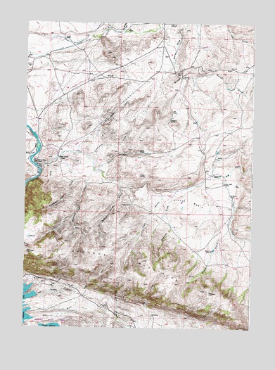
Seminoe Dam NE, WY USGS Topographic Map
Click on map above to begin viewing in our Map Viewer.

This topographic map contains these locations and features:
Feature Name Type Latitude Longitude GNIS ID View Map
Big DrawValleyN42.1877°W106.7659°1585454View Map
Black Canyon RanchLocaleN42.1944°W106.8559°1585587View Map
Bunker HillSummitN42.2280°W106.7895°1586135View Map
Cottonwood CreekStreamN42.1955°W106.8406°1587018View Map
Cow CanyonValleyN42.1908°W106.8617°1587103View Map
Deadman CanyonValleyN42.2061°W106.8350°1587428View Map
Dry LakeLakeN42.1619°W106.8725°1587861View Map
Hamilton CreekStreamN42.1969°W106.8684°1589266View Map
House GulchValleyN42.1663°W106.7623°1589766View Map
House Gulch ReservoirReservoirN42.1573°W106.7708°1589767View Map
Hurt GulchValleyN42.1322°W106.8703°1589830View Map
Hurt GulchValleyN42.1816°W106.8037°1589831View Map
Indian SpringSpringN42.1754°W106.8167°1589920View Map
Iron Springs CreekStreamN42.2469°W106.8220°1589972View Map
Kortes Dam CampLocaleN42.1930°W106.8692°1590413View Map
Lost CreekStreamN42.1916°W106.8687°1591026View Map
Lost Creek RanchLocaleN42.1880°W106.7714°1591036View Map
Lost Creek SchoolSchoolN42.1844°W106.7648°1591038View Map
Nine Bar W RanchLocaleN42.1788°W106.7614°1592042View Map
Number One GulchValleyN42.1852°W106.8478°1592318View Map
Number Three GulchValleyN42.1827°W106.8231°1592319View Map
Number Two GulchValleyN42.1841°W106.8412°1592320View Map
Red SpringSpringN42.1403°W106.8599°1593331View Map
Red Spring DrawValleyN42.1383°W106.8667°1593336View Map
Sage Creek ClubhouseLocaleN42.2494°W106.7959°1593755View Map
Seminoe CanyonValleyN42.1869°W106.8675°1594095View Map
Seminoe MountainsRangeN42.1511°W106.8253°1596898View Map
Shirley Mountains Area MineMineN42.1647°W106.7584°1746809View Map
Sips SpringSpringN42.1302°W106.8042°1594386View Map
Spencer DrawValleyN42.1791°W106.7939°1594777View Map
Threemile SpringSpringN42.2100°W106.7957°1595550View Map
Vivian RanchLocaleN42.2438°W106.8542°1595946View Map
Wildcat SpringsSpringN42.1874°W106.8094°1596391View Map
Willow SpringsSpringN42.1967°W106.8102°1596484View Map
Willow Springs CreekStreamN42.1894°W106.8356°1596488View Map

Note: Coordinates in the location and feature list above are referenced to NAD83 datum.


Copyright (C) 2008-2025 Ryan Niemi / Sunset Dynamics ... All Rights Reserved