TopoQuest Logo
Do you find TopoQuest useful?
Help keep TopoQuest running and adding new maps/features by donating!
Bitcoin:  19c7KJd3qBynnjoSw5npx9KScwjBe4ifkT
Litecoin:  LXs6TkuXGGXo1vDsWCkWVdjQX94eUKd6ui
Home View Maps Find Maps Find Places Resources & Links


Mill Pocket Creek, Montana Topographic Map

USGS Map Title: Mill Pocket Creek, MT
USGS Map MRC: 47114G6
DRG (GeoTIFF) Download: o47114g6.tif


Neighboring USGS Topographic Map Quads:


  Murr Peak, MT  
47114H7
 

  Hubbart Reservoir, MT  
47114H6
 

  Kofford Ridge, MT  
47114H5
 

  Bassoo Peak, MT  
47114G7
 

  Mill Pocket Creek, MT  
47114G6
 

  Niarada, MT  
47114G5
 

  Coney Peak, MT  
47114F7
 

  Lonepine, MT  
47114F6
 

  Hot Springs NE, MT  
47114F5


Map MRC Location:

N48°
W115°
N48°
W114°
H8 H7 H6 H5 H4 H3 H2 H1
G8 G7 G6 G5 G4 G3 G2 G1
F8 F7 F6 F5 F4 F3 F2 F1
E8 E7 E6 E5 E4 E3 E2 E1
D8 D7 D6 D5 D4 D3 D2 D1
C8 C7 C6 C5 C4 C3 C2 C1
B8 B7 B6 B5 B4 B3 B2 B1
A8 A7 A6 A5 A4 A3 A2 A1
N47°
W115°
N47°
W114°

Mill Pocket Creek, MT USGS 1:24K Topographic Map Preview:
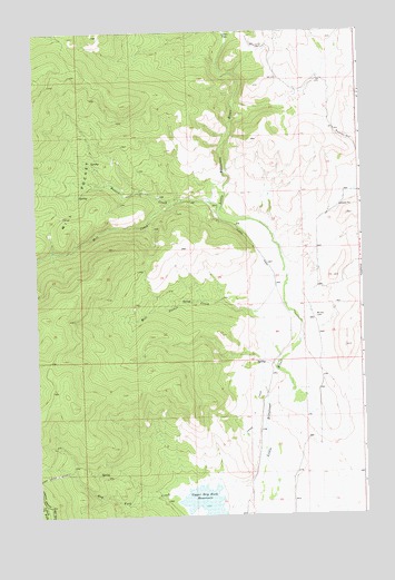
Mill Pocket Creek, MT USGS Topographic Map
Click on map above to begin viewing in our Map Viewer.

This topographic map contains these locations and features:
Feature Name Type Latitude Longitude GNIS ID View Map
23N24W02CABA01 WellWellN47.7816°W114.6399°824943View Map
23N24W02CCD_01 WellWellN47.7766°W114.6446°824922View Map
23N24W03BAB_01 WellWellN47.7888°W114.6624°824953View Map
23N24W03BAB_02 SpringSpringN47.7894°W114.6629°824954View Map
23N24W10ADA_01 WellWellN47.7708°W114.6490°824898View Map
23N24W10BCDD01 WellWellN47.7688°W114.6654°824889View Map
23N24W10CBC_01 WellWellN47.7652°W114.6676°824883View Map
23N24W11CAC_01 WellWellN47.7652°W114.6410°824882View Map
23N24W15AAA_01 WellWellN47.7599°W114.6490°824856View Map
23N24W15BBA_01 WellWellN47.7599°W114.6651°824857View Map
23N24W15CBC_01 WellWellN47.7508°W114.6890°824818View Map
23N24W15CCBB01 WellWellN47.7505°W114.6690°824815View Map
24N24W14DDD_01 WellWellN47.8336°W114.6268°825066View Map
24N24W27BDBB01 WellWellN47.8147°W114.6618°825010View Map
24N24W32DAA_01 WellWellN47.7955°W114.6921°824972View Map
Bassoo CreekStreamN47.8313°W114.6929°779430View Map
Camas A CanalCanalN47.7774°W114.6665°780801View Map
Dry Fork CreekStreamN47.7549°W114.6954°782602View Map
Lozeau FlatsFlatN47.8747°W114.6762°786695View Map
McKay CemeteryCemeteryN47.8014°W114.6431°787071View Map
Mill CreekStreamN47.8288°W114.6793°787367View Map
Mill PocketBasinN47.8324°W114.7349°787390View Map
Mill Pocket CreekStreamN47.7899°W114.6579°787391View Map
Sullivan HillSummitN47.8430°W114.6257°791653View Map
Upper Dry Fork ReservoirReservoirN47.7532°W114.6870°792628View Map
Valleyview Post Office (historical)Post OfficeN47.7755°W114.6418°1781031View Map

Note: Coordinates in the location and feature list above are referenced to NAD83 datum.


Copyright (C) 2008-2024 Ryan Niemi / Sunset Dynamics ... All Rights Reserved