TopoQuest Logo
Do you find TopoQuest useful?
Help keep TopoQuest running and adding new maps/features by donating!
Bitcoin:  19c7KJd3qBynnjoSw5npx9KScwjBe4ifkT
Litecoin:  LXs6TkuXGGXo1vDsWCkWVdjQX94eUKd6ui
Home View Maps Find Maps Find Places Resources & Links


Millinocket, Maine Topographic Map

USGS Map Title: Millinocket, ME
USGS Map MRC: 45068F6
DRG (GeoTIFF) Download: o45068f6.tif


Neighboring USGS Topographic Map Quads:


  Trout Mountain, ME  
45068G7
 

  Whetstone Mountain, ME  
45068G6
 

  Stacyville, ME  
45068G5
 

  Norcross, ME  
45068F7
 

  Millinocket, ME  
45068F6
 

  East Millinocket, ME  
45068F5
 

  Cedar Lake, ME  
45068E7
 

  Nollesemic Lake, ME  
45068E6
 

  Medunkeunk Lake, ME  
45068E5


Map MRC Location:

N46°
W69°
N46°
W68°
H8 H7 H6 H5 H4 H3 H2 H1
G8 G7 G6 G5 G4 G3 G2 G1
F8 F7 F6 F5 F4 F3 F2 F1
E8 E7 E6 E5 E4 E3 E2 E1
D8 D7 D6 D5 D4 D3 D2 D1
C8 C7 C6 C5 C4 C3 C2 C1
B8 B7 B6 B5 B4 B3 B2 B1
A8 A7 A6 A5 A4 A3 A2 A1
N45°
W69°
N45°
W68°

Millinocket, ME USGS 1:24K Topographic Map Preview:
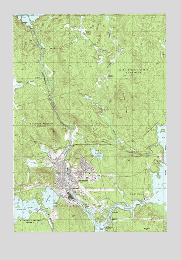
Millinocket, ME USGS Topographic Map
Click on map above to begin viewing in our Map Viewer.

This topographic map contains these locations and features:
Feature Name Type Latitude Longitude GNIS ID View Map
Aroostook Avenue SchoolSchoolN45.6592°W68.7078°1913308View Map
Bowden (historical)Populated PlaceN45.6751°W68.6711°579147View Map
Church of the NazareneChurchN45.6564°W68.7106°1913405View Map
Ferguson LakeLakeN45.6444°W68.7205°566100View Map
First Congregational ChurchChurchN45.6595°W68.7117°1913525View Map
First Pentecostal ChurchChurchN45.6551°W68.7078°1913527View Map
Granite Street Elementary SchoolSchoolN45.6534°W68.7048°1913554View Map
Grindstone TownshipCivilN45.7218°W68.6274°1987295View Map
Jerry BrookStreamN45.6398°W68.6589°568804View Map
Jerry PondLakeN45.6696°W68.6815°568809View Map
Katahdin Avenue SchoolSchoolN45.6578°W68.7134°1913636View Map
Ledge Cut BrookStreamN45.6659°W68.7103°569437View Map
Little ItalyPopulated PlaceN45.6509°W68.6989°578991View Map
Little Smith BrookStreamN45.6648°W68.7167°570062View Map
Little Smith PondLakeN45.7092°W68.7447°570065View Map
MillinocketPopulated PlaceN45.6573°W68.7098°571390View Map
Millinocket Baptist ChurchChurchN45.6589°W68.7095°1913706View Map
Millinocket Census Designated PlaceCensusN45.6596°W68.6996°2377938View Map
Millinocket Fire DepartmentBuildingN45.6564°W68.7085°1913707View Map
Millinocket High School (historical)SchoolN45.6578°W68.7134°1913708View Map
Millinocket Lake DamDamN45.7422°W68.7335°1773891View Map
Millinocket Memorial LibraryBuildingN45.6563°W68.7111°1913709View Map
Millinocket Municipal AirportAirportN45.6471°W68.6906°582185View Map
Millinocket Police DepartmentBuildingN45.6565°W68.7089°2735907View Map
Millinocket Post OfficePost OfficeN45.6551°W68.7088°1913711View Map
Millinocket Regional HospitalHospitalN45.6528°W68.7158°1913712View Map
Millinocket Regional Hospital Medical LibraryBuildingN45.6528°W68.7161°1913713View Map
Millinocket StreamStreamN45.6259°W68.6842°571396View Map
Pond Falls IslandIslandN45.6320°W68.6736°573596View Map
Quakish DamDamN45.6373°W68.7298°573926View Map
Rice FarmLocaleN45.6448°W68.6398°574156View Map
Saint Martin of Tours Catholic ChurchChurchN45.6587°W68.7134°1913862View Map
Saint Martin of Tours CemeteryCemeteryN45.6524°W68.7009°1913863View Map
Schoodic DeadwaterLakeN45.7151°W68.6729°574994View Map
Schoodic RidgeRidgeN45.6970°W68.6609°575005View Map
Schoodic StreamStreamN45.6598°W68.6411°575007View Map
Shack HillSummitN45.6351°W68.7045°575424View Map
Smith BrookStreamN45.7167°W68.7256°575593View Map
Smith Brook DeadwaterStreamN45.7095°W68.7467°575610View Map
Stearns High SchoolSchoolN45.6614°W68.7059°1913918View Map
Stearns Junior Senior High SchoolSchoolN45.6612°W68.7059°1913710View Map
Town of MillinocketCivilN45.6521°W68.6851°582596View Map
Union ChapelChurchN45.6512°W68.7078°1913941View Map
WSYY-AM (Millinocket)TowerN45.6734°W68.7181°582024View Map
WSYY-FM (Millinocket)TowerN45.6737°W68.7179°582072View Map

Note: Coordinates in the location and feature list above are referenced to NAD83 datum.


Copyright (C) 2008-2024 Ryan Niemi / Sunset Dynamics ... All Rights Reserved