TopoQuest Logo
Do you find TopoQuest useful?
Help keep TopoQuest running and adding new maps/features by donating!
Bitcoin:  19c7KJd3qBynnjoSw5npx9KScwjBe4ifkT
Litecoin:  LXs6TkuXGGXo1vDsWCkWVdjQX94eUKd6ui
Home View Maps Find Maps Find Places Resources & Links


Cedar Lake, Maine Topographic Map

USGS Map Title: Cedar Lake, ME
USGS Map MRC: 45068E7
DRG (GeoTIFF) Download: o45068e7.tif


Neighboring USGS Topographic Map Quads:


  Pemadumcook Lake, ME  
45068F8
 

  Norcross, ME  
45068F7
 

  Millinocket, ME  
45068F6
 

  Ragged Mountain, ME  
45068E8
 

  Cedar Lake, ME  
45068E7
 

  Nollesemic Lake, ME  
45068E6
 

  Seboeis Lake, ME  
45068D8
 

  Endless Lake, ME  
45068D7
 

  Mattamiscontis Mountain, ME  
45068D6


Map MRC Location:

N46°
W69°
N46°
W68°
H8 H7 H6 H5 H4 H3 H2 H1
G8 G7 G6 G5 G4 G3 G2 G1
F8 F7 F6 F5 F4 F3 F2 F1
E8 E7 E6 E5 E4 E3 E2 E1
D8 D7 D6 D5 D4 D3 D2 D1
C8 C7 C6 C5 C4 C3 C2 C1
B8 B7 B6 B5 B4 B3 B2 B1
A8 A7 A6 A5 A4 A3 A2 A1
N45°
W69°
N45°
W68°

Cedar Lake, ME USGS 1:24K Topographic Map Preview:
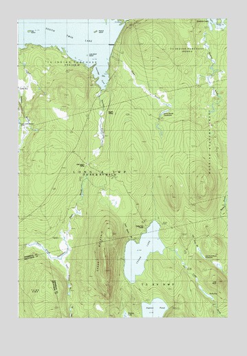
Cedar Lake, ME USGS Topographic Map
Click on map above to begin viewing in our Map Viewer.

This topographic map contains these locations and features:
Feature Name Type Latitude Longitude GNIS ID View Map
Cedar LakeLakeN45.5276°W68.8011°563723View Map
Cedar Lake CampsLocaleN45.5376°W68.7978°563724View Map
Cedar Lake TrailTrailN45.5506°W68.8078°563725View Map
Cedar MountainSummitN45.5198°W68.8227°563729View Map
Dean BrookStreamN45.5289°W68.8748°564913View Map
Dean Brook DeadwaterSwampN45.5251°W68.8550°564915View Map
Flatiron PondLakeN45.5023°W68.7944°566292View Map
Grant BrookStreamN45.6098°W68.8192°567052View Map
Grant Brook DeadwaterLakeN45.5861°W68.7877°567054View Map
Gray Ledge Dam TrailTrailN45.5067°W68.7659°567102View Map
Ingalls SidingLocaleN45.5825°W68.8223°568628View Map
Libby BogSwampN45.5939°W68.8689°569508View Map
Little Birch IslandIslandN45.6098°W68.8334°569686View Map
Long A TownshipCivilN45.5596°W68.8644°1987298View Map
Oak IslandIslandN45.6195°W68.8675°572614View Map
Oak KnollSummitN45.5150°W68.7552°572616View Map
Oak Knoll BrookStreamN45.5189°W68.7500°572617View Map
Oak Knoll Brook DeadwaterLakeN45.5269°W68.7658°572618View Map
Old Long A SidingLocaleN45.5642°W68.8325°572707View Map
Partridge BrookStreamN45.5950°W68.8248°573026View Map
Partridge CoveBayN45.5987°W68.8239°573029View Map
Peanut IslandIslandN45.6198°W68.8278°573108View Map
PerkinsPopulated PlaceN45.6128°W68.8170°579614View Map
Quakish BrookStreamN45.6239°W68.7606°573925View Map
Ragged Mountain TrailTrailN45.5806°W68.8564°573970View Map
Rocky BogLakeN45.5096°W68.7621°574367View Map
Sand Beach BrookStreamN45.5317°W68.8084°574822View Map
South Branch BrookStreamN45.5245°W68.8492°575773View Map
South Twin LakeLakeN45.6207°W68.8606°575917View Map
Upper East Ragged PondLakeN45.5813°W68.8743°577598View Map

Note: Coordinates in the location and feature list above are referenced to NAD83 datum.


Copyright (C) 2008-2024 Ryan Niemi / Sunset Dynamics ... All Rights Reserved