TopoQuest Logo
Do you find TopoQuest useful?
Help keep TopoQuest running and adding new maps/features by donating!
Bitcoin:  19c7KJd3qBynnjoSw5npx9KScwjBe4ifkT
Litecoin:  LXs6TkuXGGXo1vDsWCkWVdjQX94eUKd6ui
Home View Maps Find Maps Find Places Resources & Links


Milnesand, New Mexico Topographic Map

USGS Map Title: Milnesand, NM
USGS Map MRC: 33103F3
DRG (GeoTIFF) Download: o33103f3.tif


Neighboring USGS Topographic Map Quads:


  Dora SW, NM  
33103G4
 

  Pep, NM  
33103G3
 

  Garrison, NM  
33103G2
 

  Milnesand NW, NM  
33103F4
 

  Milnesand, NM  
33103F3
 

  Bluit, NM  
33103F2
 

  Milnesand SW, NM  
33103E4
 

  Crossroads, NM  
33103E3
 

  Bledsoe SW, NM  
33103E2


Map MRC Location:

N34°
W104°
N34°
W103°
H8 H7 H6 H5 H4 H3 H2 H1
G8 G7 G6 G5 G4 G3 G2 G1
F8 F7 F6 F5 F4 F3 F2 F1
E8 E7 E6 E5 E4 E3 E2 E1
D8 D7 D6 D5 D4 D3 D2 D1
C8 C7 C6 C5 C4 C3 C2 C1
B8 B7 B6 B5 B4 B3 B2 B1
A8 A7 A6 A5 A4 A3 A2 A1
N33°
W104°
N33°
W103°

Milnesand, NM USGS 1:24K Topographic Map Preview:
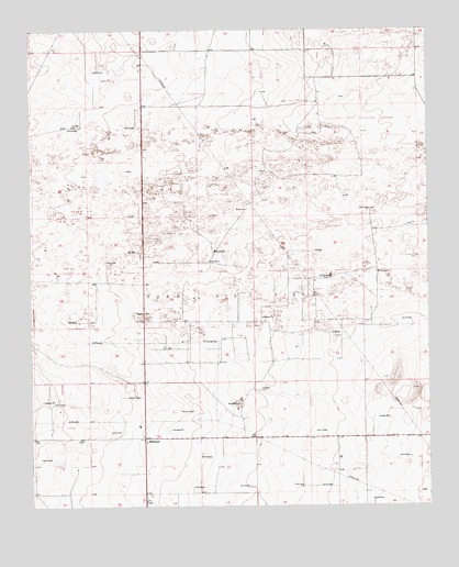
Milnesand, NM USGS Topographic Map
Click on map above to begin viewing in our Map Viewer.

This topographic map contains these locations and features:
Feature Name Type Latitude Longitude GNIS ID View Map
06223 Water WellWellN33.7309°W103.3372°934723View Map
06224 Water WellWellN33.6804°W103.2627°934713View Map
10138 Water WellWellN33.6557°W103.2644°935080View Map
11402 Water WellWellN33.7493°W103.3616°935067View Map
11403 Water WellWellN33.7490°W103.3372°935066View Map
11426 Water WellWellN33.7401°W103.3011°935064View Map
11427 Water WellWellN33.7412°W103.2802°935065View Map
11512 Water WellWellN33.7387°W103.3177°934726View Map
11513 Water WellWellN33.7337°W103.3372°934724View Map
11514 Water WellWellN33.7354°W103.3391°934725View Map
11515 Water WellWellN33.7251°W103.3652°935070View Map
11516 Water WellWellN33.7148°W103.3427°934719View Map
11517 Water WellWellN33.7257°W103.3369°935072View Map
11518 Water WellWellN33.7254°W103.3211°935071View Map
11520 Water WellWellN33.7398°W103.2522°934727View Map
11521 Water WellWellN33.7279°W103.2827°935073View Map
11522 Water WellWellN33.7290°W103.3011°934722View Map
12556 Water WellWellN33.7009°W103.3219°935078View Map
12557 Water WellWellN33.6734°W103.3363°934712View Map
12560 Water WellWellN33.6587°W103.3375°935083View Map
12588 Water WellWellN33.6454°W103.3672°934709View Map
12590 Water WellWellN33.6357°W103.3588°935087View Map
12591 Water WellWellN33.6345°W103.3461°935086View Map
12592 Water WellWellN33.6434°W103.3338°934707View Map
12603 Water WellWellN33.6420°W103.3016°934705View Map
12604 Water WellWellN33.6426°W103.2675°934706View Map
MilnesandPopulated PlaceN33.6429°W103.3397°898574View Map
Milnesand Baptist ChurchChurchN33.6429°W103.3397°921210View Map
Milnesand Fire and Rescue Station 1BuildingN33.6422°W103.3394°2657899View Map
Milnesand Natural Gas MastLocaleN33.6529°W103.3433°929318View Map
Milnesand Post OfficePost OfficeN33.6429°W103.3403°938195View Map
Todd Oil FieldOilfieldN33.6804°W103.3091°929072View Map

Note: Coordinates in the location and feature list above are referenced to NAD83 datum.


Copyright (C) 2008-2025 Ryan Niemi / Sunset Dynamics ... All Rights Reserved