TopoQuest Logo
Do you find TopoQuest useful?
Help keep TopoQuest running and adding new maps/features by donating!
Bitcoin:  19c7KJd3qBynnjoSw5npx9KScwjBe4ifkT
Litecoin:  LXs6TkuXGGXo1vDsWCkWVdjQX94eUKd6ui
Home View Maps Find Maps Find Places Resources & Links


Bluit, New Mexico Topographic Map

USGS Map Title: Bluit, NM
USGS Map MRC: 33103F2
DRG (GeoTIFF) Download: o33103f2.tif


Neighboring USGS Topographic Map Quads:


  Pep, NM  
33103G3
 

  Garrison, NM  
33103G2
 

  Lingo, NM  
33103G1
 

  Milnesand, NM  
33103F3
 

  Bluit, NM  
33103F2
 

  Bledsoe NE, TX  
33103F1
 

  Crossroads, NM  
33103E3
 

  Bledsoe SW, NM  
33103E2
 

  Bledsoe, TX  
33103E1


Map MRC Location:

N34°
W104°
N34°
W103°
H8 H7 H6 H5 H4 H3 H2 H1
G8 G7 G6 G5 G4 G3 G2 G1
F8 F7 F6 F5 F4 F3 F2 F1
E8 E7 E6 E5 E4 E3 E2 E1
D8 D7 D6 D5 D4 D3 D2 D1
C8 C7 C6 C5 C4 C3 C2 C1
B8 B7 B6 B5 B4 B3 B2 B1
A8 A7 A6 A5 A4 A3 A2 A1
N33°
W104°
N33°
W103°

Bluit, NM USGS 1:24K Topographic Map Preview:
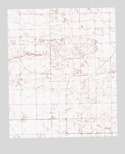
Bluit, NM USGS Topographic Map
Click on map above to begin viewing in our Map Viewer.

This topographic map contains these locations and features:
Feature Name Type Latitude Longitude GNIS ID View Map
11523 Water WellWellN33.7179°W103.2263°926232View Map
11525 Water WellWellN33.7376°W103.1324°926326View Map
11526 Water WellWellN33.7343°W103.1505°926226View Map
11527 Water WellWellN33.7295°W103.1911°926223View Map
11528 Water WellWellN33.7209°W103.1502°926320View Map
11529 Water WellWellN33.7204°W103.1319°926234View Map
11531 Water WellWellN33.7084°W103.1361°926317View Map
11532 Water WellWellN33.7054°W103.1936°926241View Map
12561 Water WellWellN33.7368°W103.2074°926228View Map
12562 Water WellWellN33.7307°W103.2480°926224View Map
12563 Water WellWellN33.7248°W103.2011°926322View Map
12564 Water WellWellN33.6929°W103.2280°926235View Map
12565 Water WellWellN33.6882°W103.2083°926313View Map
12566 Water WellWellN33.6779°W103.2349°926308View Map
12568 Water WellWellN33.6612°W103.2169°926244View Map
12569 Water WellWellN33.7232°W103.1786°926321View Map
12570 Water WellWellN33.6948°W103.1986°926236View Map
12580 Water WellWellN33.6870°W103.1586°926311View Map
12581 Water WellWellN33.6868°W103.1816°926310View Map
12582 Water WellWellN33.6668°W103.1802°926247View Map
12583 Water WellWellN33.6598°W103.1488°926243View Map
12602 Water WellWellN33.6445°W103.2352°926302View Map
12605 Water WellWellN33.6432°W103.2119°926252View Map
12614 Water WellWellN33.6465°W103.1727°926303View Map
12615 Water WellWellN33.6573°W103.1963°926306View Map
12616 Water WellWellN33.6501°W103.1836°926305View Map
12617 Water WellWellN33.6298°W103.1738°926249View Map
12618 Water WellWellN33.6343°W103.1386°926251View Map
12622 Water WellWellN33.6282°W103.1502°926301View Map
12623 Water WellWellN33.6265°W103.1966°926300View Map
12692 Water WellWellN33.6587°W103.2352°926242View Map
BluitPopulated PlaceN33.6293°W103.1836°915802View Map
Bluitt CemeteryCemeteryN33.6293°W103.1835°931232View Map
Bluitt Post Office (historical)Post OfficeN33.6293°W103.1836°938112View Map
Perkins Memorial CemeteryCemeteryN33.6359°W103.1488°893190View Map

Note: Coordinates in the location and feature list above are referenced to NAD83 datum.


Copyright (C) 2008-2025 Ryan Niemi / Sunset Dynamics ... All Rights Reserved