TopoQuest Logo
Do you find TopoQuest useful?
Help keep TopoQuest running and adding new maps/features by donating!
Bitcoin:  19c7KJd3qBynnjoSw5npx9KScwjBe4ifkT
Litecoin:  LXs6TkuXGGXo1vDsWCkWVdjQX94eUKd6ui
Home View Maps Find Maps Find Places Resources & Links


Milstead, Georgia Topographic Map

USGS Map Title: Milstead, GA
USGS Map MRC: 33083F8
DRG (GeoTIFF) Download: o33083f8.tif


Neighboring USGS Topographic Map Quads:


  Snellville, GA  
33084G1
 

  Loganville, GA  
33083G8
 

  Between, GA  
33083G7
 

  Conyers, GA  
33084F1
 

  Milstead, GA  
33083F8
 

  Jersey, GA  
33083F7
 

  Kelleytown, GA  
33084E1
 

  Porterdale, GA  
33083E8
 

  Covington, GA  
33083E7


Map MRC Location:

N34°
W84°
N34°
W83°
H8 H7 H6 H5 H4 H3 H2 H1
G8 G7 G6 G5 G4 G3 G2 G1
F8 F7 F6 F5 F4 F3 F2 F1
E8 E7 E6 E5 E4 E3 E2 E1
D8 D7 D6 D5 D4 D3 D2 D1
C8 C7 C6 C5 C4 C3 C2 C1
B8 B7 B6 B5 B4 B3 B2 B1
A8 A7 A6 A5 A4 A3 A2 A1
N33°
W84°
N33°
W83°

Milstead, GA USGS 1:24K Topographic Map Preview:
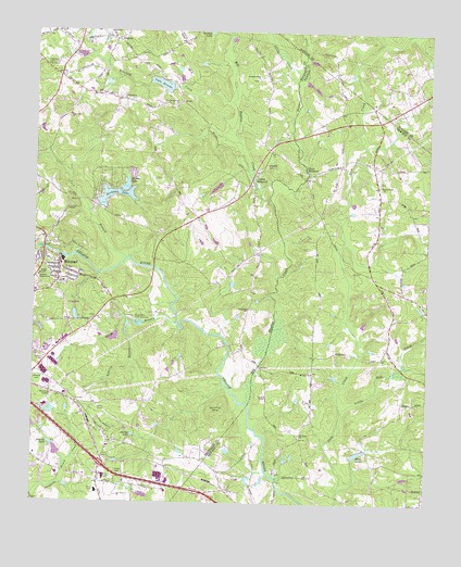
Milstead, GA USGS Topographic Map
Click on map above to begin viewing in our Map Viewer.

This topographic map contains these locations and features:
Feature Name Type Latitude Longitude GNIS ID View Map
Almand CemeteryCemeteryN33.6582°W83.9982°310493View Map
Ashley GrovePopulated PlaceN33.7118°W83.8905°1673417View Map
Baby Farms ChurchChurchN33.7315°W83.8894°342650View Map
Ball Rock ChurchChurchN33.6765°W83.9316°354445View Map
Big Haynes CreekStreamN33.6515°W83.9310°311387View Map
Big Haynes Creek Recreation AreaParkN33.7437°W83.9394°357612View Map
Boar Tusk BranchStreamN33.6857°W83.9788°357525View Map
Cambridge ForestPopulated PlaceN33.6271°W83.8774°1673437View Map
Carr BranchStreamN33.6901°W83.9705°312352View Map
Cedar Grove Church (historical)ChurchN33.7357°W83.9557°357527View Map
Cedar Grove School (historical)SchoolN33.6954°W83.9510°357528View Map
Church in the NowChurchN33.6410°W83.9900°2345768View Map
Conyers Church of GodChurchN33.6673°W83.9811°2345770View Map
Conyers Commerce CenterBuildingN33.6696°W83.9759°2345771View Map
Conyers Plaza Shopping CenterLocaleN33.6530°W83.9970°2345772View Map
Conyers WaterworksLocaleN33.6848°W83.9985°344216View Map
Costley Mill (historical)LocaleN33.7121°W83.9302°357532View Map
Costley MillpondLakeN33.7121°W83.9305°313006View Map
Coursey LakeReservoirN33.6493°W83.9940°337814View Map
Coursey Lake DamDamN33.6501°W83.9932°337813View Map
Cousins LakeReservoirN33.7087°W83.9422°342293View Map
Cousins Lake DamDamN33.7101°W83.9399°342292View Map
Dial Mill (historical)LocaleN33.7123°W83.9135°357536View Map
Dials MillpondLakeN33.7132°W83.9139°313462View Map
Double Springs ChurchChurchN33.7307°W83.9552°355526View Map
East View LakeReservoirN33.6748°W83.9868°338870View Map
East View Lake DamDamN33.6768°W83.9866°338869View Map
Ellis LakeReservoirN33.6386°W83.8964°313924View Map
Exit 43CrossingN33.6351°W83.9777°357625View Map
Fieldstone Plaza Shopping CenterLocaleN33.6321°W83.9769°2345773View Map
First Shady Grove Baptist ChurchChurchN33.6437°W83.9777°357541View Map
Flat Shoals Elementary SchoolSchoolN33.6325°W83.9917°357542View Map
Gee Mill (historical)LocaleN33.6668°W83.9382°357546View Map
Gees Mill Business ParkLocaleN33.6496°W83.9763°357626View Map
Georges LakeReservoirN33.6251°W83.9599°342296View Map
Georges Lake DamDamN33.6251°W83.9599°342295View Map
Georgia International Horse ParkParkN33.6829°W83.9291°357627View Map
Gethsemane Baptist ChurchChurchN33.6515°W83.9760°357547View Map
Griffin MountainSummitN33.6487°W83.9421°331873View Map
Gum Creek ChurchChurchN33.7098°W83.8899°356124View Map
Gum Creek Presbyterian CemeteryCemeteryN33.7105°W83.8906°1673493View Map
Hi Roc ShoresPopulated PlaceN33.7112°W83.9749°357551View Map
Hi-Roc Community ChurchChurchN33.7047°W83.9816°2345774View Map
Hi-Roc LakeReservoirN33.7087°W83.9711°315354View Map
Hi-Roc Lake DamDamN33.7082°W83.9724°337801View Map
Hightower ForestPopulated PlaceN33.7071°W83.9138°1673504View Map
Hightower Indian Trail MonumentParkN33.7407°W83.9977°315404View Map
Hightower Trail Elementary SchoolSchoolN33.6932°W83.9622°2545931View Map
Horseshoe SpringsPopulated PlaceN33.6368°W83.9416°1673507View Map
Hyde ChapelChurchN33.7379°W83.9913°357557View Map
Jack Turner DamDamN33.7300°W83.9370°2750194View Map
Lake BrooksReservoirN33.7360°W83.9600°311835View Map
Lake Brooks DamDamN33.7357°W83.9563°337837View Map
Lakeside Baptist ChurchChurchN33.7046°W83.9821°357566View Map
Little Gum CreekStreamN33.6490°W83.9016°317077View Map
Little Haynes CreekStreamN33.7101°W83.9246°317081View Map
Lola LandingAirportN33.7243°W83.9764°2717251View Map
Lola Landing AirportAirportN33.7301°W83.9746°351724View Map
McDaniel BridgeBridgeN33.6671°W83.9380°357571View Map
MilsteadPopulated PlaceN33.6879°W83.9921°332397View Map
Milstead Baptist ChurchChurchN33.6854°W83.9927°357573View Map
Milstead Crossing Shopping CenterLocaleN33.6842°W83.9980°2345775View Map
Milstead United Methodist ChurchChurchN33.6854°W83.9916°357574View Map
Mount Olive Baptist ChurchChurchN33.6909°W83.9988°357575View Map
Mount Tabor ChurchChurchN33.6434°W83.9146°318888View Map
Mount Zion ChurchChurchN33.6598°W83.9110°319013View Map
Newton County Fire Station 9BuildingN33.6470°W83.9127°2604125View Map
North Conyers FarmsPopulated PlaceN33.6876°W83.9091°1673558View Map
North Rockdale Baptist ChurchChurchN33.7034°W83.9428°2345776View Map
North Rockdale DivisionCivilN33.7255°W83.9736°1936443View Map
Oakland School (historical)SchoolN33.6309°W83.9799°357577View Map
Owens CemeteryCemeteryN33.6534°W83.9258°320129View Map
Park 20 East Industrial ParkLocaleN33.6632°W83.9762°2345777View Map
Parkers LakeLakeN33.7426°W83.9398°320229View Map
Patrick PondReservoirN33.6385°W83.9922°320267View Map
Peachtree Academy Main CampusSchoolN33.6251°W83.9798°2546399View Map
Pentecost ChurchChurchN33.6951°W83.9966°357582View Map
Philadelphia ChurchChurchN33.7326°W83.9730°320439View Map
Pine Log BridgeBridgeN33.6873°W83.9619°357584View Map
Pine Log ParkParkN33.6621°W83.9977°357636View Map
Princeton (historical)Populated PlaceN33.7209°W83.9277°357588View Map
Quigg BranchStreamN33.6726°W83.9544°321251View Map
Randy Poynter LakeReservoirN33.7438°W83.9392°2750195View Map
Roberts BranchStreamN33.6737°W83.9699°321672View Map
Rock Mill Fish HatcheryLocaleN33.6732°W83.9674°344331View Map
Rockdale County Animal ShelterBuildingN33.6835°W83.9997°2345778View Map
Rockdale County Fire Department Station 1BuildingN33.6672°W83.9864°2604128View Map
Rockdale County Fire Department Station 5BuildingN33.7332°W83.9762°2604644View Map
Rockdale LakeReservoirN33.7071°W83.9743°321765View Map
Rockdale Lake DamDamN33.7054°W83.9807°337823View Map
Saint Simon's Episcopal ChurchChurchN33.6635°W83.9953°2516644View Map
Salem Baptist ChurchChurchN33.7154°W83.9263°322366View Map
Sandy CreekStreamN33.7379°W83.9166°322471View Map
Sarasota Commerce CenterBuildingN33.6603°W83.9921°2345779View Map
Shady Grove School (historical)SchoolN33.6434°W83.9774°357598View Map
Sheppards LakeReservoirN33.7163°W83.9999°339137View Map
Sheppards Lake DamDamN33.7168°W83.9999°339136View Map
Smiths LakeReservoirN33.6431°W83.9680°323161View Map
Spring ValleyPopulated PlaceN33.6804°W83.8907°1673613View Map
Summer Hills ChurchChurchN33.7382°W83.9285°323739View Map
Tabernacle ChurchChurchN33.7421°W83.9755°357603View Map
The RocksAreaN33.7207°W83.9727°357596View Map
Twin Haynes CreekPopulated PlaceN33.7093°W83.9157°1673625View Map
Victory Church CemeteryCemeteryN33.6591°W83.9114°1673539View Map
Water Oak ChurchChurchN33.6971°W83.9946°357610View Map
Weaver LakeReservoirN33.6684°W83.9716°339085View Map
Weaver Lake DamDamN33.6684°W83.9716°339084View Map
Westminster ChurchChurchN33.7396°W83.9960°357611View Map
Winfield CreekStreamN33.7309°W83.9363°325453View Map
ZingaraPopulated PlaceN33.7479°W83.9741°333495View Map

Note: Coordinates in the location and feature list above are referenced to NAD83 datum.


Copyright (C) 2008-2025 Ryan Niemi / Sunset Dynamics ... All Rights Reserved